Download
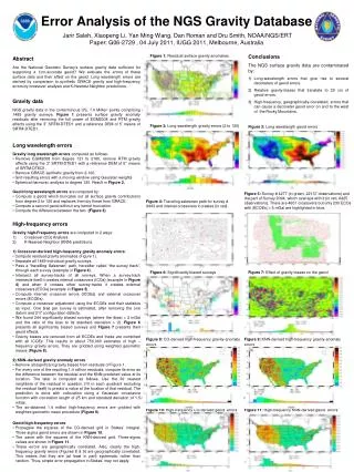
1 / 4
60 likes | 165 Vues
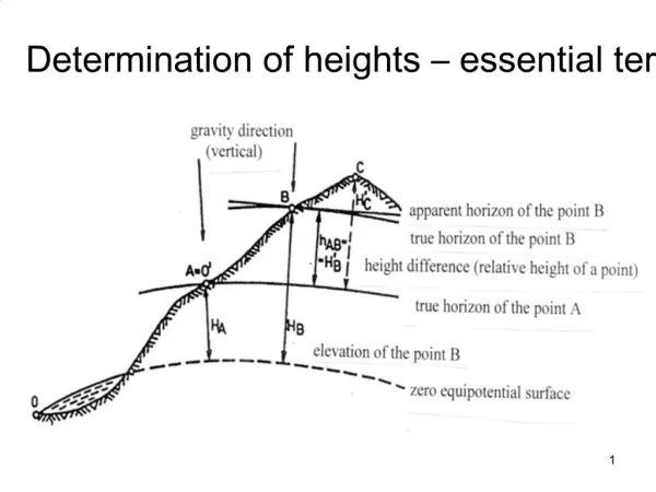
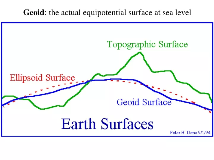
Geoid : the actual equipotential surface at sea level. Image Name : ww15mgh Boundaries : Lat -90N to 90N ; Lon 0E to 360E Color Scale, Upper (Red) : 85.4 meters and higher Color Scale, Lower (Magenta) :-107.0 meters and lower

E N D
Image Name : ww15mgh Boundaries : Lat -90N to 90N ; Lon 0E to 360E Color Scale, Upper (Red) : 85.4 meters and higher Color Scale, Lower (Magenta) :-107.0 meters and lower Data Max value : 85.4 meters Data Min value :-107.0 meters Illuminated from the : East This is an image generated from 15'x15' geoid undulations covering the planet Earth. These undulations represent the NIMA/GSFC WGS-84 EGM96 15' Geoid Height File. This file is a global grid of undulations generated from: (a) the EGM96 spherical harmonic coefficients and (b) correction terms that convert pseudo-height anomalies on the ellipsoid to geoid undulations.
Internal mass effects upon geoid •Density contrasts cause geoid upward deflection • But motion of blob in mantle causes deflection in density contrasts at surface and internal boundaries (depending on viscosity) From: Hager, 1984