Download
1 / 1
20 likes | 121 Vues
Collision and Safety Analysis for 35 th Ave SW, Seattle, WA Xiaoyue (Cathy) Liu, Wenjuan Zhao, Barrett Taylor Department of Civil & Environmental Engineering, University of Washington. BACKGROUND AND METHODOLOGY. Classify the collision types and volume Identify collision hot spots

E N D
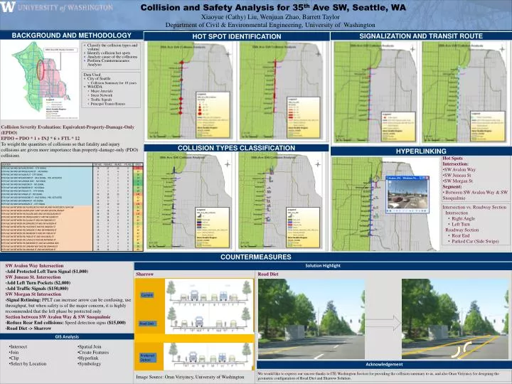
Collision and Safety Analysis for 35th Ave SW, Seattle, WA Xiaoyue (Cathy) Liu, Wenjuan Zhao, Barrett Taylor Department of Civil & Environmental Engineering, University of Washington BACKGROUND AND METHODOLOGY • Classify the collision types and volume • Identify collision hot spots • Analyze cause of the collisions • Perform Countermeasures Analysis Data Used • City of Seattle • Collision Summary for 10 years • WAGDA • Major Arterials • Street Network • Traffic Signals • Principal Transit Routes HYPERLINKING HOT SPOT IDENTIFICATION COUNTERMEASURES COLLISION TYPES CLASSIFICATION SIGNALIZATION AND TRANSIT ROUTE Collision Severity Evaluation: Equivalent-Property-Damage-Only (EPDO) EPDO = PDO * 1 + INJ * 6 + FTL * 12 To weight the quantities of collisions so that fatality and injury collisions are given more importance than property-damage-only (PDO) collisions • Hot Spots • Intersection: • SW Avalon Way • SW Juneau St • SW Morgan St • Segment: • Between SW Avalon Way & SW Snoqualmie • Intersection vs. Roadway Section • Intersection • Right Angle • Left Turn • Roadway Section • Rear End • Parked Car (Side Swipe) New Development: High Point • SW Avalon Way Intersection • Add Protected Left Turn Signal ($1,000) • SW Juneau St. Intersection • Add Left Turn Pockets ($2,000) • Add Traffic Signals ($150,000) • SW Morgan St Intersection • Signal Retiming: PPLT can increase arrow can be confusing, use throughput, but when safety is of the major concern, it is highly recommended that the left phase be protected only • Section between SW Avalon Way & SW Snoqualmie • Reduce Rear End collisions: Speed detection signs ($15,000) • Road Diet -> Sharrow Solution Highlight Sharrow Road Diet Current Road Diet GIS Analysis • Intersect • Join • Clip • Select by Location • Spatial Join • Create Features • Hyperlink • Symbology PreferredOption Acknowledgement We would like to express our sincere thanks to ITE Washington Section for providing the collision summary to us, and also Oran Viriyincy for designing the geometric configuration of Road Diet and Sharrow Solution . Image Source: Oran Viriyincy, University of Washington