Download
1 / 17
170 likes | 293 Vues
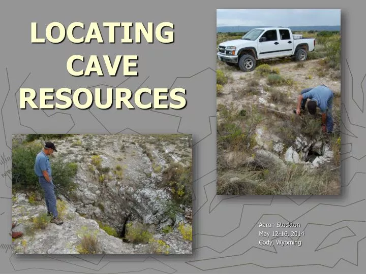
LOCATING CAVE RESOURCES. Aaron Stockton May 12-16, 2014 Cody, Wyoming. WHY ?. To Protect Resources from Theft, Vandalism, and Careless Damage. To Eliminate or Reduce Threats from Human Surface Activities. Reduce Potential Hazards Caves May Present to Visitors and Surface Users.

E N D
LOCATING CAVE RESOURCES Aaron Stockton May 12-16, 2014 Cody, Wyoming
WHY ? • To Protect Resources from Theft, Vandalism, and Careless Damage. • To Eliminate or Reduce Threats from Human Surface Activities. • Reduce Potential Hazards Caves May Present to Visitors and Surface Users. • Gain a Better Understanding of the Natural Environment We are Responsible for Managing.
SEARCH YOUR FILES AND RECORDS • Cultural Records • Range and Timber Files • Recreation Files • Wildlife Records • Minerals Records • Engineering Files • Law Enforcement Files
LOCAL RESEARCH • Ask Ranchers, Loggers, Well Drillers, Hunters, Local Cavers, Hikers, and Riders. • Local SAR, Law Enforcement, Fire Department • Geological, Newspapers, Local History Books, and Articles. • Library • Old Timers • Fly Overs • Google Earth
TOPOGRAPHIC MAPS Search for Features with Cave Names Sinkholes Losing/Ephemeral Streams Springs Road Anomalies Vegetation Anomalies
GEOLOGIC SENSING • Ground Penetrating Radar • Seismic Detection • Acoustic Resonance Detection • Resistivity – Electric Current Flow • Magnetometer
Digging • Hot button topic • Produced entry into incredible cave systems – Lechuguilla • Can damage valuable information/resources • Not one size fits all….
Questions ?Which way is north? Modified from 2001 M. Safford, 2004 B. Hummel, 2007 D. Kampwerth, 2011 A. Stockton Presentations Photos by A. Stockton and BLM files