Download
1 / 22
220 likes | 350 Vues
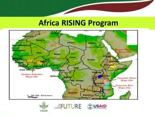
Up scaling Africa RISING Interventions using Development domains. Tunrayo Alabi Geospatial Laboratory, IITA. Outline of presentation. Concept of Development Domain Criteria for Development Domain Biophysical & Socioeconomic characteristics Domain map of West Africa

E N D
Up scaling Africa RISING Interventions using Development domains Tunrayo Alabi Geospatial Laboratory, IITA
Outline of presentation • Concept of Development Domain • Criteria for Development Domain • Biophysical & Socioeconomic characteristics • Domain map of West Africa • Up scaling Research Results
Concept of Development Domain • Development domain is the spatial representation of factors important for agric. development • Characterized using stratification criteria • Reduce complexity by prioritizing criteria based on its influence on production. • Example of simple domain • Agroecological zone • Farming systems map
Why Development domain approach? • Domain helps to dissect/stratify the complex region into geographical units in which similar agricultural problems or opportunities are likely to occur • Where are those geographic areas in which development problems and opportunities are likely to be most similar? • Where else can a successful tested technologies be employed. Where else can we replicate successes (up-scaling research results)
Criteria for Development domains • The following 3 criteria were used • Agricultural Potential • Market access • Population density
Agricultural Potential • Agricultural potential of any location is a strong indicator of its absolute advantage in agricultural production • the extent to which this might actually be realized or its comparative advantage is conditioned by other factors such as market access and population density (Pender et al. 1999). • It is not a static concept but changes over time in response to changing natural conditions (e.g climate change) and human-induced conditions (e.gland degradation )
Length of Growing period • LGP was used to compute agric. Potential • Defined as the no of days in a year when sufficient water is available in the soil profile to support plant growth • It captures the complex interaction of rainfall, PET, temperature , solar radiation and soil properties. • It expresses the distribution of rainfall as well as its availability for crop growth when runoff and PET has been accounted for.
Agricultural Potential Agric. potential • High: (LGP > 180 days ) • Medium: (LGP 90-180 days • Low :(< 90 days)
Market access • Critical for determining the comparative advantage of a given location, given its agricultural potential. • It determines access to inputs and output outlets • e.g, a community with absolute advantage in producing perishable vegetables may have little or no comparative advantage (low profitability) in vegetable production if it is far from roads and markets.
Market access • Computing market access involves travel time based on landuse, roads, places with population > 10,000 • High (< 2 hours); Medium (3-8 hours); Low (> 8 hours)
Population density • Population pressure affects the labor intensity of agriculture by affecting the land/laborratio • Influences innovations in technology • Markets & institutions /investments in agric • Population density is high in the coastal belt of WA • Medium are scattered all over • Low density are more in the northern belt of WA the region
Development Domain 27 Domain units produced LLL : 30% HLM : 11% LLM : 10%
Dev. Domain Ghana Africa RISING Intervention sites In Ghana are in 3 regions
Intervention sites in Ghana & Domain 25 sites in Ghana falls within 5 Dev. Domains
HHH Domain similarity Manguli & Sabulungo HHH occurrence Country (%) Ghana 9.8 Nigeria 10.4 West Africa 3.2 Research results from the 2 sites represent about 3.2% of West Africa
HLM Domain similarity Natodori (Upper West) Country (%) Ghana 27.5 Nigeria 8.6 Guinea 49 Cote D’voire 34 West Africa 10.7 … represents about 11% of west Africa and 49 % Guinea, 34 % of Cote d’voire
HLH Domain similarity 8 Sites in Wa West & Nadowli HHH occurrence Country (%) Ghana 10 Nigeria 3.8 Guinea 23.3 Liberia 15 West Africa 4.5
HMH Domain similarity HMH occurrence Country (%) Ghana 4.4 Nigeria 4.9 West Africa 2.6
HMM Domain similarity HMH occurrence Country (%) Ghana 4.4 Nigeria 4.9 West Africa 2.6