Download
1 / 15
150 likes | 378 Vues
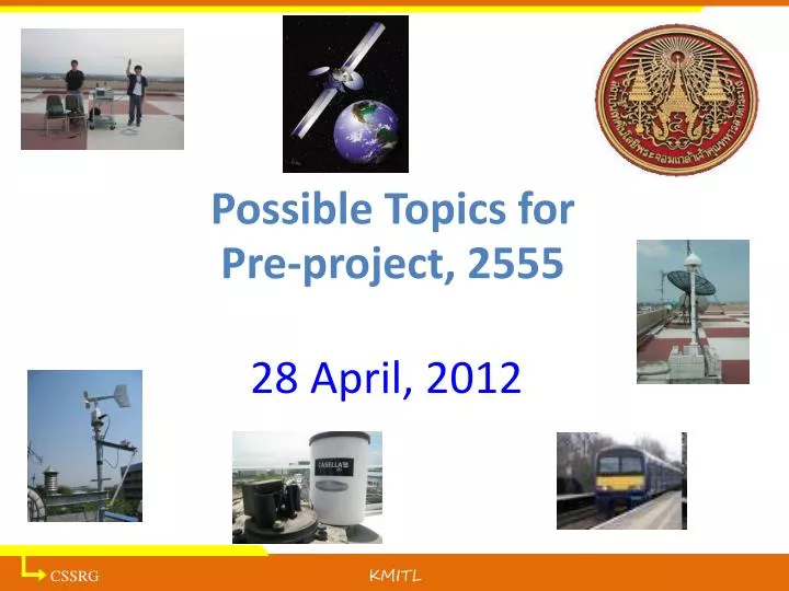
Possible Topics for Pre-project, 2555. 28 April, 2012. C S SRG. KMITL. ลักษณะของหัวข้อโครงงาน. กลุ่มวิจัยเน้นลักษณะหัวข้อวิจัยและโครงงานต่างๆได้แก่ อุปกรณ์/ซอฟต์แวร์ระบบสื่อสารดาวเทียม อุปกรณ์/ซอฟต์แวร์ระบบตรวจวัดปริมาณน้ำฝน (ซึ่งกระทบต่อคุณภาพสัญญาณดาวเทียม) ความชื้น ความเร็วลม ฯลฯ

E N D
Possible Topics for Pre-project, 2555 28 April, 2012 CSSRG KMITL
ลักษณะของหัวข้อโครงงานลักษณะของหัวข้อโครงงาน • กลุ่มวิจัยเน้นลักษณะหัวข้อวิจัยและโครงงานต่างๆได้แก่ • อุปกรณ์/ซอฟต์แวร์ระบบสื่อสารดาวเทียม • อุปกรณ์/ซอฟต์แวร์ระบบตรวจวัดปริมาณน้ำฝน (ซึ่งกระทบต่อคุณภาพสัญญาณดาวเทียม) ความชื้น ความเร็วลม ฯลฯ • ระบบวิทยุกำหนดด้วยซอฟต์แวร์ (software defined radio)สำหรับการสื่อสารทั่วไป และการสื่อสารการบิน • ระบบการทดสอบฮาร์ดดิสก์ไดรฟ์ การประมวลสัญญาณ • ระบบจีพีเอสหนึ่งความถี่ / สองความถี่ เพื่อการระบุตำแหน่งและการสื่อสารการบิน ดังนั้นขอให้นักศึกษาอ่านดูรายชื่อโครงงานและรายละเอียดด้านหลัง และหากมีความ สนใจอื่นๆที่ยังอยู่ในหัวข้อโครงงานแนวนี้ ขอให้นำมาปรึกษาร่วมด้วย
Topics • ILS receiver using Software Defined Radio Partner: บริษัทวิทยุการบินแห่งประเทศไทย • Ground-based augmentation system (GBAS) receiver Partner: บริษัทวิทยุการบินแห่งประเทศไทย • Train location tracking Partner: รฟท. • Wireless rain gauge and logger Partner: บริษัท ไทยคม • Meteorological recording system Partner: บริษัท ไทยคม, ม. เกษตรศาสตร์ (ยังไม่แน่นอน) • อุปกรณ์ทดสอบ printed circuit board บนตัวฮาร์ดดิสก์ไดรฟ์ (ไมโครคอนโทรเลอร์) Partner: บริษัทเวสเทิรนดิจิทัล จำกัด
Project 1: ILS receiver using SDR Purpose: • สร้างสายอากาศสำหรับสัญญาเอเอ็ม (VHF และ UHF) • ทดสอบอัตราขยายสายอากาศ และพารามิเตอร์ต่างๆ • ใช้บอร์ด USRP ร่วมกับคอมพิวเตอร์สร้างตัวรับสัญญาณควบคุมได้ด้วยซอฟต์แวร์ เพื่อประมวลสัญญาณ ‘localizer’ และ ‘glide slope’ Number of students: 3(1 ฮาร์ดแวร์, 2 ซอฟต์แวร์) Deliverables: • สายอากาศ สำหรับรับสัญญาณเอเอ็ม • ผลการทดสอบคุณภาพของสายอากาศ • ซอฟต์แวร์ในการประมวลผลสัญญาณที่วัดได้ในคอมพิวเตอร์และแสดงผลบนหน้าจอ Knowledge (ที่จะได้รับ): • การออกแบบสายอากาศ, ระบบปฏิบัติการลินุกซ์ (Ubuntu inux), การใช้งานเครื่องวิเคราะห์สเปกตรัม, ภาษาไพธอน (python)
1. ILS receiver ILS : Instrumentation Landing System Consists of “Localizer” and “Glide Slope” Localizer transmits 90-Hz and 150-Hz tone on carrier fc1 (108.1 – 119.9 MHz) Glide slope transmitter sends 90-Hz and 150-Hz tone on carrier fc2 (328.6 – 335.4 MHz) The airplane will receive these two tones to determine the whether the plane deviates from the runway center deviates from 3o angle (angle of approach)
Project 2: GBAS Purpose: • ศึกษาการระบุตำแหน่งของระบบจีพีเอสและมาตรฐาน GBAS (ground-based augmentation system) • ศึกษาเครื่องรับจีพีเอส (แบบสองความถี่) และ ไฟล์ชนิด RINEX ที่ได้รับ • พัฒนาซอฟต์แวร์ในการตัดพารามิเตอร์ในไฟล์เหล่านี้และคำนวณตำแหน่ง • พัฒนาซอฟต์แวร์ในการปรับปรุงความแม่นยำของการระบุตำแหน่ง • พัฒนาซอฟต์แวร์แสดงผลบนหน้าจอในรูปแบบที่บ.วิทยุการบินต้องการ Number of students: 3 (ซอฟต์แวร์) Deliverables: 1. ซอฟต์แวร์ในการตัดพารามิเตอร์ในไฟล์ RINEX และคำนวณตำแหน่ง 2. พัฒนาซอฟต์แวร์ในการปรับปรุงความแม่นยำของการระบุตำแหน่ง (ผลกระทบจากชั้นไอโอโนสเฟียร์และชั้นโทรโพสเฟียร์) 3. พัฒนาซอฟต์แวร์แสดงผลบนหน้าจอ Knowledge (ที่จะได้รับ): • การทำงานของระบบจีพีเอส, มาตรฐาน GBAS ในกิจการวิทยุการบิน, ภาษา C++
Project 3: Train Location Tracking Purpose: To locate train locations using either GPS system or smart phone • Design controller to process GPS signals • Programming on Android phone to track/send train position • Choose (1) and/or (2) to build map of train positions • Send information over LED screen, webpage and/or SMS Number of students: 3 Deliverables: • A system to send map+ addition information of the train position to users พี่เลี้ยง –
Project 3: Smart phone PIC18F458 #1 GPS Receiver MySQL database Apache server map with Google API
Project 4: Wireless rain gauge and logger Purpose: To develop a wireless rain gauge and logger system • Learn the tipping bucket rain gauge • Program microcontroller to record the rain rate (amount + date/time) • Study a wireless system that transmits the data remotely, for example, via GPRS or Zigbee, once a day, and store data in the computer • Develop database to store the rain data • Design the GUI to display and search for the rain data Number of students: 2 Deliverables • A system that collects the rain statistics remotely and store data in the server • GUI display for the rain data and statistics พี่เลี้ยง – มายด์
Project 4: RAINGAUGE MySQL
Project 5: Meteorological recording system Purpose: To develop a recording system for meteorological parameters • Learn the meteorological parameters, for example wind speed/direction, atmospheric pressure, humidity • Set up the equipment for recording • Develop a system that transmits data to the computer • Develop database to store the data Number of students: 2 Deliverables • A recording system that collects meteorological statistics and store data in the database พี่เลี้ยง – มายด์
Project 5: MySQL
Meeting นักศึกษาที่มีความสนใจในหัวข้อโครงงานแนวนี้ (หรือมีไอเดียอื่นๆที่ อยู่แนวนี้) • ขอให้นักศึกษามาลงชื่อและเลือกหัวข้อที่สนใจ (ที่แบบฟอร์มหน้าห้องอ.ตุลยา, T-305, หรือทางเฟสบุ๊กอ.ตุลยา) • ค้นหาข้อมูลเพิ่มเติมเกี่ยวกับโครงงานที่สนใจ • มาประชุมใน วัน - อังคารที่ 1 พฤษภาคม 2555 เวลา - 15.00 น. สถานที่ – ห้อง T-305 ตึกภาคโทรฯ (ชั้น 3)


![C = [K] C = [S]](https://cdn2.slideserve.com/3890150/c-k-c-s-dt.jpg)