Download
1 / 33
330 likes | 441 Vues
A law on geoinformation in Switzerland Why? For whom? How?. CLGE – GA Prag 1 march 2008. René Sonney Ingénieur Géomètre Breveté Responsable du centre de compétence e-geo.ch. Plan of the presentation. Overview of the swiss political system Why a new law

E N D
A law on geoinformation in Switzerland Why? For whom? How? CLGE – GA Prag 1 march 2008 René Sonney Ingénieur Géomètre Breveté Responsable du centre de compétence e-geo.ch
Plan of the presentation Overview of the swiss political system Why a new law The birth of a new law Presentation of the law Which consequences Conclusion
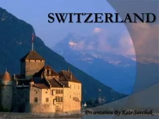
7’321’000 inhabitants. 40’000 km2
Overview of the swiss political system Confederation 23 cantons 26 states
Overview of the swiss political system • 1 Federal Constitution • 26 cantonal constitutions • 1 federal law • 26 cantonal implementing laws • xx federal implementing rules • yyy cantonal implementing rules
Overview of the swiss political system Why a new law The birth of a new law Presentation of the law Which consequences Conclusion
Article 75 a of the federal Constitution Art. 75a Mensuration/ measurment • The national measurement is under the control of the Confederation. • The Confederation legislates on the cadastral survey. • It can legislate on the harmonization of official landinformation. Adopted by the swiss people in 2004
National Spatial Data Infrastructure (NSDI) Basic Geoinformation Metadata Basic Geoservices Network e-geo.ch Technical Infrastructure Education Training Standards Legal basis Strategy for distribution and pricing One of the goals of this constitutional article is the development of the national spatial data infrastructure : NSDI
The new law should make it possible to achieve the following objectives: • A uniform legal basis for national surveying, cadastral survey, the national geology and all other land information based on the various federal decrees • A legal basis for the introduction of a cadaster of public and lawful limitations of ownership rights • A clear logic for a systematic application • A greater transparency with regard to the tasks and competences
The new law should make it possible to achieve the following objectives: • Taking full account of the existing decentralized structures and the federal organization; • The compliance with the allocation of tasks for the cadastral survey • The considerable improvement in the documentation • A clear overview of all other land information based on the various federal decrees.
Overview of the swiss political system Why a new law The birth of a new law Presentation of the law Which consequences Conclusion
The path to a new law can be broken down into five phases : • The phase of the initiative • The phase of the development • The examination phase into the parliament • The phase of the ratification • The phase of the coming into force
Timing of the development of the LGeo The national parliament has adopted the law on geoinformation the 5th october 2007.
Overview of the swiss political system Why a new law The birth of a new law Presentation of the law Which consequences Conclusion
General part • Unless otherwise provided by other federal laws, the general part of the LGeo applies to the entire federal legislation. • All basic geographical data regulated by federal law must follow these general rules. • The LGeo also contains rules for the cadaster of public and lawful limitations of ownership rights.
Somewhere in Switzerland. At least 101 situation to which a law applies
Purpose of a cadaster of public and lawful limitations of ownership rights • Scientific objective : to define more accurately and comprehensively the concept of a cadaster of public and lawful limitations of ownership rights(drawing up a classification) • Legal objective: to define the legal requirements relating to the security and the impact of information dissemination • Technical objective: to identify ways and means to disseminate information reliably • Organizational aspect : to define thoroughly partners (federal, cantonal, communal, private) to such dissemination of information and the flow of data and information • Financial objective: to define the financial costs and benefits of such a distribution
Special Part (technical parts) • The LGeo also plays the role of a techical law in the fields of • 0f the national surveying • 0f the national geology • And of the cadastral surveying. • These three areas are key competencies of the Federal Office of Topography. • These office will assume the implementation of the provisions of the law on geoinformation. • The central theme of this law is the basic geodata
Technical parts All other fields of application of basic geodata (Example: cadaster of noise)will be further addressed in the legislation specific to each field (Example: Law on the protection of environment or decree on the protection against the noise).
Structure of the LGeo • General provisions Purpose, Scope, Terms and definitions • Principles Qualitative and technical requirements for geodata Collection, revision and management, Access and use Cadaster of public and lawful limitations of ownership rights Commercial activities of the Federal Government • Special rules National survey – Geological survey - Cadastral survey - • Organization Responsibility and cooperation – Financing – Education and research • Final provisions
Overview of the swiss political system Why a new law The birth of a new law Presentation of the law Which consequences Conclusion
Which consequences The Law on geoinformation (LGeo) is a fundamental element of the national spatial data infrastructure (NSDI) insofar as it establishes the organizational, technical and financial conditions of the development of the geoinformation in Switzerland. With the NSDI, geodata will be available throughout the country under a defined technical and quality standard. Only federal laws can meet such requirements.
Which consequences for the people Dematerialization of plans and maps is increasing at a quicker rate over time. Along with the changing consumption habits and the need for immediacy of access to information, the paper is not as practical as the data in digital form.
Which consequences for swisstopo Swisstopo has a number of expectations The old law on mapping still serves today as a basis for the action of the Federal Office of Topography. At this time, digital technologies and geodata were not even "science fiction"! That’s why the time has come to create a modern legal framework for the important work of swisstopo. It is in the interest of swisstopo, but also of all partners and users of products and services.
National Spatial Data Infrastructure (NSDI) Basic Geoinformation Metadata Basic Geoservices Network e-geo.ch Technical Infrastructure Education Training Standards Legal basis Strategy for distribution and pricing Which consequences for the Confederation The Confederation expects from the creation of the national spacial data infrastructure (NSDI) a great utility for the economy through an increase of added value of the geodata. Broadly speaking, the LGeo constitutes an essential element for the development of the market for geographic information.
Which consequences relating to Inspire As non EU member the Switzerland is not formally obliged to implement the INSPIRE directive. To be aware of the situation swisstopo has mandated a study. The result is that on a legaly aspect we are not concerned by INSPIRE but on a practical aspect it is our interest to be conform to the INSPIRE directive. With the new law on geoinformation the legal base is ready.
Plan of the presentation Overview of the swiss political system Why a new law The birth of a new law Presentation of the law Which consequences Conclusion
Conclusion The Federal law on geoinformation can’t provide an answer to all questions, however it must provide the legal framework for the development of NSDI in Switzerland while taking into consideration European initiatives in this area (INSPIRE program).
Conclusion A federal legal framework is an asset to the development of geoinformation in Switzerland.Have high quality geo-data throughout the entire territory make it also possible to create added value by offering services and derived products.
Thank you for your attention Questions, remarks... www.swisstopo.ch