Download
1 / 3
30 likes | 148 Vues
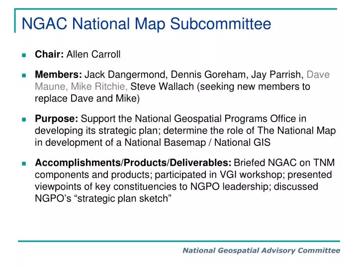
NGAC National Map Subcommittee. Chair: Allen Carroll Members: Jack Dangermond, Dennis Goreham, Jay Parrish, Dave Maune, Mike Ritchie, Steve Wallach (seeking new members to replace Dave and Mike)

E N D
NGAC National Map Subcommittee • Chair: Allen Carroll • Members: Jack Dangermond, Dennis Goreham, Jay Parrish, Dave Maune, Mike Ritchie, Steve Wallach (seeking new members to replace Dave and Mike) • Purpose: Support the National Geospatial Programs Office in developing its strategic plan; determine the role of The National Map in development of a National Basemap / National GIS • Accomplishments/Products/Deliverables: Briefed NGAC on TNM components and products; participated in VGI workshop; presented viewpoints of key constituencies to NGPO leadership; discussed NGPO’s “strategic plan sketch”
NGAC National Map Subcommittee Possible Next Steps/Deliverables: 1. The case for a national base map: The Subcommittee may seek formal acknowledgement by NGAC that • A national base map made up of integrated foundation data layers is a key component of a national GIS / geospatial platform • Regardless of architecture or governance structure of a national GIS, The National Map is the primary government effort to provide this integration, and that its function should be maintained • Effectively providing these core services requires adequate and sustained funding levels that are significantly higher than TNM currently receives • Governance needs to be refined to better mandate provision of data in layers not managed by USGS (e.g., transportation) 2. Investment in enhanced elevation data for the nation • Elevation, along with imagery and geodetic control, is among the most fundamental components of the national base map • Unlike imagery, where multiple data providers are currently active, elevation is a prime target for a focused initiative/investment • Initiative should include increased coordination of existing efforts across federal agencies and states, and significant funding commitment—both for data acquisition and for its hosting and distribution
NGAC National Map Subcommittee Possible Next Steps/Deliverables: 3. Issues and options for licensing private data • The subcommittee will seek to provide guidance to NGPO on licensing commercial data, particularly for imagery and transportation • Key issues to balance: full public access vs. best possible quality of data (currency, resolution, value-added attributes, etc) • Goal: Outline a framework to discuss at June NGAC meeting in order to provide timely support to TNM strategic plan 4. Provide continued comment and feedback to drafts of NGPO’s strategic plan