Download
1 / 8
80 likes | 180 Vues
Identifying Risk Areas for Soil Erosion in Europe. Members of the Task Group: R J A Jones (Lead), Christine Le Bas, Josef Kozak Advisors: Olaf Düwel, Dominique King. Identification of a risk area or zone requires: Defining spatial dimension (component)

E N D
Identifying Risk Areas for Soil Erosion in Europe Members of the Task Group: R J A Jones (Lead), Christine Le Bas, Josef Kozak Advisors: Olaf Düwel, Dominique King • Identification of a risk area or zone requires: • Defining spatial dimension (component) • Defining temporal dimension (in future) • Key aspects of the risk assessment are: • Level of detail • Measurement or prediction of current level of risk • Prediction of future trend for that risk • Important considerations remain: • Subsidiarity should be optimized • Maximum use should be made of existing inventory and monitoring systems activities and other sources of information • Risk assessment, particularly the definition of areas at risk from the particular threat is the primary objective, not collection and harmonisation of soil data ESBN Plenary 2005
Identifying Risk Areas for Soil Erosion in Europe • Three options to define risk areas (zones): • Empirical - on-site measurement • Modelling – calibrated with real data • Combination of 1 and 2 above • Spatial resolution required to define risk areas; • Risk measurements already undertaken • Modelling: (i) Models available (ii) Data requirements (iii) Calibration/validation • Useful links to existing European databases: • CORINE, CIS, LUCAS,ICP Forest Focus • European Soil Database (http://eusoils.jrc.it/) • Agricultural Statistics data, e.g. from Eurostat • (http://epp.eurostat.cec.eu.int/pls/portal), • MARS Agroclimatic Database (http://mars.jrc.it/) • NUTS (Nomenclature of Territorial Units for Statistics) • as used by Eurostat (see also Appendix III: Auxiliary Data). (in future) the t ESBN Plenary 2005
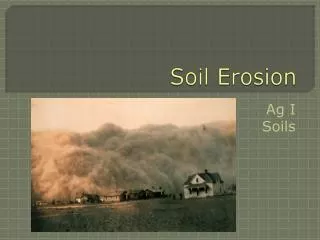
Definition of Soil Erosion ‘Soil erosion is the wearing away of the land surface by physical forces such as rainfall, flowing water,wind, ice, temperature change,gravity or other natural or anthropogenic agents that abrade, detach and remove soil or geological material from one point on the earth's surface to be deposited elsewhere’. ‘In the context of environmental protection, most concerns about erosion are related to accelerated erosion, where the natural rate has been significantly increased mostly by human activity.’ ‘Accelerated erosion by running water has been identified as one of the most severe threats to soil in Europe.’ ESBN Plenary 2005
Types of Soil Erosion in Europe Water erosionby rill and inter-rill, gully, snowmelt, banks in rivers and lakes; Translocation erosion by tillage, land-levelling, harvesting of root crops, trampling and burrowing animals; Wind erosion by the action of strong dessicating wind; Geological erosion: internal subterranean erosion by groundwater, coastal erosion, and landslides. Landslides including debris flows, other forms of geological erosion, and bank erosion (along rivers and lake shores) are reported by another SIWG Task group ESBN Plenary 2005
XXX Predom XX Important X Minor N Not found ? Not known
DATA SETS ESBN Plenary 2005
Proposed Approach - 1 I. Each Member State should be requested to provide accurate information to update Table of ‘Types of Soil Erosion’. II. Each Member State should delineate areas at risk of accelerated soil erosion by estimating soil loss, for each 1 km x 1 km unit falling wholly or partly within its national boundaries, as a result of: Water erosion: (i) Rill and inter-rill erosion using a standard model, such as PESERA or RUSLE, validated against erosion measurements and harmonised standard input data. Member States should also be encouraged to use, for comparison, any national approach that is scientifically robust, fully documented and based on the most detailed data available at national level. (ii) Snowmelt erosion using climatic and topographic criteria (together with expert judgement) where this form of erosion is known to be prominent (see Table). Upland (Peat) erosion, often resulting from a combination of water and wind erosion, using the occurrence of susceptible soil types (e.g. Histosols), topography, rainfall, wind exposure, with the aid of expert judgement; ESBN Plenary 2005
Proposed Approach – 2 Tillage and land leveling, largely confined to southern Europe, identified from a combination of slope and agro-ecological zone; Wind erosion:this is more difficult to assess but there are models such as WEELS and WELSONS to estimate soil loss. Delineation of risk areas could be made on the basis of occurrence of sandy and silty soils with loose structure, in combination with relatively low rainfall and incomplete land cover at critical times of the year and likely to be exposed to strong desiccating winds. Further consultation is needed to finalise the best approach to estimating losses from wind erosion, but expert judgement and observation will undoubtedly play an important part. III. Defining risk areas by these means will inevitably result in the inclusion of land that has already been severely eroded and the obscuring local pockets of erosion because of the scale. However, these problems must be accepted in interests of harmonization at European level. ESBN Plenary 2005