Download
1 / 32
320 likes | 324 Vues
Collaborative Convective Forecast Product (CCFP). CCFP Overview. Convective weather is the single most disruptive force affecting the National Airspace System (NAS). These disruptions are the largest cause of delays in the system

E N D
CCFP Overview • Convective weather is the single most disruptive force affecting the National Airspace System (NAS). These disruptions are the largest cause of delays in the system • Mitigation of delays requires collaboration in thunderstorm forecasting used for traffic flow management (TFM) decisions • CCFP seeks to reduce these disruptions by creating an accurate and reliable convective forecast for strategic use through collaboration
CCFP Overview Continued • The CCFP forecast has been endorsed by the CDM Collaborative Routing Workshop as the cornerstone of strategic planning in NAS operations • The Aviation Weather Center (AWC) is the host for the generation of CCFP forecasts with input from CWSUs and airline meteorologists • The CCFP forecast is generated six times a day with two, four, and six hour forecast windows. The forecast is available on websites at the Air Traffic Control System Command Center (ATCSCC), AWC, and Collaborative Decision Making (CDM)
CCFP Participants & Users • CCFP was jointly developed by the FAA, NWS and the airline industry to provide a strategic forecast for NAS users to coordinate a system-wide approach to thunderstorm events • The participants who generate the CCFP forecast are the Aviation Weather Center (AWC), Center Weather Service Units (CWSUs), and airline meteorologists • CCFP is designed for use by traffic flow planners: • Flight Operations Centers (FOCs) • FAA Traffic Flow Management Units • Others
CCFP Goals • Provide traffic flow planners with common situational awareness of forecast thunderstorms. • Increase opportunities for forecast input by individual NAS stakeholders through their meteorologists • Reduce delays due to thunderstorm activity • Improve FOC/TFM route coordination during thunderstorm events • Eliminate the time required for review of thunderstorm forecasts during telcons of the Strategic Planning Team (SPT)
CCFP History • 1998 – Northwest Airlines, ZMP ARTCC CWSU and AWC initiate collaborative convective forecast • 1999 – CCFP run as a test program • 2000 – First full operational CCFP season • 2001 – CCFP production expanded to 7X24 • 2002 – Production begins March 1
Collaboration vs. Consensus • Collaboration: All participants contribute their meteorological expertise. A final decision is made by a designated authority IS NOT… • Consensus: All participants agree upon the final product before it is issued
Collaborative Forecast • Stakeholders have agreed to contribute their expertise to CCFP through open discussion in a chat room setting • It has been agreed by all stakeholders that AWC is the designated authority for the final CCFP forecast product
Responsibilities of Product Developers • AWC: • Produce the initial forecast • Moderate the chat room • Produce the final forecast • CWSUs: • Provide input on the forecast for their area of responsibility
Responsibilities of Product Developers continued • Airline Meteorologists: • Provide input on the forecast for their areas of interest • ATCSCC Weather Unit • Monitor chat room input • Request clarification on areas of concern
Chat Room Guidelines • All meteorologists are encouraged to provide input in response to the initial forecast from AWC • All stakeholders have agreed the AWC forecaster is the final authority on the CCFP forecast product • Participants should limit input to their respective areas of responsibility/interest • Participants are not required to remain in the chat room. They are able to review input at any time and add additional comments
Initial Product • 60 minutes before final issue time AWC will post the initial forecast to the chat room for review • 45 minutes before final issue time the chat room session commences • 15 minutes before final issue time AWC closes the chat room session and develops the final forecast product based on chat room participation
Final Product • The final forecast product is posted on the Web • The SPT uses the final forecast product for the development of a strategic plan
CCFP Package Initial Issue Time Collaboration Session Final Issue Time Valid Time 0300 0145 0200-0230 0245 0500, 0700, 0900 0700 0545 0600-0630 0645 0900, 1100, 1300 1100 0945 1000-1030 1045 1300, 1500, 1700 1500 1345 1400-1430 1445 1700, 1900, 2100 1900 1745 1800-1830 1845 2100, 2300, 0100 2300 2145 2200-2230 2245 0100, 0300, 0500 CCFP Timetable (UTC)
Thunderstorm Forecasting • Thunderstorms are an extreme form of convection. Individual cells are fast, small, and tall: approximately a 20 minute lifespan, 1 mile wide, and up to 10 miles high • Lines or clusters of thunderstorms have a longer lifespan and are predictable under certain circumstances. This is the objective of CCFP
Thunderstorm ForecastingContinued • Limitations on forecasting • Numerical weather prediction cannot yet reliably forecast detailed thunderstorms on a national scale • Traditional observations (Rawinsonde balloons) are inadequate: measurements are made every 12 hours and approximately 500 miles apart • A modern observational network does not make direct measurements, but only detects thunderstorms indirectly from satellites, by NEXRAD, and through lightning detection data • Therefore, specific locations of thunderstorms, their coverage and intensity cannot be predicted in detail
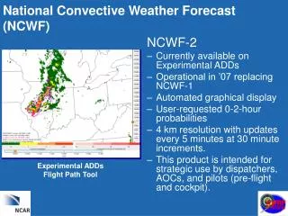
Thunderstorm Forecasting Continued • The CCFP forecast is designed for strategic planning of NAS operations • Best available forecast from experts in government and industry • Includes all technical information • The CCFP forecast is used for daily TFM strategic planning decisions • Augmented with Short term products: Convective SIGMETS; NCWF; ITWS; CIWS
Thunderstorm Forecasting Continued • Methodology: • Predict the patterns of thunderstorms; not all convection; not the detailed locations or times • Utilize forecasting tools from traditional observations • Utilize numerical model forecasts of the large-scale pattern • Integrate all information with experience of an operational forecaster • Make specific forecasts, but marked with the Probability of Detection (POD)
Product Format • Forecast thunderstorms with tops above 25,000 ft. and 25% or greater coverage • Colors indicate forecast thunderstorm coverage within the designated areas: • Yellow (low coverage, 25 to 49%) • Orange (medium coverage, 50 to 74%) • Red (high coverage, 75 to 100%) • Purple (solid lines)
Product Format Continued • Colors DO NOT indicate intensity levels! • Colors DO NOT indicate video integrator processor (VIP) levels that are found in radar reports!
Product Format Continued • Low 25 to 49% - is an area where scattered thunderstorms are expected • Med 50 to 74% - is an area where thunderstorm clusters and/or frontal activity is expected • High 75 to 100% - is an area where dense overall thunderstorm coverage is expected. The area will likely include lines and clusters of thunderstorms • Solid lines of thunderstorms will be depicted as a purple line
Product Format Continued • Maximum thunderstorm heights within the forecast area are reported in the following three categories • 25,000 – 31,000 feet • 31,000 – 37,000 feet • 37,000+ feet • The forecast heights identified are the maximum visible thunderstorm tops within the entire area, not the average Note: NEXRAD radar indicates precipitation tops, which will always be lower than visible tops
Product Format Continued • Growth rate • ++ = Fast Positive Growth • + = Moderate Positive Growth • NC = No Change • - = Negative Growth (area/tops decreasing) • This is an indicator of how the volume of denied airspace associated with the depicted forecast is likely to change with time
Product Format Continued • Probability of Occurrence: • The forecasters’ confidence level is expressed as a probability of occurrence of thunderstorms within the designated area in one of three classes: Low, Medium or High Note: Generally, there will be a low level of confidence in the early morning forecast, and for forecast lead times of 6 hours. For shorter lead-times (e.g., 2 hours), or after thunderstorms have started, confidence will generally increase. Probability will also be influenced by expertise contributed during the collaborative forecast discussion.
CCFP Scientific Verification • Thunderstorm forecasts are compared to actual weather conditions to assess accuracy and is posted within 24 hours • Statistical results are computed by the Real-Time Verification System (RTVS) and independently assessed by the Forecast Systems Laboratory (FSL) • These results and further explanation can be found on the FSL website, which is linked from the CCFP+ section of AWC’s CCFP website
Product Utilization • CCFP is a strategic Traffic Flow Management planning tool (2 to 6 hrs in the future) • All stakeholders have agreed CCFP will be the thunderstorm forecast product for SPT planning • CCFP is used during SPT telcons for the development of the Strategic Plan of Operation (SPO) • CCFP is intended to be used by traffic planners in developing a strategic plan during thunderstorm activity
Product Utilization Continued • The goal of the CCFP is to forecast a level of thunderstorm activity (25% coverage or higher) that may impact the NAS. It is not intended to forecast all thunderstorm activity • Thunderstorms of less than 25% coverage may still impact the NAS but are handled as a tactical issue with input from local meteorologists
Product Utilization Continued • Differences in traffic volume, time of day and geographic areas affect planning decisions • Low probability of convection may be viewed as a tactical problem with “triggers” in the affected area • Low coverage with high probabilities in some areas of the NAS may have limited impact and be a tactical problem. In other areas of the NAS low coverage may have a major impact on the system operation (for example, NY area vs. Midwest)
Summary • CCFP is a strategic planning tool • CCFP will not meet all thunderstorm forecasting needs • Other weather forecasting tools (e.g. NCWF, Convective SIGMETS, ITWS, etc.) should be used in conjunction with CCFP
Summary Continued • Colors do not correlate to intensity levels • Regional differences in traffic density varies impacts of convective activity from place to place • Please provide suggestions for improvement on CCFP website and through CDM representatives
CCFP Web Locations • AWC: http://cdm.aviationweather.noaa.gov/ccfp/index.php3 • ATCSCC: http://www.fly.faa.gov/ • Volpe: http://www.volpe.dot.gov/ • Forecast Systems Lab: http://www-ad.fsl.noaa.gov/