Download
1 / 24
240 likes | 373 Vues
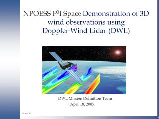
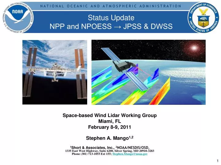
Status Update NPP and NPOESS → JPSS & DWSS. Space-based Wind Lidar Working Group Miami, FL February 8-9, 2011 Stephen A. Mango 1,2 1 Short & Associates, Inc., 2 NOAA/NESDIS/OSD, 1335 East West Highway, Suite 6200, Silver Spring, MD 20910-3283

E N D
Status UpdateNPP and NPOESS → JPSS & DWSS Space-based Wind Lidar Working Group Miami, FL February 8-9, 2011 Stephen A. Mango1,2 1Short & Associates, Inc., 2NOAA/NESDIS/OSD, 1335 East West Highway, Suite 6200, Silver Spring, MD 20910-3283 Phone (301) 713-1055 Ext 155; Stephen.Mango@noaa.gov
After reviewing options, including those suggested by an Independent Review Team (IRT) and Congressional Committees, the President’s FY2011 budget takes significant new steps. Today the White House is announcing that NOAA and the Air Force will no longer continue to jointly procure the polar-orbiting satellite system called NPOESS. This decision is in the best interest of the American public to preserve critical operational weather and climate observations into the future. The three agencies (DOD, NOAA and NASA) have and will continue to partner to ensure a successful way forward for the respective programs, while utilizing international partnerships to sustain and enhance weather and climate observation from space. • The major challenge of NPOESS was jointly executing the program between three agencies of different size with divergent objectives and different acquisition procedures. The new system will resolve this challenge by splitting the procurements. NOAA and NASA will take primary responsibility for the afternoon orbit, and DOD will take primary responsibility for the morning orbit. The agencies will continue to partner in those areas that have been successful in the past, such as a shared ground system. The restructured programs will also eliminate the NPOESS tri-agency structure that has made management and oversight difficult, contributing to the poor performance of the program. • NOAA and the Air Force have already begun to move into a transition period during which the current joint procurement will end. A detailed plan for this transition period will be available in a few weeks. The agencies will continue a successful relationship that that they have developed for their polar and geostationary satellite programs to date. NOAA’s portion will notionally be named the “Joint Polar Satellite System” (JPSS) andwill consist of platforms based on the NPP satellite. Restructuring the NPOESS [OSTP – Feb 1, 2010]U.S. Polar-orbiting Operational Satellite Systems [1 of 3]
• In addition, these Agencies have a strong partnership with Europe through the European Organisation for the Exploitation of Meteorological Satellites (EUMETSAT) that will continue to be a cornerstone of our polar-orbiting constellation, and will ensure our ability to provide continuous measurements. • These changes to the NPOESS program will better ensure continuity of crucial civil climate and weather data in the future. Decisions on future satellite programs will be made to ensure the best plan for continuity of data. • While the Air Force continues to have remaining Defense Meteorological Satellite Program (DMSP) polar-orbiting satellites available for launch for the next few years, NOAA launched its final polar-orbiting satellite in February 2009. Given that weather forecasters and climate scientists rely on the data from NOAA’s current on-orbit assets, efforts will focus development of the first of the JPSS platforms on ensuring both short- and long-term continuity in crucial climate and weather data. • NASA’s role in the restructured program will be modeled after the procurement structure of the successful POES and GOES programs, where NASA and NOAA have a long and effective partnership. Work is proceeding rapidly with NOAA to establish a JPSS program at NASA’s Goddard Space Flight Center (GSFC). Restructuring the NPOESS [OSTP – Feb 1, 2010]U.S. Polar-orbiting Operational Satellite Systems [2 of 3]
o The NASA developed and operating Earth Observing System (EOS) Aqua satellite and ground system are very similar in scope and magnitude to the proposed JPSS program. o NOAA and NASA will strive to ensure that all current NPOESS requirements are met on the most rapid practicable schedule without reducing system capabilities. o NASA program and project management practices have been refined over decades of experience developing and acquiring space systems and NASA anticipates applying its current practices to JPSS. NASA program and project management processes will include thorough and ongoing review and oversight of project progress. Cost-estimates will be produced at or close to the 80% confidence level. • DOD remains committed to a partnership with NOAA in preserving the Nation's weather and climate sensing capability. For the morning orbit, the current DOD plan for deploying DMSP satellites ensures continued weather observation capability. The availability of DMSP satellites supports a short analysis (in cooperation with the partner agencies) of DOD requirements for the morning orbit and solutions with the start of a restructured program in the 4th quarter of fiscal year 2011. While this study is being conducted, DOD will fully support NOAA's needs to ensure continuity of data in the afternoon orbit by transitioning appropriate. [Update to OSTP Statement: the DOD system is being called the DWSS – Defense Weather Satellite System] • We expect much of the work being conducted by Northrop-Grumman and their subcontracts will be critical to ensuring continuity of weather observation in the afternoon orbit.DOD will work closely with the civil partners to ensure the relevant efforts continue productively and efficiently, and ensure the requirements of the national weather and climate communities are taken into consideration in building the resultant program for the morning orbit. Restructuring the NPOESS [OSTP – Feb 1, 2010]U.S. Polar-orbiting Operational Satellite Systems [3 of 3]
Two Acquisitions One Acquisition Two Acquisitions “Passages” LAN 1730 - 2000 DoD DoD LAN 1730 DoD/NOAA/NASA LAN 1330 and 1730 DMSP S/C ? DWSS LAN 1330 NOAA/NASA Acquisition Transitions LAN 1330 NOAA/NASA NPOESS POES S/C ? JPSS < Oct 1994 Oct 1994 – Feb 2010 > Feb 2010
OLSSSM/I, SSM/T-1, SSM/T-2 or SSMISSES VIIRS or ? SEM-N or ? MIS or ? ? LAN 1730 LAN 1730 - 2000 “Passages” VIIRSMISCrIS, ATMSOMPSSESS or SEM-NCERES or ERBSTSISALT, APSADCSSARSAT LAN 1330 and 1730 -Imaging -Sounding -Space Environment -Imaging -Sounding -Space Environment DMSP DWSS AVHRRHIRSAMSU-A, AMSU-B, MHSSBUVSEMDCSSARSAT VIIRSCrIS, ATMSOMPSCERESTSIS*ADCS * SARSAT * LAN 1330 LAN 1330 NOAA/NASA Evolution/Transition of Missions/Sensors/Requirements -Imaging -Sounding -Climate -Ozone -Space Environment NPOESS -Imaging -Sounding -Climate -Ozone -Space Environment -Imaging -Sounding -Climate -Ozone POES JPSS < Oct 1994 Oct 1994 – Feb 2010 > Feb 2010
Two polar, sun-synchronous orbits instead of three for NPOESS. Dependence on MetOp for third orbit of constellation. 4 Satellites [2 EMD + 2 production] instead of six (6), namely [C1(1330),C2(1730),C3(1330),C4(1730)]. S/C Bus sized to carry all sensors VIIRS, CrIS, ATMS, OMPS-N, CERES, SEM, ADCS, SARSAT remain [are manifested] CMIS deleted from C1; MIS planned for C2, C3 & C4 APS, TSIS, OMPS-L, ERBS, ALT, SuS, SESSde-manifested from C1& C2 [accommodationremains] Ground architectureessentially unchanged NPOESS Restructured Certified Program 2006-2007 NPOESS LAN 17:30 NPOESS LAN 13:30 MetOp LAN 21:30
Two U.S.polar, sun-synchronous orbits with two separate procurements: NOAA/NASA procurement [JPSS] for early afternoon [LAN 1330], USAF/DoD procurement [DWSS]for early morning orbit [LAN 1730] Dependence on MetOp for third orbit of constellation, mid-morning [LAN 2130]. 4 U.S. Satellites namely, JPSS -1 and JPSS-2, DWSS-1 and DWSS-2. S/C Bus sized to carry its sensors: JPSS --- “NPP-like” DWSS --- “NPOESS-like” ? [TBD] JPSS - VIIRS, CrIS, ATMS, OMPS, CERES, TSIS*, SEM *, DCS*, SARSAT* DWSS – VIIRS or ?, MIS ? [TBD], SEM-N, ADCS ? [TBD], SARSAT ? [TBD] TSIS in NOAA/NASA Mission; APS, ALT not manifested on JPSS or DWSS Ground architecture may bemostly unchanged ??? NPOESS Restructured Program2010-2011 DWSS LAN 17:30 JPSS LAN 13:30 MetOp LAN 21:30
NPOESS Concept of OperationsJPSS/DWSS ConOps – Similar !? 2. Downlink raw data 1. Sense phenomena 3. Transport data to Centrals for processing X and L bands Ka-band SafetyNet !? Global fiber network connects 15 receptors to Centrals Field Terminals SafetyNetTM Receptors 4. Process raw data into EDRs and deliver to Centrals Monitor and control Satellites and Ground Elements MMC (Suitland) Aurora MMC Full IDP Capability at each Central NESDIS, AFWA, FNMOC, NAVO
“Bridges EOS & NPOESS Climate Measurement Missions” NPOESS Preparatory Project [NPP] “Bridge from EOS to NPOESS” LTAN 1330 NPP AQUA C1 LTAN 1330 LTAN 1330 EOS NPOESS
NPOESS Preparatory Project [NPP] “Bridge from EOS to JPSS & DWSS” “Bridges EOS & JPSS Climate Measurement Missions and DWSS Measurements” LTAN 1330 NPP S/C ? DWSS LAN 1330 AQUA LTAN 1330 JPSS S/C ? LAN 1330 EOS
As of Feb 2010 - NPP Development was Nearly Completed NPOESS Production was in Progress & on Schedule for 2014 Launch DEVELOPMENT PRODUCTION Flight 2 H/W Coming together • Delivered: • ATMS Flight 1 • CERES Flight 5 • OMPS Flight 1 • VIIRS Flight 1 • CrIS Flight 1 Initial Sensors All sensors delivered [as of June 2010] Flight 2 schedules have margin to need dates NPPLaunch Final NPP Prep On track • Command & Control Operational • Data processing Installed at 2 sites • AlgorithmsDelivered • OperationsReady Ground Segment Mature NPOESS C1 upgradeOn track C1Launch CDRConducted Key Engineering ModelsDemonstrated I&Tschedulehas schedule margin EEMTB makinggoodprogress SpacecraftDesign is complete, development on track 2002 2004 2006 2008 2010 2012 2014 Behind Schedule; progressing Completed or On Scheduleto Complete near-term On Schedule and progressing nominally
CERES OMPS NPP Spacecraft ATMS All Five Sensors Installed on NPP NPP Launch – October 2011 CrIS Instrument VIIRS in Thermal Vacuum Chamber NPP Satellite at Spacecraft facility NPOESS Preparatory Project (NPP) in system integration & test phase
JPSS-1 [was NPOESS C1] Payloads [LAN 1330] Visible/Infrared Imager/ Radiometer Suite Cross-track Infrared Sounder Ozone Mapping & Profiler Suite OMPS Instrument (Ball) VIIRS Instrument (Raytheon) CrIS Instrument (ITT) Clouds and Earth’s Radiant Energy System Advanced TechnologyMicrowave Sounder Total Solar Irradiance Sensor S/C ? TSIS Instrument (LASP) CERES Instrument (NGAS) ATMS Instrument (NGES)
The Need for an operational, sustainable Doppler Wind Lidar [DWL] Still Exists
NOAA and DoD, through NPOESS/IPO, have been funding risk reduction, calibration/validation, research and simulation studies related to Wind Profiling LIDAR for several years. • Risk Reduction Efforts • Requirements definitions and refinements, realizability studies • LIDAR scatterers’ distributions and characterization studies • Ground based Wind LIDAR Validation Systems • Airborne Validation of the Concept [DDWL (various), CDWL, Hybrid] • LIDAR Technology Studies e.g. HOE, Tunable LOs, Detectors, efficient, long-life, high-rep Lasers • Hybrid DWL feasibility studies; Adaptive Targeting studies • Platform Accommodation Studies [airborne & spaceborne (incl. NPOESS, NPOESS Lite)] • Calibration/Validation of space-based WL • Ground ( stationary and mobile) system development & demonstrations • Airborne system development & demonstrations • Utilization of Sondes [Rawinsondes, Dropsondes]; Collateral measurements req. (e.g. aerosols) • Comparison of “truth techniques” for space based WL • OSSEs [Observing System Simulation Experiments] & OSEs • Showing the relative benefits of various Space-based DWL concepts. • Space based Doppler Wind LIDAR Mission Studies – Demonstration NWOS • BalloonWinds – NOAA/NESDIS Office of Systems Development • International Space Station Wind Lidar Study- NASA/GSFC IDL/MDL • NOAA/NESDIS/OSD co-sponsoring w/NASA & USAF NOAA / NESDIS Wind Lidar Activities
NOAA ProgramsRequiring Atmospheric Winds* • Data provided by NOAA/ Technology, Planning and Integration Office/ • Consolidated Operational Requirements List[CORL] Team
The Needed Measures of the Atmosphere For NWP • Mass Field--- T (z), P (z), g (z), mu (z) NPOESS Atmospheric Sounders – CrIS, ATMS, OMPS, MIS • Moisture Field--- q (z) NPOESS Atmospheric Sounders – CrIS, ATMS, OMPS, MIS • Motion Field--- v (u,v,z) “ 3D Winds” Doppler Wind Lidar Hybrid Doppler Wind Lidarfor full atmosphere 3-D Winds [DWL] Vertical Wind Profiles # 1 Unaccommodated EDR
Need for Improved Accuracy of Transport Estimates for Climate Applications • Improved reanalysis data sets are needed to provide a more accurate environmental data record to study global warming; for example, recent studies1,2 indicate that the recent dramatic reduction in sea ice extent observed in the Arctic may be due, in large part, to heat transport into the Arctic, but this finding is based on reanalysis wind data with large uncertainty in the Arctic because of lack of actual wind measurements • The measurement of accurate, global winds is critical for climate • monitoring: “The nation needs an objective, authoritative, and consistent source of . . . reliable. . . climate information to support decision-making. . .”3 ___ 1 JCSDA Seminar by ErlandKallen, April 23, 2009 2 Graverson et al., 2008, in Nature; Graversonet al., 2006, in J. Clim. 3 NOAA Annual Guidance Memorandum, Internal Draft, May 10, 2009
Dual Doppler Receiver: • Coherent & Direct Detection • Science/technology trades • Coherent ‘heterodyne’ • (e.g. SPARCLE-NASA/LaRC) • Direct detection • “Double Edge” • (e.g. Zephyr-NASA/GSFC) • Direct detection • “Fringe Imaging” • (e.g. Michigan Aerospace) Utilizes Lidar Dual Backscatter From Aerosols & Molecules Backscattered Spectrum DOP Aerosol (l-2) Molecular (l-4) Frequency Conventional & HDWL Methods of Spaceborne Measurements of Atmospheric Winds Successive GOES Cloud ImagesCross-Correlation Method OVW CMV QuickSCATSeaWinds MODIS Polar H2O Vapor Winds WVMV HDWL 3D Surface(1000 hPa) Mid-trop (800 hPa) Polar Water Vapor Winds Improve Weather Fcx Courtesy of Dr. W. Paul Menzel – NOAA/NESDIS
NexGen NexGen NWOS (2026) GWOS (2016) Operational 3-D global wind measurements ADM Aeolus (2011) Demo 3-D global wind measurements GWOS TODWL (2002 - 2008) Single LOS global wind measurements DWL Airborne Campaigns, ADM Simulations, etc. NWOS TODWL: Twin Otter Doppler Wind Lidar [CIRPAS NPS/NPOESS IPO] ESA ADM: European Space Agency-Advanced Dynamics Mission (Aeolus) [ESA] GWOS: Global Winds Observing System [NASA/NOAA/DoD] NexGen: NPOESS [2nd] Generation System [PEO/NPOESS] NexGen Hybrid Doppler Wind Lidar - NWOSPossible NPOESS Wind Observing System For Vertical Wind Profiles 2007 NAS Decadal SurveyRecommendations for Tropospheric Winds • 3D Tropospheric Winds mission called “transformational” • and ranked #1 by Weather panel. • 3D Winds also prioritized by Water Cycle panel. • “The Panel strongly recommends an aggressive program • early on to address the high-risk components of the • instrument package, and then design, build, aircraft- • test, and ultimately conduct space-based flights of a • prototype Hybrid Doppler Wind Lidar (HDWL).” • “The Panel recommends a phased development of the • HDWL mission with the following approach: • Stage 1:Design, develop and demonstrate a prototype HDWL system capable of global wind measurements to meet demonstration requirements that are somewhat reduced from operational threshold requirements. All of the critical laser, receiver, detector, and control technologies will be tested in the demonstration HDWL mission. Space demonstration of a prototype HDWL in LEO to take place as early as 2016. • Stage II:Launch of a HDWL system that would meet fully-operational threshold tropospheric wind measurement requirements. It is expected that a fully operational HDWL system could be launched as early as 2022.”
NexGen JWOS (2022 ?) ISS HDWL (2017) Operational 3-D global wind measurements ADM Aeolus (2011) Demo 3-D global wind measurements TODWL (2002 - 2008) Single LOS global wind measurements DWL Airborne Campaigns, ADM Simulations, etc. TODWL: Twin Otter Doppler Wind Lidar [CIRPAS NPS/NPOESS IPO] ESA ADM: European Space Agency-Advanced Dynamics Mission (Aeolus) [ESA] ISS HDWL: International Space Station Hybrid Doppler Wind Lidar [NASA] NexGen: Joint [JPSS/DWSS] Wind Observing System [NASA/NOAA/DoD ???] NexGen Hybrid Doppler Wind Lidar - JWOSPossible Joint [JPSS/DWSS] Wind Observing System For Vertical Wind Profiles 2007 NAS Decadal SurveyRecommendations for Tropospheric Winds NexGen Joint JPSS/DWSS Acquisition ? • 3D Tropospheric Winds mission called “transformational” • and ranked #1 by Weather panel. • 3D Winds also prioritized by Water Cycle panel. • “The Panel strongly recommends an aggressive program • early on to address the high-risk components of the • instrument package, and then design, build, aircraft- • test, and ultimately conduct space-based flights of a • prototype Hybrid Doppler Wind Lidar (HDWL).” • “The Panel recommends a phased development of the • HDWL mission with the following approach: • Stage 1:Design, develop and demonstrate a prototype HDWL system capable of global wind measurements to meet demonstration requirements that are somewhat reduced from operational threshold requirements. All of the critical laser, receiver, detector, and control technologies will be tested in the demonstration HDWL mission. Space demonstration of a prototype HDWL in LEO to take place as early as 2016. • Stage II:Launch of a HDWL system that would meet fully-operational threshold tropospheric wind measurement requirements. It is expected that a fully operational HDWL system could be launched as early as 2022.” ISS HDWL JWOS?
Thanks for the Opportunity to Talk to You