Download
1 / 27
270 likes | 461 Vues
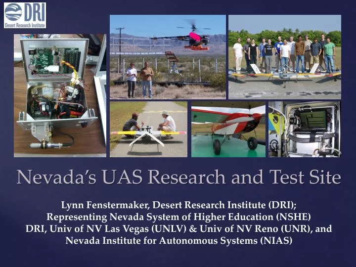
Nevada’s UAS Research and Test Site. Lynn Fenstermaker, Desert Research Institute (DRI); Representing Nevada System of Higher Education (NSHE) DRI, Univ of NV Las Vegas (UNLV) & Univ of NV Reno (UNR), and Nevada Institute for Autonomous Systems (NIAS). Manned aircraft: Cloud seeding

E N D
Nevada’s UAS Research and Test Site Lynn Fenstermaker, Desert Research Institute (DRI); Representing Nevada System of Higher Education (NSHE) DRI, Univ of NV Las Vegas (UNLV) & Univ of NV Reno (UNR), and Nevada Institute for Autonomous Systems (NIAS)
Manned aircraft: • Cloud seeding • Air quality monitoring and profiling with LiDAR • Hyperspectral imaging for ecosystem monitoring • Unmanned Balloons: • Air quality, chemistry and water content monitoring • Class I UAS (fixed wing and helicopter): • Ecosystem monitoring • Aerosol and cloud physics • Radiative and water flux measurement above and below clouds • Pollution monitoring DRI Research Using Airborne Platforms
Climate Change (DOE): Lynn Fenstermaker - DRI Lead Land Management (USDA ARS): Ken McGwire - DRI Lead Pollution and Trade Cumulus Cloud (NSF): Eric Wilcox - DRI Lead Subset of DRI UAS Applications Projects
Mojave Global Change Facility 96 plots with factorial treatments of increased summer precipitation, nitrogen deposition and soil crust disturbance Needed an efficient way to monitor whole plot treatment effect UAS for Whole Plot Monitoring of Climate Change Impacts
Assessing Climate Change Treatment Effects with a Radio Control Helicopter Multispectral Platform Dr. Lynn Fenstermaker, Desert Research Institute ▪ Eric Knight, University of Nevada, Las Vegas Multispectral CIR photo Standard color digital photo UAS Platform: Class I, radio control helicopter, 55.7” length Sensor Package: Tetracam multispectral camera simulating green, red and IR Landsat bands and real time altimeter with engine and battery monitoring
Canopy cover segmentation, red indicates presence of plants. Percentage of plant cover is notated at the bottom of the image. Linear regression analysis of field validation data and multiple sessions of canopy segmentation analysis revealed a reproducible r2 of 0.82 for calculation of percent green cover MGCF UAS Data Analysis
Desert Research Institute Kenneth McGwire Lynn Fenstermaker David McGraw USDA Agricultural Research Service Mark Weltz Christo Morris Julie Finzell Feasibility Testing of Helicopter-based Unmanned Aircraft Systems Technology to Support Land Management Agency Objectives Federal land management agencies like the USFS, BLM and the NRCS rely heavily on field measurements to monitor the health and productivity of millions of acres. UAS technology can support more efficient and comprehensive landscape characterization to meet those missions.
Feasibility Testing Results UAS color infrared imagery used to measure leaf area in cattle allotments and set stocking rates. The very high spatial resolution of UAS imagery helps improve models for soil erosion and ecosystem function. Graph shows UAS sampling improves statistical confidence over field and satellite observations and with a significantly smaller number of observation points.
Moisture dynamics in the cloudy and polluted tropical atmosphere: The Cloud Aerosol Radiative Forcing Dynamics Experiment (CARDEX) Eric Wilcox, DRI, eric.wilcox@dri.edu, 775-673-7686 Rick Thomas, P. S. Praveen, Kristina Pistone, V. Ramanathan, Lynne Russell, Scripps/UCSD Frida Bender, ÖrjanGustaffson, Stockholm University Yan Feng, Argonne National Laboratory NicBeres, Hans Moosmüller, Rajan Chackrabarty, DRI Julia Remmers, Steffen Doener, Max Planck Institute, Mainz
Feb.-Mar. 2012 Hanimaadhoo Island, Republic of Maldives, North Indian Ocean • Goal: document detailed impact of continental-scale plume of sooty pollution from South Asia on trade cumulus clouds • Aircraft: Three Manta UAS (Scripps) • Ground measurements: aerosol, radiation, lidar aerosol profiles, microwave radiometer • Modeling: WRF-Chem simulations of aerosol transport and boundary layer clouds. The Cloud Aerosol Radiative Forcing Dynamics Experiment (CARDEX)
Experiment site: Hanimaadhoo Island, Maldives February-March 2012 The winter monsoon winds collect industrial, biofuel, and transport pollution from South Asia and transports them thousands of kilometers to the Maldives.
Aerosol/radiation aircraft measures aerosol particle concentration, black carbon concentration and up/down solar fluxes. Flux aircraft measures high-frequency variations of vertical velocity, temperature, and humidity. Cloud physics aircraft measures cloud drop sizes and concentration.
First-ever UAV profiles of turbulent moisture flux in the boundary layer • Determination of how soot-induced warming of the lower troposphere affects transport of moisture from the ocean and through the boundary layer to the clouds
UAS Measurement of micro-aethalometerblack carbon concentrations and absorption coefficient vertical profiles on Mar 26th, 2012
Other UAS Research Search and Rescue Dr. ShahramLatifi Professor, Department of Electrical and Computer Engineering Director, Center for Information and Communications Technology (CICT) Shahram.Latifi@unlv.edu • Research Interests • Search and Rescue Technologies • Geolocation of RF Emitters • UAS System Health Monitoring • UAS Data Acquisition and Management April 2014
Environmental Engineering and Water Resources Research Temporal evolution of Flooding Dr. Haroon Stephen Assistant Professor, Department of Civil and Environmental Engineering and Construction Director, GIS and Remote Sensing Core Lab and Visualization Facility Haroon.Stephen@unlv.edu • Expertise • Microwave remote sensing • Geographic information systems (GIS) • Land scatterometry and radiometry • Remote sensing applications to water resources and hydrologic studies • Data visualization • Integration of remote sensing, GIS, and global position systems for Earth system science research • Surface water hydrology • Urban thermodynamic and hydrodynamic modeling Results of hydrological modeling of a September 2012 on-campus flood using GIS. The time series of inundation depth illustrates onset and temporal evolution of flooding. The underlaid frames depict the spatial extent of flooding at selected times. This approach can be used to assess flooding risks under various precipitation and urban development scenarios. April 2014
Disaster Maps: Real-time observation of disaster scenarios for first-responders • Sushil Louis, CSE-UNR • (under discussion with ONR) • Develop multi-robot systems to map a large area quickly and efficiently. • Develop an operator interface to allow coarse and fine-grained control without overwhelming the user.
UAS Localization • George Bebis and Monica Nicolescu CSE-UNR (related work funded by NASA) • Localization – estimate the 3D position and orientation of a UAS with respect to some reference frame • Use horizon line and Digital Elevation Maps (DEMs) for UAS localization in GPS denied environments match
UAS Cloud Seeding: Jeff Tilley • Goal: Develop cost-effective miniaturized cloud seeding technologies for testing and application, with eventual commercialization • First Development phase: ejectable flare technology • DRI lead, Drone America major partner w/ State of Nevada, Province of Alberta (via NV-AB MOU) • Field Operational Tests • DRI Walker River Seeding Project Area (Hawthorne depot base), winter 2014-15 • Identifying partners (NASA/Droplet Measurement Tech) to provide complementary UAS-based measurements of cloud/aerosol properties. • Current Partners: DRI, UND, OU ARRC; • Possible Partners: DMT, NSSL, NASA/Ames-Armstrong Two Future Directions Drone America aircraft for cloud seeding
UAS Fire Research: Adam Watts • Situational awareness • Pre-/post-burn analysis (vegetation, wildlife, hydrology) • On-site weather monitoring of smoke plume altitudes • Emissions monitoring (smoke constituents, temperatures, etc.) • Real-time thermal monitoring (modeling, operations) • Precision post-fire perimeter mapping Current efforts: Proposal to State of Nevada Knowledge Fund and discussions with NASA/Ames, NV Div Forestry and UAS businesses Future Directions Cont.
Services include: • Airworthiness: documentation, checklists, test validation, inspection, maintenance, FAA safety data • Personnel Certification: evaluate and assist UAS teams • Operations Qualification: evaluation of UAS flight characteristics and ground control systems • Location Assessment: specific range assessment and air space parameters • Airspace Design: harmonize procedures with local ATC • Safety/Risk Management: safety provisions of 14 CFR, ISRB, Flight readiness review, range safety, etc. • Overall COA / SAC Process • Flight operations on the Nevada UAS Test Site Nevada Institute for Autonomous Systems
General Manager 702-816-5095 Business Development 702-816-5086 Contracts 702-816-5096 Flight Operations 702-816-5091 Safety 702-816-5097 Media Relations 702-486-2700 Northern NV Ranges Coordinator 775-750-6852 Southern NV Ranges Coordinator 702-816-5089 Email: Information@nias-uas.com NIAS Contact Information
VS Questions Las Vegas Review Journal July 9, 2014 Research Plot Harvest , NNSS