Download
1 / 15
150 likes | 270 Vues
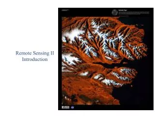
Remote Sensing II autumn 2007 - spring 2008. "The practice of computer-aided interpretation of satellite images.“ Markus Törmä Markus.Torma@tkk.fi. Introduction. There are three types of students in this course: those who make standard exercises illustrated below

E N D
Remote Sensing IIautumn 2007 - spring 2008 "The practice of computer-aided interpretation of satellite images.“ Markus Törmä Markus.Torma@tkk.fi
Introduction • There are three types of students in this course: • those who make standard exercises illustrated below • foreign student who use different data and may not take all exercises • in latter case course name and number of study credits changes. • students with their own exercises / study problems
Introduction Standard exercises: • I. Land use / cover classification • Corine-like land use / cover classification using Landsat-image • II. Change detection • Compare Landsat-images from different dates • III. Rule based classification • Dempster-Shafer with pen and paper • Search software and classify exercise I data with it
Introduction • Software: Foto has PCI Geomatica but also other similar software can be used • In case of computer problems, user licenses, etc. contact Juho Kolari, jkolari@cc.hut.fi, M315. • Mailing list: maa57252@foto.hut.fi
I. Land use / cover classification • Land cover / use classification using Landsat data. Images • There are following Landsat-5 Thematic Mapper images, choose one: • 188/17 3.7.2006 • 188/18 3.7.2006 • 189/18 5.8.2004 • 190/15 1.7.2006 • 190/16 17.7.2006 • 190/17 17.7.2006 • 190/18 17.7.2006 • Foreign students download suitable Landsat ETM-image from Global land Cover Facility (http://glcf.umiacs.umd.edu/).
188/17 3.7.2006 188/18 3.7.2006 189/18 5.8.2004 190/15 1.7.2006
190/16 17.7.2006 190/17 17.7.2006 190/18 17.7.2006
Classes are Corine Land Cover 2000 Level 2/3 classes and they are combination of land cover and use: 1. Artificial surfaces 1.1 Urban fabric 1.2 Industrial, commercial and transport 1.3 Mine, dump and construction sites 1.4 Artificial, non-agricultural vegetated areas 2. Agricultural areas 2.1 Arable land 2.3 Pastures 3. Forests and seminatural areas 3.1 Forests 3.1.1 Broad-leaved forest 3.1.2 Coniferous forest 3.1.3 Mixed forest 3.2 Shrub and/or herbaceous vegetation associations 3.2.1 Natural grassland 3.2.2 Moors and heathland 3.2.4 Transitional woodland/shrub 3.3 Open spaces with little or no vegetation 3.3.1 Beaches, dunes, and sand plains 3.3.2 Bare rock 3.3.3 Sparsely vegetated areas 4. Wetlands 4.1. Inland wetlands 4.2 Coastal wetlands 5. Water bodies 5.1 Inland water 5.2 Marine waters I. Land use / cover classification
I. Land use / cover classification • More information about CLC2000 can be found from www.ymparisto.fi • http://www.ymparisto.fi/default.asp?contentid=143286&lan=fi • Final report of Finnish version • http://www.ymparisto.fi/download.asp?contentid=38725&lan=fi • class descriptions from EEA: • part 1 http://reports.eea.europa.eu/COR0-part1/en/index_html • part 2 http://reports.eea.europa.eu/COR0-part2/en/index_html
I. Land use / cover classification Preprocessing of images • Aim is to get radiometrically corrected reflectances from images • Geometric correction • orthocorrection using DEM • GLCF-images already geometrically corrected • Cloud and shadow masking, manually or PCI? • Atmospheric correction using PCI • Topographic correction, is it needed? • Jenni Lampila's Master thesis, 2000 • Törmä, Härmä: Topograhic correction of Landsat ETM-image in Finnish Lapland, IGARSS 2003
I. Land use / cover classification Classification • Interprete land cover / use of some Landsat ETM-image • Ground truth for classes can be acquired from • map-servers of cities (aerial images available in many cases) • Paikkatietolainaamo • Lounaispaikka • Paper maps • Ground surveys, etc.
I. Land use / cover classification Rough workflow: • Acquire ground truth • Feature extraction and selection • you can compute also other features than original channels: NDVI, PCA, TC,… • which channels correlate with each other and which not • class separability measures for comparison of individual channels and channel combinations • Branch-and-Bound -algorithm for feature selection • pricipal component transform for feature extraction
I. Land use / cover classification • Compare different classification methods • supervised classification using Maximum Likelihood • supervised classification using kNN-classifier • unsupervised classification using K-means • Accuracy assessment, compare to CLC2000 • use Corine 2000 as reference material • error matrix and accuracy measures • Study digital map data available from Natinal Land Survey • which classes can be formed that way? • define benefits and drawbacks in using data from NLS • Report results in a form of scientific article
II. Change detection • Change detection of previously interpreted area, using new Landsat Thematic Mapper image from previous exercise and older Landsat Enhanced Thematic Mapper image from IMAGE2000 –dataset • can be downloaded from JRC, http://image2000.jrc.it/ • Test simple change detection methods (difference, ratio, principal components) and compare. • What are you able to say about change type? • How change type could be characterized. • Report results in a form of scientific article. • Foreign students use Landsat TM images from 1990's downloaded from Global land Cover Facility http://glcf.umiacs.umd.edu/
III. Rule based classification Alternative A • Design rule-based classification using Dempster-Shafer method and experiences of previous parts with pen and paper. • Construct hierarchy of classification using previously presented CLC2000-classes. • Form rules for each set of classes to be classified, so that the result would be good. • Material for classification is Landsat (E)TM-image, digital elevation model, soil map, road database and topographic database (maastotietokanta). • Present methodology which combines the evidences of individual rules. • Useful literature: • A.Srinivasan, J.A.Richards: Knowledge-based techniques for multi-source classification. International Journal of Remote Sensing, Vol. 11, No. 3, pp. 505-525, 1990 • G.G.Wilkinson, J.Megier: Evidential reasoning in a pixel classification hierarchy - a potential method for integrating image classifiers and expert system rules based on geographic context. International Journal of Remote Sensing, Vol. 11, No. 10, pp. 1963-1968, 1990 • G.Shafer, R.Logan: Implementing Dempster's rule for hierarchial evidence. Artificial Intelligence, Vol. 33, No. 3, pp. 271-298, 1987 • G.Shafer: A Mathematical Theory of Evidence. Princeton University Press, 1976 Alternative B • Search rule based / tree classifier and classify your data from exercise I with it.