Download
1 / 34
340 likes | 527 Vues
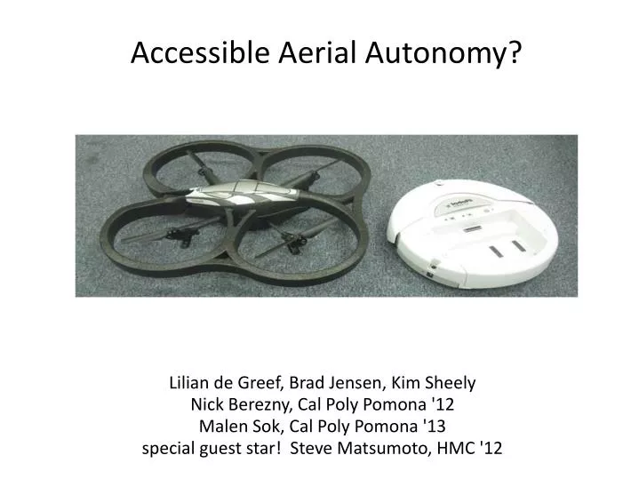
Accessible Aerial Autonomy?. Lilian de Greef, Brad Jensen, Kim Sheely Nick Berezny, Cal Poly Pomona '12 Malen Sok, Cal Poly Pomona '13 special guest star! Steve Matsumoto, HMC '12. Motivation. Key lesson: Neither all drones – nor all programmers – are created equal. Question.

E N D
Accessible Aerial Autonomy? Lilian de Greef, Brad Jensen, Kim Sheely Nick Berezny, Cal Poly Pomona '12 Malen Sok, Cal Poly Pomona '13 special guest star! Steve Matsumoto, HMC '12
Motivation Key lesson: Neither all drones – nor all programmers – are created equal
Question Does the ARDrone make an effective robot?
Question Does the ARDrone make an effective robot? Raw material: • closed hardware • but an open, ASCII API • two cameras • internal sensing (gyro/accel.) Goal: accomplish tasks with the drone, the create, and computer vision
ROS ~ Robot Operating System blind-enord.py FLANN for nearest neighbors Other ROS facilities pydrone OpenCV msg libardrone ARDrone srv generic API/ framework arnetwork too low level for our needs
Several tasks tried... (0) Room/hallway flying (1) Cooperating with the Create (2) Navigating among landmarks (3) Localization without landmarks (4) Room/hallway flying i
Task 1: Follow that ! • We put a ! on the Create to • help discern location • help discern orientation • Image processing approach: • (1) threshold image to find dark regions and contours • (2) circle? compare region with min. enclosing circle • (3) rectangle? compare region with min. enclosing rect. • (4) filter noise, find centers, and construct heading line
Lessons learned • The ! was far from a perfect landmark • We wanted to use something more robust that could give us more accurate pose estimation • We decided to explore April Tags...
APRIL tags Autonomy, Perception, Robotics, Interfaces, and Learning Java-based landmark library from U. Michigan an example tag in the center... provides full 6 DOF pose and scale We integrated it into ROS using Python's os.system call...
APRIL tags' scale range an example tag in the center... provides full 6 DOF pose and scale
Task 2: The Hula-hoop hop Getting from A to B A B
getting from point A to point B Task 2: The Hula-hoop hop
Hula-hop's state machine all transitions can also be made by the keyboard
Hula-hop demo sliding-scale autonomy is crucial
Hula-hop challenges • Drone challenges: • drift ~ not easily positionable • connection ~ video freezes • artifacts ~ image stream noise example encoding (?) artifact • APRIL tag challenges: • too narrow a field of view: height/scale tradeoffs • call to APRIL library is slow (.5 second/image) • unmodifiable environments? Could we do without tags?
Localization without tags? • SURF features • locally unique image patches • fast libraries for extraction • each SURF feature is described by a 64- or 128-dimensional vector that encodes size and local edge orientations • in general, similar descriptor vectors are likely to be similar (or identical) image features SURF features are great for place-recognition training!
Localization plan? • Mapping (by hand) • collect images and positions • extract & store SURF features • Localization • take a new image • extract SURF features • match them against the map • estimate a pose distribution map images + matches new image
Image-based map... Locations with stored images == nodes in a graph four locations in the NW corner of Sprague
Image-based map... beside the kitchen, facing roughly W
Image-based map... beside the boardgames, facing roughly N
Live localization top three matches and their likelihood distribution plotted on the map
Results Simply counting the # of matches did not yield good localization results: < 25% of correct locations < 10% of correct orientations simple image-match score S 1 matches m
Other scoring systems... distance-scaled score weights features inversely proportional to their SURF distance S matches m ... and filters 1 e + dist(m) omits features whose nearest neighbor is about as good a match as its 2nd nearest neighbor strong ratio-matches only omits features whose best match is not unique in both directions bidirectional matches only
Without bidirectional filtering many different features can have the samebest match
With bidirectional filtering only mutually unique best matches are considered
The AR Drone is a capable platform -- as long as precise positioning is not required Comparative results • Options include • research to improve localization • tasks that do not require precision The ROS software scaffolding is excellent -- (though not always thoroughly documented) The project's AR Drone drivers and supporting software generated interest at AAAI and will be released into the community's (Willow Garage's) repository.
AR Drone Mechanics • Drone itself has only 4 degrees of freedom. (roll, pitch, yaw, thrust) • Commands give us control of 4 different degrees of freedom. (x, y, z and yaw) Roll Yaw Key lesson learned: The drone is NOT precisely positionable.