Download
1 / 30
300 likes | 318 Vues
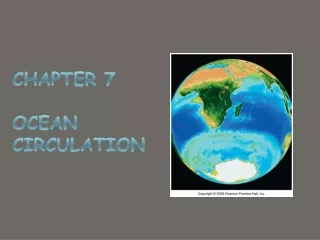
CHAPTER 7 Ocean Circulation. Fig. CO7. Ocean currents. Understanding what causes currents and where they flow is fundamental to all marine sciences. Currents transports 1 2 3 4 Causes of Currents Three major factors drive ocean currents. 1. Wind . 2. Changes in sea level .=

E N D
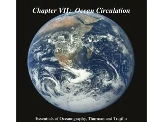
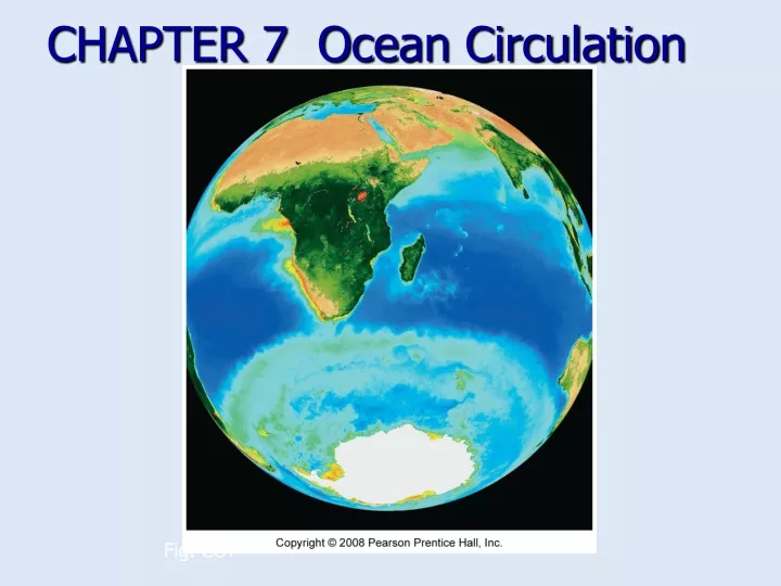
CHAPTER 7 Ocean Circulation Fig. CO7
Ocean currents • Understanding what causes currents and where they flow is fundamental to all marine sciences. • Currents transports • 1 • 2 • 3 • 4 • Causes of Currents • Three major factors drive ocean currents. • 1. Wind. • 2. Changes in sea level.= • 3. Variations in water density. Surface Currents Chapter 9 Pages 9-3 & 9-4
Ocean gyres There are five major gyres – one in each major ocean basin: 1. North Atlantic Gyre 2. South Atlantic Gyre 3. North Pacific Gyre 4. South Pacific Gyre 5. Indian Ocean Gyre Fig. 7.4
Other surface currents • Equatorial countercurrents • Subpolar gyres Fig. 7.5
Western and Eastern Boundary Currents • The currents on either side of an Ocean is different • Western Boundary Eastern Boundary • 1W_______ water from the equator 1. C_______water from the poles • 2. Currents are n________ 2. Currents are w________ • 3. Current water is d_________ 3. Current water is shallow • 4. Currents are f_________ 4. Currents are s_______ • 5. Eddies are common 5. Eddies are rare • Total water volume balances out. Western boundary currents handle thesame volume, but through smaller areas,so water must move more rapidly. Surface Currents Chapter 9 Pages 9-10 to 9-16
Western and Eastern Boundary Currents Currents are not fixed steady streams of water • They s______ up and s______ down • They w_____ and c______ • They curl and change directions 4. They form eddies, two types2 • cold water = • Warm water=
Gulf Stream Fig. 7.17b
Climate effects of North Atlantic currents • Gulf Stream warms East coast of U.S. and Northern Europe • North Atlantic and Norwegian Currents warm northwestern Europe • Labrador Current cools eastern Canada • Canary Current cools North Africa coast
Ekman spiral • Surface currents move at angle to wind • Ekman spiral describes speed and direction of seawater flow at different depths • Each successive layer moves increasingly to right (N hemisphere) Fig. 7.6
Ekman transport • Average movement of seawater under influence of wind • 90o to right of wind in Northern hemisphere • 90o to left of wind in Southern hemisphere Fig. 7.7
Countercurrents • Countercurrents and undercurrents are water flows that differ from the major ocean currents. • Countercurrents are associated with equatorial currents – it runs opposite of its adjacent current They are weak and found in the ITCZ. • Longshore currents –run opposite of dominant current offshore • Undercurrents flow beneath theadjacent current and are foundbeneath most major currents. • Example Mediterranean sea Surface Currents Chapter 9 Pages 9-16 & 9-17
Upwelling and Downwelling • Upwelling is an upward vertical current that brings deep water to the surface. Downwelling is a downward vertical current that pushes surface water to the bottom. • Coastal upwellings occur when the wind blows offshore or parallel to shore. These currents have strongbiological effects: • Upwelling= • Upwellings also influence weather patterns. • Cold water next to shore = • Warm water next to shore = • Downwellings = Surface Currents Chapter 9 Pages 9-17 to 9-20
El Niño Southern Oscillation (ENSO El Niño Southern Oscillation (ENSO) • El Niño tremendously affects worldweather patterns. • Normal = Winds blow east to west along the equator • This brings low pressure and highrainfall in the Western Pacific. • Eastern Pacific = High Pressure= Dry weather Surface Currents Chapter 9 Pages 9-20 to 9-22
Normal conditions Fig. 7.20a
every 3 to 8 years a rearrangement of the high- and low-pressure systems occur. Warm water of the west pacific migrate east to the coast of South America. It causes the collapse of local fisheries and marine ecosystems in South America. Flooding, tornados, drought and other weather events lead to loss of life and property damage. El Nino changes the weather Worldwide Wet places= Dry places= United States Peru= El Niño (continued)
El Niño-Southern Oscillation (ENSO): Warm phase (El Niño) Fig. 7.20b
El Nino (Spanish name for the male child) • initially referred to a weak, warm current appearing annually around Christmas time along the coast of Ecuador and Peru (not good for their fishing industry and quano birds!) • can produce significant economic and atmospheric consequences worldwide • occur every 3-7 years, lasting about one year • Recent major events: 1982-1983 and 1997-1998 • The 97-98 event was the strongest ever recorded!! • Previous El Niño Years1902-1903 1905-1906 1911-1912 1914-1915 1918-1919 1923-1924 1925-1926 1930-1931 1932-1933 1939-1940 1941-1942 1951-1952 1953-1954 1957-1958 1965-1966 1969-1970 1972-1973 1976-1977 1982-1983 1986-1987 1991-1992 1994-1995 1997-1998 2002-2003 2006-7
Thermohaline Circulation and Water Masses • Thermohaline circulation= • In the deep-ocean layers, water density variation, not wind, is the primary causeof current. • Thermohaline circulation works because waterdensity increases due to cooling, increasedsalinity or both. • 1. Warm Water= • 2. Cold Water= Five distinct water masses result from density stratification.
Thermohaline circulation • Selected deep-water masses • Antarctic Bottom Water • North Atlantic Deep Water • Mediterrian Deep Waters
How Deep Water Forms • The intermediate, deep, and bottom watermasses form primarily, but not entirely, athigh latitudes (around 70° North and South). • Antarctic Bottom Waters form in the Antarctic in winter, sink to the bottom and spread along the ocean floor to about 40° north latitude. • North Atlantic Deep Waters form in the artic, • but often get trapped there by the topography of the ocean basin. • layers. • Mediterranean Deep Waters form due to evaporation rather than cooling, with a salinity of 38‰. Flowing out of the Mediterranean they form the intermediate water layer resting above the bottom layer and deep layer. Deep Currents Chapter 9 Pages 9-28 to 9-30
Conveyor-belt circulation • Combination deep ocean currents and surface currents Fig. 7.27