Download
1 / 21
210 likes | 215 Vues
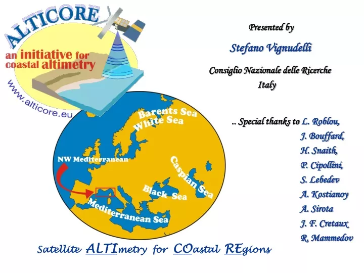
Presented by. Stefano Vignudelli. Consiglio Nazionale delle Ricerche Italy. .. Special thanks to L. Roblou, J. Bouffard, H. Snaith, P. Cipollini,

E N D
Presented by Stefano Vignudelli Consiglio Nazionale delle Ricerche Italy .. Special thanks toL. Roblou, J. Bouffard, H. Snaith, P. Cipollini, S. Lebedev A. Kostianoy A. Sirota J. F. Cretaux R. Mammedov Satellite ALTImetry for COastal REgions
Outline • Context & Motivation • ALTICORE in a nutshell (who, what, where, how) • Lessons learned • Use of coastal altimetry (who, for what, how) • Summary • with more technical details coming up in Working Groups … • Roblou ( IB & Tides & Editing) • Snaith (Data & Editing) • Bouffard & Cipollini (Currents)
Terminology – What do we mean by “Coastal Altimetry”? • Altimetry over that ocean domain close to land • where standard processing is problematic • Information is somehow hidden and must be • recovered by ad hoc techniques
Why “Coastal Altimetry” now? • A good thing: fully exploitation of huge data volumes produced by missions • -Almost two decades of altimeter data …long-term series are great! • Interesting fact: Coastal zones are of strategic importance • -over 35% of the European Union population lives near the sea • - valuable source of food and raw materials • - vital link to transport and trade • - host valuable habitats and landscape • - favored destination for leisure • To be noted: Data assimilation by models is transforming the use of data • -Altimeters can “see” in all weather day/night • A hope at horizon: progresses in technology promise better resolution capability • -New techniques (Delay-Doppler, Interferometry, Reflectometry) • - New concepts (formation flying) There are solid motivations for investigating …
Which problems near coasts? 1st: proximity of land effects: no measurements at all (if the satellite approach from land) land contamination of footprints (if close to shoreline) SYMPHONIE Coastal Model Current field at 50 m depth Rms difference between radiometer and model Jason (ECMWF) + GFO (NCEP) mm Help by R. Dussurget NW Mediterranean 2nd: complexity of the context effects: greater inhomogeneity of sea state within the footprint inadequacy of even failure of some auxiliary corrections (e.g. Wet Tropo, IB, Tides) Courtesy: P. Marsaleix Which actions? Pre-processing -Revisiting the conversion of the radar altimetric signal to measurements (new re-tracking system) Post-processing -Reinventing the “processing” strategy (quality control) - Integrating local knowledge (new corrections) We started with this approach ..
Genesis of ALTICORE • Built on precursor ALBICOCCA project • ALtimeter-Based Investigations in COrsica, Capraia and Contiguous Areas • ALBICOCCA was a joint France/Italy/UK effort supported by CNES/ASI • (2001-2004) • Focus on TOPEX/Poseidon mission at first and then extension to all • NW Mediterranean proposed as • the “operational lab” for coastal altimetry • Backward reanalysis of standard products • - data source: CTOH (LEGOS) • - 1 Hz at first • A revised post-processing strategy • - Editing and reconstruction • - MOG2D-MedSea (high-freq signal de-aliasing) • - Vertical reference frame (local MSS) Incubator of the X-Track coastal altimeter processor (Author: L. Roblou)
L. Roblou France Now at ECWMF F. Lyard J. Bouffard J. F. Cretaux France Now at LEGOS ALTICORE – WHO we are Sharing knowledge across organisational and national boundaries … … but more importantly across disciplines (oceanography, remote sensing, modelling, information technology, etc.) S. Vignudelli G.P. Gasparini C. Galli E. Lazzoni UK H. Snaith P. Cipollini F. Venuti CNR Italy … and drawing developing countries into the project brings their local expertise (tidal modelling, in situ measurements for validation/calibration, etc.) A. Kostianoy N. Sheremet A. Ginzburg E. Kuzmina S. Lebedev A. Sirota D. Medvedev S. Khlebnikova R. Mamedov K. Ismatova A. Alyev T. Nabijev A project funded by EU under Cooperation Program - INTAS (2007-2008) SIO Russia GC Russia IG Azerbaijan
ALTICORE – WHAT, HOW and WHERE Remember two fundamental keywords: moreandbetterdata … but more importantly add the new one:easyaccess .. and build capacityin coastal altimetry on Eastern countries • with two priority topics for action • in the NW Mediterranean: • - Use of higher-rate data, no re-tracking • -Multi-mission configuration analysis • with three priority topics for action in • the other regional seas: • -Getting the local knowledge • (in situ data, regional models, etc.) • - Applying ALBICOCCA methodologies • - Exploring the adoption of RADS data sets • with Web Services and Grid concepts … also incubator of other initiatives
ALTICORE – room for new projects and pilot sites • COASTALT project • -Development of radar altimetry data processing in the oceanic coastal zone • -funded by ESA (more from J. Benveniste & P. Cipollini) • MARINA proposal • -MARgin INtegrated Approach - On monitoring the dynamics of the coastal • ocean through an integrated approach using in situ measurement, improved • high-resolution altimetry and ocean modelling • -submitted to Eumetsat/CNES RA (more from L. Roblou) • ALTICORE-Africa workshop (April 2008) • -Coastal dynamics from altimetry and high- resolution satellite data • - funded by Royal Society UK (more from P. Cipollini) • ALTICORE-India pilot study (since 2007) • -to replicate coastal altimetry around the Indian coasts • -joint research work involving NIO and INCOIS Buoy Locations and now in the next slides some examples of the lessons learned …
Starting point … really no data ? Standard editing strategy too much conservative
Lessons learned I – Playing with flags Some data flagged as “bad” would be recoverable simply turning off RADS flags
Lessons learned II – Beyond flags: new editing strategy • Screening profiles rather than single values • Reconstructing /extrapolating profiles where possible Much more data on average than using standard editing (more in “Data editing” session …)
Lessons learned III – Replacing global tidal models Example of regional tidal model from HRC (Russia) Difference of order of meters when compared with GOT00 (global) Tidal correction is problematic White Sea High resolution Mog2D mesh cm ..Mog2D-Medsea … the regional solution for the NW Med Sea with better mapping of Hi-freq More in “Tides” & “IB” sessions …
Lessons learned IV – Using new vertical reference frame Sea Level Anomaly computed from standard MSS is good for deep basin but not for shelves and slopes A new method to compute a local MSS (more in “Data Editing” session …)
Lessons learned V – More in quantity and quality Nearer coasts but even in open sea This promises a better monitoring of the Liguro-Provencal Current which flows very close to the coast and exhibits a small spatial extension. (Bouffard et. al. 2008, submitted to JAOT ..)
Lessons learned VI – Exploiting a multi-mission scenario • Non-homogeneity between missions is the major problem • … Large-scale orbit error is the dominant component • LSER methodology for regional applications, Bouffard et al. 2008, GRL in rev. • Example of comparison of multi-mission altimetry at Genoa sea level station Multi-satellite altimetry agrees well with the in situ measurements even at time scales shorter than seasonal.
Lessons learned VII – Disseminating data efficiently Interoperability: Not only a technical question, but a cultural issue ! OPenDAP + netCDF in coastal altimetry data management ? (more from H. Snaith in “Data” WG) e.g. we tested access to data on remote sites from within Matlab code With an “eye” to possible users and applications …
First the user, then the user, finally the user (GEOSS) • Requirements for operational use • -Easy Access • - Product Quality • - Service Reliability • - Service Sustainability • - Fit for Purpose • .. to deliver information (not data) to “end-users” • Coastal altimetry at early R&D stage • Data-integrators and modellers in the best position to exploit data • (operational oceanography moving from deep oceans to coasts) next slide shows an example
Water levels of high interest to private & public communities The Caspian Sea Level Variability by instrumental measurements (1837-2005) KASHAGAN Oil Field .. But no GLOSS-compliant stations!!! A bottom pressure in operation soon T/P Jason-1 Benefits from satellite altimetry, but stakeholders not sufficiently aware of it or familiar with it. CASPINFO Supporting Action (funded by EU) ( CASPIAN SEA ENVIRONMENTAL AND INDUSTRIAL DATA & INFORMATION SERVICE)
Caspian ..lake or sea .. Taking benefit from other experiences Rivers Ice ..and even wetlands Lakes Coastal altimetry shares some issues with other targets (e.g. retracking)
Existing initiatives such as ALBICOCCA/ALTICORE have paved the way • to coastal altimetry … and we have learnt a number of lessons: • - Need specialized processing • - Much improved corrections now possible but not everywhere • - Promote along-track data rather than gridded products • - Rethinking data management is crucial to success • (measured in terms of users exploiting the data) • - International cooperation is essential • but we still need to improve coastal altimetry • - Optimizing signal to noise ratio (developing specialized re-tracking, • to go closer coasts, improve measurement accuracy and precision • - like in COASTALT) • - Testing new sensor concepts (constellations, SWOT, • Ka-band Altimeter, Delay-Doppler Altimeter, - see SAMOSA) • Coastal altimetry should become part of any coastal observing system • - we need to merge in situ, modeling and remote sensing • to study local dynamics Summary This newly formed community of "coastal altimetrists“ must be encouraged to work together Essential message: