Download

1 / 22
220 likes | 229 Vues
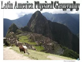
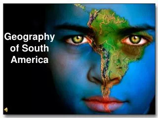
Explore the diverse physical features of South America, including the Andes Mountains, the Amazon Basin, the Gran Chaco, the Pampas, the Guiana Highlands, and more. Learn about the major rivers, lakes, and mountain climates that shape the continent's unique landscape.

E N D
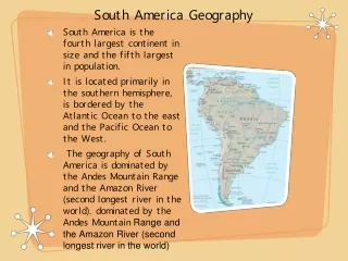
Landforms, Rivers, and Lakes • South America has nearly every type of physical feature. • Few lakes but five major river systems.
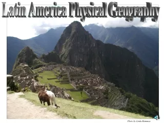
Andes Mountains • Longest mountain range in the world, stretching 5,500 miles along western edge of the continent. • Second tallest mountain range in the world.
Andes Mountains • Mount Aconcagua at 22,834 feet tall is the tallest mountain in the Western Hemisphere.
Altiplano • High plateaus shared by Peru and Bolivia. • One of the highest inhabited regions of the world.
Ilanos (YAH-nohs) • Wide grasslands that stretch across northeastern Colombia and western Venezuela • Here there are cattle ranches and farms.
Amazon Basin • Covers 40% of Brazil with rainforest.
Gran Chaco • Largely uninhabited area consisting of subtropical grasslands and low forests. • Half located in Argentina and the remainder in Paraguay.
Pampas • Grassy plain located in Argentina. • Covers an area of almost 295,000 square miles. • Area good for raising cattle and a variety of crops. • Argentina’s most populated area with most of its cities located here.
Guiana Highlands • North of the Amazon Basin consisting of tropical forests and grasslands. • Location of Angel Falls the world’s tallest waterfall at 3,212 feet.
Brazilian Highlands • Located south of the Amazon Basin, covers ¼ of the continent. • Made up of mostly hills and plateaus.
The Amazon River • Carries about 1/5 of the world’s total river water making it the world’s largest river in terms of volume. • Flows from the Andes to the Atlantic Ocean about 4,000 miles.
Mountain Climates • The climates of the Andes is dictated by elevation.
Mountain Climates • Tierra Helada-(Frozen Land) • Above 10,000 feet • Livestock: Llamas, sheep • Usually covered in snow • Tierra Fria-(Cold Land) • 6,000-10,000 feet • Crops: wheat, apples, potatoes • Temperature usually 50-60 degrees. • Tierra Templada-(Temperate Land) • 3,000-6,000 feet • Crops: corn, cotton, coffee • Average temperatures 64-71 degrees • Tierra Caliente-(Hot Land) • sea level to 3,000 feet • Crops: bananas, sugar cane, rice • Tropical Climate
Tropical Rainforest • Amazon rainforest covers more than 2 million square miles. • Yearly average rainfall between 50-175 inches. • Has the world’s largest collection of life forms.