Download
1 / 32
320 likes | 336 Vues
Dynamics of Thunderstorms Part 1: Downdraft Organization Lecture 12a. AOS 453 Professor Tripoli. Introduce Environmental Wind Shear to Prevent Breakdown. Assume: two-dimensions, i.e. infinitely long convective line

E N D
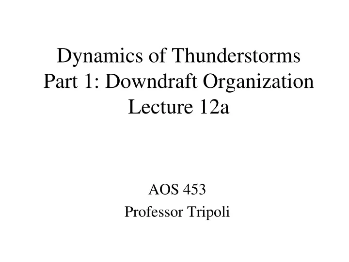
Dynamics of ThunderstormsPart 1: Downdraft OrganizationLecture 12a AOS 453 Professor Tripoli
Introduce Environmental Wind Shear to Prevent Breakdown • Assume: • two-dimensions, i.e. infinitely long convective line • Straight-line shear with height, I.e. wind speed change with without direction change
Prefrontal Middle Latitude Squall Line • In its formative stage the line organizes along a preexisting convergence line and is three-dimensional in character, i.e. it is composed of a linear arrangement of individual convective cells. • The mature line becomes essentially two-dimensional in construction and follows the equilibrium model of sheared convection presented earlier. • It is the mature stage of squall line MCS that begins with a line of cumulus initiated along a preexisting boundary such as a cold front or local thermal circulation
Middle Latitude Squall Line(continued) • After several hours of down shear tilting short lived cumulus a deep density current is built that becomes the basis of maintenance of the steady state quasi-two-dimensional line structure • Persistence of the quasi-steady structure can evolve to build a strong positive vortex sheet along a shear line at middle levels. Associated mass adjustment to the vorticity results in low pressure and mesoscale circulations that support the line.
Middle Latitude Squall Line(continued) • Eventual shearing instability can lead to “balling up” of the vortex sheet into a circular warm core vortex aloft • Mid-level vorticity maximum can drive mesoscale ascent in support of convection.
Middle Latitude Squall Line(continued) • Role of slantwise convection in trailing stratiform anvil. • Slantwise mesoscale subsidence driven by melting and evaporation in anvil. • Compensating upward slantwise motion are forced helped by new condensation and ice growth along upward motion. • Vertical circulation may build jet streak feature at upper levels
Major Conceptual Models of Squall Lines Tropical Squall Line Middle Latitude Squall Line California Squall Line
Results of a numerical simulation of a middle latitude squall line by Rotunno, Klemp and Weisman
Super Cell Squall Lines • Another form of the middle latitude squall line is a super cell line • Formed by a line of right moving super cells oriented so that left movers move back over density current and right movers move with squall line. • Very dangerous squall line because of the increased potential for tornadoes
Geostrophic Adjustment • Recall winds adjust to mass for scales larger than LR and mass adjust to wind for scales smaller than LR. • In mid-latitude squall line momentum transport by the rear inflow jet converging with the front updraft inflow produce a mid-level line vortex through momentum transport and the mass field adjusts to the vorticity, ie the pressure lowers along the line vortex. • This regionally decreases LR . • The melting layer heating function projects on to a small LR because the layer is shallow, further enhancing the line vortex. • Hence the squall line grows a quasi-geostrophic component through scale interactions. • Eventually the line vortex can ball up creating a circular vortex and a circular convective system of meso-alpha scale proportions.
Dynamic Flywheel • The formation of a quasi-geostrophic component to an MCS is significant because: • Quasi-geostrophic flows have long time scales compared to transient gravity wave components, with e-folding times of ½ pendulum day. • The quasi-geostrophic component effectively stores the available energy of the storm’s convective latent heating in its mass balanced circulation. • Essentially, the quasi-geostrophic system works in reverse to what synoptic-small scale flow interaction: The small scale vertical motion, driven by conditionally unstable latent heating, creates a geostrophic flow that would have created the vertical motion had the process run in the forward direction. Hence the tail wags the dog using energy coming from the tail. • The mid level line vortex of the middle latitude squall line is such a component that provides a lasting organization of the system. In essence the quasi-geostrophic component of the system, built from cumulus and slant wise processes, stores the energy released in the latent heating into a long time scale balanced quasi-geostrophic circulation.. That is why that circulation can be called a dynamic flywheel.
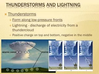
Severe Density Current Storms • Downbursts • Microbursts • Derechos • Serial • Progressive • Australian Squall Line
Progressive Derecho(Bow Echo) • This is similar to middle latitude squall line except for an increased role of the up-downdraft and the interaction with a stable layer • Occurs pole ward of stationary front with extremely unstable capped air equator ward. • Pole ward advection of unstable air over front feeds updraft of strong elevated deep convective line.
Progressive Derecho(continued) • Dynamic lifting of vigorous convection entrains stable frontal air lifting it and cooling it until it is released in a strong up-downdraft. • Up-downdraft crashes downward, assisted by evaporatively cooled air from middle levels (rear inflow jet or from front of storm) hitting surface and spreading as a strong wind storm. • Spreading wind pushes up more post frontal air into convection.
Progressive Derecho(continued) • By definition, the derecho is long lived (6 hours or more) and contains severe winds. • Most common over upper mid-west United states just north of an east-west oriented stationary front. • Associated with conditionally unstable air located equator ward of the front and capped by an elevated mixed layer usually advected from the Rockies.