Download
1 / 12
120 likes | 282 Vues
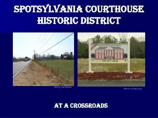
presented to the. Spring-Sandusky Interchange Traffic Task Force updated December 18, 2002. An Overall Traffic Management Plan for the Near North Side Historic District. Presented by the. Consulting Party Representatives to the Spring-Sandusky Interchange Traffic Task Force:.

E N D
presented to the Spring-Sandusky Interchange Traffic Task Force updated December 18, 2002 An Overall Traffic Management Plan for the Near North Side Historic District Presented by the Consulting Party Representatives to the Spring-Sandusky Interchange Traffic Task Force: Citizens for a Better Spring-Sandusky Dennison Place Association Friends of Goodale Park Harrison West Society Italian Village Society Victorian Village Society 1/12
Overall Traffic Management Planas described in the Memorandum of Agreement The Traffic Task Force (TTF) is charged with developing an overall traffic management plan (OTMP) which may include the following measures as well as others: • truck route restrictions • one-way streets • traffic calming on non-arterial streets • traffic signal timing • median islands• reduced speed limits • street parking • destination/routing signage • gateway elements • arterial enhancements • enhanced perimeter route capacity. 2/12
Principles for the OTMP The following principals are to serve as a guide to the development of an overall traffic management plan. Any physical reworking of streets should be historically appropriate. Perimeter elements should be used to encourage through traffic to take perimeter routes. Interior elements should be used to reinforce interior speed limits and to maintain a hierarchy of framework versus side streets. The plan should be equitable, in terms of one element not causing problems for another part or street of the district. Elements should be used in a consistent, repeated fashion that gives the district a strong, collective identity. Elements should employ visual and physical narrowing of streets, in locations where drivers decide which street to take. 3/12
Principles for the OTMP (cont'd) G. Elements should maximize impact relative to cost by: • employing trees and planting materials an on-street parking to visually narrow streets, • minimizing hardscaping (e.g., brick pavers and concrete), • minimizing reworking of street drains, • minimizing reworking of cross walks, • maximizing use of a common template. • The plan should maintain existing 24-hour on-street parking and increase 24-hour on-street parking where possible. • The development of a plan should be considered together with funding mechanisms. • A shared neighborhood/city maintenance plan should be developed. • Following discussion, development, and adoption of a revised OTMP (the original OTMP being that developed by Glatting-Jackson), the revised OTMP will be presented to neighborhood societies and commissions for final approval. • Comparable treatments are advocated for adjoining neighborhoods. • Use elements that promote continuity with adjoining neighborhoods as opposed to barriers between adjoining neighborhoods (neighborhood feedback from 12.18.02 Vict. Vill. Soc. meeting). 4/12
Proposed OTMP: Phase Iof V Phase I goal: Set speed limits, street classifications, truck policies. • District wide policy changes: • Adopt uniform 25 mph speed limit. • Adopt uniform thru-truck ban (except 5th Ave) • Time traffic lights to reinforce25 mphspeed limit. • Street layout/parking changes • Neil, Third, Fifth, King Avenues:Reclassify to accommodate speed limit & future traffic calming elements. • West side of Neil: Extend 24-hr parkingsouth to Collins Ave. • Fifth Ave between Neil and High:Reconfig lanes similar to Neil,but with only one 24-hr parking lane. • King Ave between Neil and Cannon:Implement 24-hr parking; both sides of street. • Buttles between Park & Dennison:Permit 24-hr parking. • Michigan between 2nd & 3rd:Permit 24-hr parking both sides of street. • Possible integration of bike lanes(Dale Hooper to review). • Fifth Ave east of High: reconfigurelanes to include parking (added 12.10) • existing bump out projects on Summit, 4th. • Consider parking/curb islands to narrowportions of Goodale before and after I670exit ramps (feedback from 12.18 VVS meeting) (2i) (2d) (2c) (2h) (2f) (2b) (2e) (2j) (2j) 5/12
S S S S S exit entry S S S S S S Proposed OTMP: Phase IIof V Phase II goal: Design and Construct Entry Point Elements. Consider smaller internal elements rather than entrypoint elements here, as to promote the continuation of residential treatment eastward across High St. (see Principle M on slide 4/12). • Entry point elements: • Determine location and footprintfor entry point elements at 9locations shown on map. • Recommended footprint:Street width restriction using Level 1paired bump outs or curb islandson sides of street plus a Level 1island or drivable median in center of street.(see p. 11 for conceptual view oflevel 1 bump-outs/curb islands) • Recommended in fill: Raisedplanters with trees and groundcover; brick between raisedplanter and curb edge; entrysign "S" to be incorporated(see slide 12 for concepts). • Cost Estimate: • to be determined by city. • neighborhood funds/TIF should beconsidered for entry signs. These elements will be smaller in width, since 5th Ave has no parking lanes on either side of the street. additional sites in ItalianVillage discussedwith A. Klein built 6/12
Proposed OTMP: Phase IIIof V Phase III goal: Apply internal elements to framework & higher volume side streets. • Level 2 median islands: • Determine location and footprintfor median islands at approximately17 mid-block locations along Neiland Fifth Aves. • Recommended footprint:Similar to existing midblockisland between First & Second,except length will be varied inproportion to available mid-blockspace. • 4-way stop signs • 4 locations as shown onPennsylvania and Michigan. • Level 2 bump-outs/curb islands • 2 located on west side of Neilbetween Buttles and Collins todefine parking lane; 4 on King;2 on Fifth (see p. 12 for conceptualview of a level 2 bump-out/curbisland). • Cost Estimate: • to be determined by city. special attention needed for 5thAve. Elementary existing 7/12
Proposed OTMP: Phase IVof V Phase IV goal: Address any problems on sides streets, including an imbalance between side and framework streets. • Harrison West • Assess traffic count data andconsider brick streets, brickintersections, bump outs, stopsigns, one-way movement, andother methods to correct problems. • Italian Village • assess locations identified inGlatting-Jackson report; constructelements at those locations asneeded. • Victorian Village/Dennison Place • Consistent with above. In addition,consider installation of interior(level 2) elements at locationsshown (see p. 12 for a conceptualview of a level 2 bump-out/curbisland). • Cost Estimate: • to be determined by city. 8/12
Proposed OTMP: Phase Vof V Phase V goal: Continue to address volume and speed anomalies on framework and side streets as needed. • Summary • Phases I to IV are shown on themap. • Additional anomalies to beaddressed as identified in trafficdata. built 9/12
Implementation of Phases • Scope of Implementation: It is expected that all phases presented here will be implemented as a base-level plan. • Order of Implementation: • If possible, the phases should be implemented in the orderpresented. • However, delays in implementing one phase should notprevent implementation of subsequent phases. • A suggested implementation process is to collectively: • review volumes/effectiveness of prior elements, • review the budget for implementation, • determine what to implement in the current budget cycle. • refine the design • prepare and review the request for bids • discuss the bids received and determine the elementsto construct for this budget cycle. 10/12
Stand Alone Sign S Features: Used where space does not permit a level 1 bump out. Positioned to inform drivers of entry into the neighborhood. Entry Point Elements Level 1 Bump Out w/Sign S Features: Water drainage is unaffected. Positioned to create an alcove for parked cars. Does not interfere with cross walks. Emphasizes soil and tree in fill. 11/12
Interior Elements Center Island Treatment Level 2 Bump Out Features: Located in the normally untraveled portions of Neil and Fifth Avenues. Simple soil, tree, and ground cover in fill. Provisions for watering should be done during construction. Features: Water drainage is unaffected. Creates an alcove at the beginning of parking lane. Does not interfere with cross walks. Entirely soil, tree, & groundcover in fill Consistent use throughout interior provides economy of scale, identity. 12/12

![OFF-SITE EMERGENCY PLAN [DISASTER MANAGEMENT PLAN] FOR ERNAKULAM DISTRICT](https://cdn0.slideserve.com/701617/off-site-emergency-plan-disaster-management-plan-for-ernakulam-district-dt.jpg)