Download
1 / 26
260 likes | 498 Vues
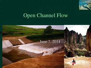
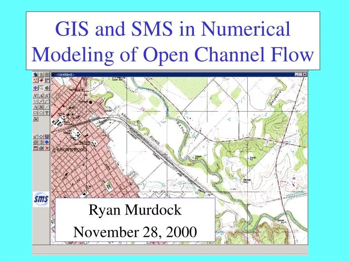
GIS and SMS in Numerical Modeling of Open Channel Flow. Ryan Murdock November 28, 2000. SMS = Surface Water Modeling Modeling System. Graphical pre and post processor for numerical surface water models. Data Collection. Detailed Stream Elevation Data. DEMs not suitable

E N D
GIS and SMS in Numerical Modeling of Open Channel Flow Ryan Murdock November 28, 2000
SMS = Surface Water Modeling Modeling System Graphical pre and post processor for numerical surface water models
Detailed Stream Elevation Data • DEMs not suitable • Small scale TIN needed • TIN representing Pecan Bayou SE of Brownwood, TX • Based on 2’ elevation contour data from aerial photogrammetry
Image Data Displayed in the background • For on-screen digitizing • To enhance display of SMS model • For model placement (with registered images)
Flow Data for Pecan Bayou • USGS gaging station • 27 mi downstream • Downloaded last 3 years of data • Apply max, mean, and min flows to SMS model
Data Processing *More happened here than meets the eye
TIN Data • Clip down data • Very large (>200 MB), hard to work with • Surface | Create Contours using Spatial Analyst • Clip contours using Geoprocessing Wizard • Recreate TIN using 3D Analyst • Now what? • Need to convert to scatter point for SMS • SMS could not read my TIN directly
Convert TIN to Grid • Theme | Convert to Grid using Spatial Analyst • Grid extents based on a smaller theme • Specify cell size
Convert Grid to ASCII Points • Arc workstation — new name = gridascii(tingrid) • SMS — import ascii points as an arc view file (.arc)
Conceptual Model • Created using GIS objects (map module) • Constructed independently of the mesh • Description of the site • Geometric features (main channel and banks) • Boundary of domain to be modeled • Flow rates and wsels of boundary conditions • Material zones (Mannings n values, etc)
Conceptual Model • River boundary feature objects
Projection Challenges • Built conceptual model and mesh based on registered quad image • Elevation data (scatter points) based on TIN • Data in different projections • TIN- Albers Equal Area • Quad Image- UTM
Finish Conceptual Model • Redistribute vertices • For good element creation • Define polygons • Assign meshing parameters • For creating finite elements • Patch desirable when direction of flow known • Apply boundary conditions • Flowrate and head • Assign materials
Construction of Mesh Network • Convert feature objects to a mesh • Interpolating to the mesh (scatter point module) • Renumber mesh (mesh module) • Organizes node and element ordering from specified boundary condition nodestring
Finite Element Modeling • Represent something physical with a mathematical equation • Want as few elements as possible, but still represent geometries accurately • Numerical model takes the conceptual model and gives results • SMS has capabilities for 1, 2, & 3 D models
2D Work • Mesh was set up to run FESWMS, a 2D hydrodynamic model • Equations based on continuity of mass and momentum • Depth-averaged flow (downstream & cross-stream) • Input model parameters (eddy viscosity, n, etc.) • Model crashed • Not a push button exercise
1D Modeling • Given position 1, find head and velocity at position 2 • Balance energy at each cross section • Conservation of continuity & momentum • Cross-section averaged flow
Near Future Work • Perform an advanced WSPRO analysis on the mesh • WSPRO is a one dimensional water surface profile computation model • Assumes flow normal to cross sections, steady state conditions, flat wsel across cross section • Examine results (depths and velocities) based on a few different characteristic flowrates at various cross sections • Refine roughness/land use estimates