Download
1 / 13
140 likes | 331 Vues
DEPARTMENT of SOIL SCIENCE. GIS in Teaching and Learning in Soil Science. Dr. Jeffrey G. White, Asst. Prof. Dept. of Soil Science-NCSU http://www.precisionag.ncsu.edu SSC-CS-BAE. Courses with GIS Instructional Components. SSC/BAE/CS 440 : GIS in Production Agriculture

E N D
DEPARTMENT of SOIL SCIENCE GIS in Teaching and Learning in Soil Science Dr. Jeffrey G. White, Asst. Prof. Dept. of Soil Science-NCSU http://www.precisionag.ncsu.edu SSC-CS-BAE
Courses with GIS Instructional Components • SSC/BAE/CS 440 : GIS in Production Agriculture • David Crouse (& Jeff White, SSC), Randy Weisz & Ron Heiniger (Crop Science), Gary Roberson (BAE) • SGIS: precision agriculture GIS, incorporates ESRI's ArcObjects and ArcSDE technology • GIS as core technology for precision agriculture, site-specific management • SSC590M: Remote Sensing Applications in Soil Science and Agriculture • Jeff White (SSC) • ArcView Image Analysis Module • Illustrate basic principals and applications of remotely sensed image analysis
Courses Using GIS for Case Studies • SSC551: Soil Chemistry • Dean Hesterberg (w/ Rob Austin, Spatial Info. Research Lab.) • Group projects to develop in-situ chemical treatment for immobilizing soil contaminants at remediation sites • SSC342: Soil Fertility Lab • John Havlin, Eugene Kamprath, Nathan Nelson • “Balancing the P Budget of a North Carolina Swine Farm”
NCSU Geospatial and Precision Technologies Regional Education Initiative • GPTREI: David Crouse, PI; Jared Jenkins, Ext’n. Assoc. • Funded by USDA-IFAFS • Objectives: • Initiate new and expand existing extension programs to include geospatial and precision agriculture technologies • Enhance problem-solving skills in students and agricultural professionals • Enable learners worldwide to access GIS technology education through an open courseware Internet training program. • Info: http://www.precisionag.ncsu.edu/GPTREI/index.htm • “OpenAg” portal: http://gptrei.soil.ncsu.edu/
The “GIS Academy” • Series of extension short courses designed to meet needs of precision agriculture & GIS practitioners • Hands-on GIS activities in CALS GIS Education Lab.: • GIS 101: Introduction to GPS and GIS • GIS 111: Using GIS Resources on the Internet • GIS 121: Field Data Collection Using GPS • GIS 131: Remote Sensing in Soil Science and Crop Production • GIS 201: GIS for Managing Spatially Variable Soil Properties • GIS 301: Data Management for Site-Specific Agriculture
Soil Science: CALS GIS Education Lab • 20 Windows XP workstations for students • 1 Windows workstation & projector for instructor • ArcGIS, ArcView, and SGIS
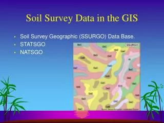
GIS Lab: Current Data Holdings • Digital county soil maps for most of NC • Digital soil attribute data • National MUIR: Map Unit Interpretation Records • SSURGO: Soil Survey Geographic Database • Statewide summer and winter Landsat TM imagery • '93, '94, '95, Winter 2000 • Statewide SPOT panchromatic (10 m) imagery • Custom-developed, hydrologically enforced DEM maps • Statewide EPA Reach File 3 hydrography • Numerous derived data layers to characterize environmental risks of N, P, and pesticides
SSC-CALS Spatial Information Laboratory Data Distribution System • Internet-based GIS data distribution system • MOA with NCCGIA to serve their data • Provide relevant natural resources GIS data layers to NC Cooperative Extension Service personnel, CALS students, faculty. • Data layers queried by county: • 1m resolution black and white DOQQs • soil surveys • hydrography data • digital elevation data • primary streets and roads • http://www.spatiallab.ncsu.edu/sirl
Spatial Info. Research Lab Activities • Terrain Analysis at Multiple Scales • Effects on terrain attribute calculation and quantitative soil-landscape modeling. • NC Nutrient Management Database Project • Internet-based nutrient utilization reporting system • Provides assessment of animal waste nutrients and waste nutrient carrying capacities of NC counties • www.spatiallab.ncsu.edu/nutman • NC Soils Explorer • Geospatial & Precision Technologies Regional Education Initiative • Custom designed ArcIMS application for on-line soils exploration. >90 GB spatial data for all 100 counties • http://arcims.soil.ncsu.edu:8080/Website/CtyMaps/index.htm
Can now identify soil properties 1 meter color infrared with soils overtop
GIS in Graduate Learning & Research • Erosion prediction modeling (Amber Moore / McLaughlin) • Predicting P losses from agricultural soils (Nathan Nelson / Mikkelsen) • Optimizing N mgt. using remote sensing for corn (Ravi Sripada / Heiniger -White) and wheat (Dianne Farrer / Weisz) • Assessing effects on groundwater NO3 of site-specific vs. uniform N mgt. (Nan Hong / White) • Characterizing clayey aquitards for wetland restoration using ground-penetrating radar (Ryan Szuch / White - Vepraskas)
GIS in Graduate Learning & Research • Using fieldscale apparent soil electrical conductivity to characterize soil spatial variability for site-specific agriculture (JiSu Bang / White) • Using LIDAR DEMs to study relationships between terrain attributes and soil C sequestration (Eric Anderson / Thompson) • Watershed-scale terrain evolution modeling (Chris Thaxton [PY] / McLaughlin) • Evaluating relationships between crop yield, soil chemical properties, and soil map units (Mindy Lohman / Osmond & White) • Evaluating spatial variability of residual soil N for improved fertilizer management in corn (Jared Williams / Crozier)