Download
1 / 60
600 likes | 721 Vues
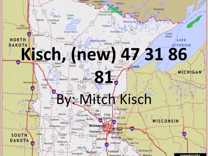
Kisch , (new) 47 31 86 81. By: Mitch Kisch. Part 1. Northeast region of Minnesota - Page 47 of the DeLORME Minnesota Atlas & Gazetteer . Reason for picking page…. The main reason I picked this page was because the city of Duluth is located on it Lake superior

E N D
Kisch, (new) 47 31 86 81 By: Mitch Kisch
Part 1 Northeast region of Minnesota -Page 47 of the DeLORME Minnesota Atlas & Gazetteer
Reason for picking page… • The main reason I picked this page was because the city of Duluth is located on it • Lake superior • There are a few different well recognized forests located within the area • I visit up in the area fairly often but don’t know nearly enough about the area around Duluth
Activities to do in Duluth • Great lakes Aquarium • North Shore Drive • Glensheen Mansion • Hawk Ridge Nature preserve • Canal Park • Fishing • Tweed museum of art
Canal Park • One of the main places to visit while in Duluth • Lift bridge- There is a lift bridge that allows ships into the harbors • Many hotels and restaurants down at Canal Park, Grandmas restaurant being the most well known. • Light house
Cloquet Valley State Forest • Established in 1933 • Located about 20 miles north of Duluth • Camping, Fishing, Hunting, Canoe/kayak, picnic • Cloquet river state water trial runs 33 miles through it • Covers 327,098 acres total
Superior National Forest • Established in 1909 • Known for its Boreal forest ecosystem, clean lakes, and colorful culture • Boundary water canoe area lies within the forest but not on page 47 • Activities: fishing, hunting, camping, canoeing, swimming, hiking, snowmobiling, and skiing
Canosia WMA • Near four corners • 2,489 acres • Deciduous and coniferous forest combined with wetlands/bogs • Some animals hunted in the area are deer, beer, small game, and waterfowl • Has extensive trial system
Anchor lake WMA • Near Eveleth • 174 acres • Mixed northern forest with a waterfowl lake • Grouse hunting trials
Island lake • Over 3000 acres big • Water clarity- 10.5 feet • Some fish include: black crappie, blue gill, brown bullhead, northern pike, pumpkinseed, rock bass, small mouth bass, walleye, white sucker, yellow perch • Walleye and northern are the primary species of the lake
North Shore drive • On this page you can go from west Duluth all the way up the north shore towards two harbors • Lake Superior is in plan site for much of the trip • Also called the scenic 61 drive
White Face reservoir • 4,567 acres • Near Markham • Water clarity- 5 feet • Sand bottom • Established in 1923 for hydropower water storage • Has maximum depth of 35 feet
Colleges St. Scholastica U of M Duluth Located in Duluth Public School Won the national championship this past year in D1 hockey and D2 football The bulldogs • Located in Duluth • Private school • Added a football team in 2008 • Educates more than 3,300 per year • Established in 1912 • The saints
Part 2 Northwest region of Minnesota - Page 31 of the DeLORME Minnesota Atlas & Gazetteer
Reason for picking page… • When I think of northern Minnesota I think of lakes and woods, more importantly I think of fishing! I decided to chose page 31 of the atlas to further look into because I wanted to get to know the Bemidji area, and explore lower red lake a little bit as well.
Bemidji info • The first city on the Mississippi river • About 13,500 people in 2010 • Houses many native American’s • Bemidji state university and northwestern technical college is in it • Name comes from the ojibwe and means “lake that traverses another body of water” • Total area of 12.9 miles
My one experience in Bemidji included… • Fishing • Golfing • Seeing a bear for the first time • Camping • One fun time!!
Buena Vista State Forest • 21 miles of marked snowmobile trials • 122,333 Acres • Lakes within it include: Beltrami, Big Bass, Gull, Sandy, and Three islands
Chippewa national Forest • Covers 1.6 million acres ( Way bigger than just what is seen on page 31) • 666,542 of those acres are forested • Established in 1902 • About 75% of land is within the leech lake Indian reservation
Lower red lake • THE BIGGEST lake the is completely in Minnesota
Lower red continued.. • It is a located within an Indian Reservation • 257 square miles • On the reservation in 2000 there were 5000 people living there • It is an unorganized territory • You can not fish it because it is owed by the Indians • If you get caught they can take all belongings you had with you
Red lake state forest • 84,105 acres • Established in 1963 • Located between Pine Island State forest and the southeast side of upper red lake
Mississippi headwaters state forest • 45,290 acres • Established in 1935 • Created through glacial action • Hills that meet flat outwash plains • Mississippi river flows through it • 95 lakes and ponds within boundaries
Little Rock • About 1,200 for a population • Located just south of lower red lake • 13.7 square miles • 98.8% of population is Native American
Long Lake WMA • 159.9 acres • Open to public hunting • No use of atv’s or snowmobiles • Bird watching • Hiking • Hunting • Wildlife viewing
Some other cities on page 31 • Pinewood • Wilton • Tenstrike • Turtle river • Solway • Pupsky • Debs • Quiring • Saum • Ponemah • Redby
Page 31 in a sum up • Many many lakes including the biggest in the state • The city of Bemidji with Paul Bunyan and Babe the blue ox. • Numerous recognizable forests and parks • A good area for a cabin • The upper half of the page is primarily Indian Reservation
Part 3 Southeast region of Minnesota -Page 86 of the DeLORME Minnesota Atlas & Gazetteer
Reason for choosing page… • This page showed much interest to me because of the town of Rochester • I have been down there several times and love the area
Rochester • Population: 107,000 about in 2010 • Largest city outside of the metro • Known mostly for it Mayo clinic
The mayo clinic • Opened in 1885 with 12 beds • Today it covers several city blocks and has 50,000 staff members • More than 2 million patients pass through doors each year • Arguably most famous Hospital in U.S.
Richard Dorer Memorial Hardwood State Forest • 1,016,204 acres • Covers seven different counties • Established in 1961 • Memorial to the state’s pioneers and veterans • Driftless area
Lake Louse State Park • 1,168 acres • Between 38 and 39 thousand annual visits • Site of oldest, continuous rec area • Over 141 species of birds • Limestone bedrock close to surface • Thin layer of glacial soil covers bedrock
Border • The border of Minnesota and Iowa runs across this page • Going through Beaver, York, Bristol, Harmony and Canton townships • Granger is the closest town to the border on this page in MN • This map was from 1873 of the border
Karst topography • Limestone area • Farms, rolling hills, hollows • Slowly dissolved by rainwater • Drained landscape • Fountain Township has great examples
White Water • A state park located near Kingsley corner • 2,700 acres • Nearly 50 kinds of mammals • Erosion carving through the bedrock created the original valleys of the river • Bluff lands landscape region • Contains oak savanna (very rare in MN) • Streams with brook trout
Trout Farms • I go down near Rochester about once every year and visit a family friends trout stream • I enjoy catching and releasing the fish and feeding them • Peaceful feeling
Niagara Cave • Located in Harmony, MN • Waterfall in cave nearly 60 feet high • 48 degrees year round • Fossils over 400 million years old
Forestville Mystery Cave (state park) • Also located on this page 86 and is a state park as well. • In Forestville • Karst region • At the edge of the tall grass prairie and the eastern deciduous forest • The cave is a maze of linear corridors • Over 12 miles of passage
Sum up of page 86 • Caves • Mayo clinic • Karst topography • Blufflands • My new favorite page in the atlas • Rochester
Part 4 Southwest region of Minnesota -Page 81 of the DeLORME Minnesota Atlas & Gazetteer
Reason for choosing page…. • The southwestern corner of the page is the only corner I have not been to • I'm curious to look learn a little more about what goes on in the smaller towns
Tall grass prairie Biome • This page is located withing the tall grass prairie biome • Lots of farming takes place here • Also located in the corn belt