Download
1 / 31
310 likes | 458 Vues
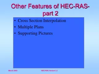
HECRAS Other Features (2) HECRAS sxva maxasiaTeblebi (2). by G. Parodi WRS – ITC – The Netherlands g. parodi WRS-ITC- niderlandebi. Other Features of HEC-RAS- part 2 HEC-RAS- is sxva maxasiaTeblebi - meore nawili. Cross Section Interpolation ganivi kveTis interpolacia Multiple Plans

E N D
HECRAS Other Features (2)HECRASsxva maxasiaTeblebi (2) by G. Parodi WRS – ITC – The Netherlands g. parodi WRS-ITC- niderlandebi
Other Features of HEC-RAS- part 2HEC-RAS-is sxva maxasiaTeblebi - meore nawili • Cross Section Interpolation • ganivi kveTis interpolacia • Multiple Plans • ramodenime gegma • Supporting Pictures • suraTebis mxardaWera
Cross Section Interpolationganivi kveTis interpolacia • Sometimes it is necessary to supplement surveyed cross section data by interpolating new sections between two surveyed sections • xandaxan saWiroa SevavsoT gamokvleuli ganivi kveTebis monacemebi, ori arsebuli ganivi kveTis interpolaciis saSualebiT. • Typically needed when the change in velocity head is large. HECRAS detects this by comparing conveyance values between two sections. • rogorc wesi am operaciis Catareba saWiroa maSin, rodesac gvaqvs mniSvnelovani cvlileba gadazidvis zewolaSi. HECRAS-i gamoavlens amas ori seqciis Soris arsebuli gadazidvis monacemebis Sedarebis gziT.
Cross Section Interpolationganivi kveTis interpolacia Geometric interpolation is accomplished by linearly interpolating between elevations and stations along “cords” geometriuli interpolacia xorcieldeba, horizontebis gaswvriv mdebare sadgurebsa da simaRleebs Soris xazovani interpolaciis saSualebiT. • 2 Options – 2 parametri • Interpolate a reach (more than 2 cross-sections) • gawvdomisinterpolacia (2 zemetiganivikveTi) • Between 2 cross-sections • 2 ganivkveTsSoris
Cross Section InterpolationMaster Cords - 5 Defaultsganivi kveTis interpolaciaZiriTadi kvanZebi- 5 aucilebeli piroba • First coordinate of cross section • ganivi kveTis pirveli koordinati • Left bank (required) • marcxena napiri (savaldebuloa) • Minimum elevation point in main channel • minimaluri simaRlis aRmniSvneli wertili ZiriTad arxSi • Right bank (required) • marjvena sanapiro (savaldebuloa) • Last coordinate of cross section • ganivi kveTis bolo koordinati
Cross Section InterpolationMaster Cords ganivi kveTis interpolaciaZiriTadi horizontebi
Be Aware Of What The “Default” Is DoingviyoT informirebuli, imaze Tu ra keTdeba “winapirobis” mixedviT • User can establish more Master Chords to prevent mis-interpolations • momxmarebelsSeuZliagamosaxosmetiZiriTadihorizontiraTaaaridosTavimcdarinterpolacias
Adding Master Chords to InterpolationZiriTadi horizontebis damateba interpolaciisas An adequate interpolation adding master chords adekvaturiinterpolaciisasematebaZiriTadihorizontebi
Cross Section Interpolation: Minor Cordsganivi kveTebis interpolacia: meoradi horizontebi zedadinebis seqcia pirveli koordinati bolo koordinati marcxena sanapiro marjvena sanapiro gadmobruneba interpolirebuli seqcia ZiriTadihorizonti meoradihorizonti qvedadinebis seqcia
Cross Section Interpolation: Minor Cordsganivi kveTebis interpolacia: meoradi horizonti • Automatically generated by program • avtomaturadyalibdebaprogramismier • Stations are determined using proportional distances between master cords • sadgurebiganisazRvrebaZiriTadhorizontebsSorisproporciulidistanciisgamoyenebiT • Number of minor cords = sum of coordinates in bounding cross sections minus number of master cords • meoradihorizontebisraodenoba= mosazRvreganivkveTebiskoordinatebis jams minus ZiriTadihorizontebisraodenoba
Cross Section Interpolation: Roughness Coefficientsganivi kveTebis interpolacia: xaxunis koeficienti • 4 default master cords (same as geometric minus the minimum channel elevation) • 4 winapirobiTmiRebuliZiriTadihorizonti (igivearac, geometriuladgamovakloTkalapotisminimalurisimaRle) • Minor cords added at other locations if more than 3 ‘n’ values at either cross sect. • meoradihorizontiematebayvelaimadgilas, sadacmniSvnelobametiavidre 3 ‘n’ yovelganivkveTze • Otherwise same as geometric interpolation • sxvaSemTxvevaSiigivea, racgeometriuliinterpolacia
Cross Section Interpolation: Other ganivi kveTebis interpolacia: sxva • Other features which are interpolated: downstream reach lengths, main channel bank stations, contraction and expansion coefficients, normal ineffective flow areas, levees, and normal blocked obstructions • maxasiaTeblebi, romelTa interpolacia xdeba: qveda dinebis gawvdomis sigrZe, ZiriTadi kalapotis napiris sadguri, kumSvis da gafarToebis koeficientebi, normuli araefeqturi dinebis regionebi, dambebi da normuli gamavlobis dablokva. • Normal ineffective flow areas, levees, and normal blocked obstructions are interpolated only if both bounding cross sections have them. • normaluri araefeqturi dinebis zona, dambebi da normuli dablokili gamavlobis Semcirebis interpolacia xdeba mxolod im SemTxvevaSi, Tu orive mosazRvre ganiv kveTas aqvs is. • Can interpolate between 2 cross sections or entire reach • SesaZlebelia interpolacia 2 ganiv kveTi Soris an srul gawvdomaze.
HEC-RAS - Multiple PlansHEC-RAS - ramodenime gegma Suggested Reading: Chapter 5 of HEC-RAS User’s Manual rekomendirebuliliteratura: HEC-RAS-is saxelmZRvaneloTavi 5
HEC-RAS - Multiple PlansHEC-RAS - ramodenime gegma proeqtisfaili: failissaxeli. prj geometriuli monacemebi fili saxeli. g02 geometriuli monacemebi fili saxeli. g03 damyarebuli dinebis monacemebi failis saxeli. g01 geometriuli monacemebi fili saxeli. g01 Suggested Reading: Chapter 5 of HEC-RAS User’s Manual rekomendirebuliliteratura: HEC-RAS-is saxelmZRvaneloTavi 5 gegma 1 fili saxeli. p01 gegma 2 fili saxeli. p02 gegma 3 fili saxeli. p013 gauSvi faili 1 fili saxeli. r01 gauSvi faili 2 fili saxeli. r02 gauSvi faili 2 fili saxeli. r03 Sedegi 1 fili saxeli. o01 Sedegi 2 fili saxeli. o02 Sedegi 3 fili saxeli. o03 proeqtis monacemTa failebis sqema
HEC-RAS - Multiple PlansHEC-RAS - ramodenime gegma Able to compare plans in tables: SesaZlebeliagegmebisSedarebacxrilissaSualebiT
HEC-RAS - Multiple PlansHEC-RAS - ramodenime gegma Able to compare plans in tables: SesaZlebelia SevadaroT gegmebi cxrilebis saSualebiT
HEC-RAS - Multiple PlansHEC-RAS - ramodenime gegma Able to compare plans in tables: SesaZlebelia SevadaroT gegma cxrilis saSualebiT:
HEC-RAS - Multiple PlansHEC-RAS - ramodenime gegma As well as in profiles, cross-sections, etc.: iseve rogorc profilebi, ganiv kveTebi da sxva..:
Supporting PicturessuraTebis mxardaWera • A picture can be “attached” to a cross section to help in documentation of the data. • SesaZlebelia suraTebis mimagreba ganiv kveTebTan, rac daxmarebas gagviwevs monacemTa bazebis dokumentaciaSi. • A picture can also be “attached” to the river schematic to assist in documentation. • SesaZlebelia aseve suraTebis mimagreba sqematur gamosaxulebasTan, rac gamosadegia monacemTa bazebis dokumentirebisas..
Log Filesregistrirebis failebi • Program will write notes to a file as it performs the computations. • programaTanmimdevruladCaiwersgaangariSebebis da operaciismsvlelobisyvelamoqmedebasSesabamisfailSi. • 10 different levels of output. • Sedegebis 10 gansxvavebuli done. • Files can get extremely large if higher levels are selected. • SeiZlebamiviRoTeqstremaluraddidizomisfailebi, TuSevarCieTgamoangariSebismaqsimaluri done. • Generally not necessary unless unusual answers are given by the program. • rogorcwesiaraasavaldebulo, TuprogramamarmogvawodauCveulo, mcdariSedegi.
Other Optionssxva parametrebi There are other options not discussed in this presentation: arseboben sxva parametrebic, romelTa ganxilvac ar moxda am moxsenebaSi: • Scour at bridges • gamorecxva, eroziaxidebTan • Lateral weirs • lateralurijebirebi • Ice-covered rivers • yinuliTdafarulimdinareebi • Cross-Section points filter • ganivikveTebiswertilebisfiltri • Fixed sediment elevations • naleqebisfiqsirebulisimaRle • Pilot channels • piloturinakadebi • Setting ineffective flow areas to permanent • araefeqturidinebismonakveTisganxilva, rogorcpermanentulidinebismqonemonakveTis.
End of lecture leqciisdasasruli