Download
1 / 32
330 likes | 802 Vues
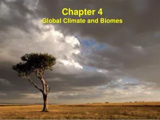
Biology PFHS Climate and Biomes. Outline. 1. Weather & Climate global patterns, El Niño, microclimate 2. Biomes generalized effects of latitude & altitude 3. Desert Biomes 4. Grassland, Tundra and Chaparral Biomes 5. Forest Biomes 6. Mountain Biomes

E N D
Biology PFHS Climate and Biomes
Outline • 1. Weather & Climate • global patterns, El Niño, microclimate • 2. Biomes • generalized effects of latitude & altitude • 3. Desert Biomes • 4. Grassland, Tundra and Chaparral Biomes • 5. Forest Biomes • 6. Mountain Biomes • 7. Perspectives on Geographical Ecology
1. Weather & Climate • What is the difference between weather and climate? • weather: short–term properties of troposphere (temperature, pressure, humidity, precipitation, solar radiation, cloud cover, wind direction and speed); • troposphere: the lowermost atmospheric layer where weather occurs; • climate: general, long–term weather of a region. • global temperature and precipitation patterns are determined by uneven heating of Earth by Sun and lead to distinct climate zones according to latitude.
Weather & Climate Fig. 7–2
Global Patterns • major factors influencing climate: • incoming solar radiation patterns: leads to uneven heating of troposphere from beneath; • air circulation patterns: determined by • uneven heating of Earth's surface; • seasonal changes due to Earth's tilt on axis and revolution about the sun; • Earth's rotation on its axis; • long–term variation of the incoming solar energy. • ocean currents • influenced by factors that influence air circulation plus differences in water density.
Geometry of the Earth & Sun Earth's rotation (24-hr period), tilted axis (23.5º), and revolution about the sun (365¼ day period) play a major role in weather and climate.
Convection Currents Vertical convection currents mix air in the troposphere and transport heat and water from one area to another in circular convection cells. Relative humidity increases as the air rises (right side) and decreases as it falls (left side).
Global Air Flow Conceptual model of global air circulation and biomes.
Greenhouse Effect The greenhouse effect is a natural process in which heat–trapping gases (CO2, H2O, etc.) trap heat in the troposphere. Without the greenhouse effect, Earth would be cold and lifeless.
Air Circulation Patterns Prevailing winds include westerlies at temperate latitudes, tradewinds in the subtropics, & doldrums (stiller air) along the equator. Fig. 7–4
Air Circulation Patterns • major patterns: • air circulation is driven by solar energy; air heated from beneath becomes unstable; solar energy becomes kinetic energy of air movement; • Coriolis effect: as Earth rotates surface turns faster beneath air masses near equator than near poles, resulting in deflection clockwise in N hemisphere & counterclockwise in S hemisphere; • huge cells of air movement result in global patterns of low & high pressure: • low pressure near 0º latitude (tropics), leads to high rainfall as warm, moisture–laden air rises; • high pressure at 30º N & S latitudes, results in deserts as dry air descends;
Ocean Currents • major patterns: • large circular patterns of movement in ocean basins, clockwise in N hemisphere and counterclockwise inS hemisphere (result of Coriolis effect), see Fig. 7–2; • ocean current kinetic energy transferred from air circulation (winds) to water at ocean surface • solar energy –> wind kinetic energy –> ocean kinetic energy • deep currents driven by cooling and by increased salinity – both make water denser and cause to sink; • currents redistribute heat and moderate coastal climate • example: Gulf stream brings warm water far north to cause NW Europe to be warm (otherwise Europe would have subarctic climate).
Upwelling Upwelling brings deep, cool, nutrient–rich waters up to replace surface water, leading to increased primary productivity, with large populations of phytoplankton, zooplankton, fish, and fish–eating birds. Fig. 7–7
El Niño–Southern Oscillation (ENSO) a periodic shift in global climate conditions (every 3–4 yrs) wherein prevailing westerly winds in the Pacific Ocean weaken or cease, the surface water along N. and S. America become warmer, upwelling decreases, and primary productivity along the coast declines sharply; strong ENSO affects over two–thirds of the globe.
El Niño–Southern Oscillation (ENSO) Fig. 7–8
Microclimate Topography, water bodies and other local features create local climate conditions known as microclimate. For example mountains commonly result in high rainfall on the windward side and low rainfall in the rain shadow of the leeward side.
2. Biomes • biome: the major types of terrestrial ecosystems • determined primarily by climate • major biomes: • arctic tundra - tropical rain forest • Desert - tropical deciduous forest • Chaparral - tropical scrub forest • boreal forest (taiga) - tropical savanna • temperate grassland • temperate deciduous forest • similar traits of plants and animals for biomes of different parts of world; because of similar climate and evolutionary pressures (convergence)
Earth's major biomes. Biomes Fig. 7–11
Biomes Precipitation and temperature are the major factors influencing the distribution of biomes. Therefore, they are the factors graphed on climatograms of the biomes.
Biomes Generalized effects of latitude and altitude on climate and biomes. Fig. 7–13
3. Desert Biomes Climatograms showing typical variation in annual temperature and precipitation for tropical, temperate and polar deserts.
DesertBiomes • Characteristics: • typically < 25 cm (10 in) annual precipitation; • sparse, widely spaced, mostly low vegetation • cover 30% of land surface, especially at 30° N and 30° S latitude; • largest deserts on interiors of continents; • plants either are typically deep rooted shrubs with small leaves, succulents, or short–lived species that flourish after rain; • animals are typically nocturnal and have physical adaptations for conserving water and dealing with heat.
Desert Biomes Fig. 7–15
4. Grassland, Tundra and Chaparral Biomes Climate graphs showing typical variations in annual temperature and precipitation in tropical, temperate and polar grasslands. Fig. 7–17
Grassland Biomes • Characteristics: • sufficient rainfall to support grass, but often too dry for forests; • mostly found on interiors of continents; • maintained by seasonal drought, grazing and periodic fires that prevent invasion by shrubs and trees; • plants include high diversity of grasses and herbaceous plants that typically have broad distributions and that have resistance to drought, grazing and fire; • animals include large and small herbivores, along with predators adapted to feed on these herbivores.
Grassland Biomes Figs. 7–19 & 7–20
5. Forest Biomes Climate graphs showing typical variations in annual temperature and precipitation in tropical, temperate and polar forests. Fig. 7–22
Forest Biomes • Characteristics: • sufficient rainfall to support growth of trees; • three types: • tropical, typically broadleaf evergreen trees with high diversity; • temperate, typically deciduous broadleaf tree with moderate diversity; • boreal, typical conifers (needle leaves) with low diversity. • community of plants and animals typically distributed in various layers: • understory of herbaceous plants and shrubs; • subcanopy of tree saplings; • canopy of full–grown trees.
Forest Biomes Fig. 7–23
6. Mountain Biomes • Characteristics: • diversity of habitat because of diversity of altitude, slope orientation, corresponding microclimate and soil over short distances; • correspondingly complex patterning of vegetation; • make up 20% of Earth's surface; • each 100 m (300 ft) gain in elevation is approximately equal to a 100 km (62 mi) change in latitude; • mountain regions contain majority of world's forests; • timberline: elevation above which trees do not grow; • snowline: elevation above which there is permanent snow; • important as watersheds for lowlands.
7. Perspectives on Geographical Ecology • Important Lessons • everything is connected; • temperature and precipitation result patterns result from interplay of incoming solar radiation and geometry of Earth's rotation and orbit; • temperature and precipitation are major determinants of the distribution of organisms; • understanding the range of biodiversity and its distribution provides a global perspective. • Value of a Geographical Perspective • maps are excellent way to represent complex information and understand complex relationships.