Download

1 / 11
140 likes | 509 Vues
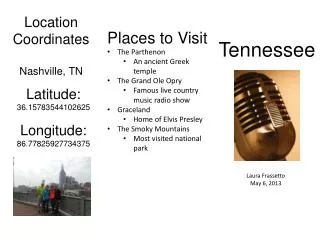
Tennessee. The Geography of Tennessee. Its boundaries touch eight of its sister states. They are Alabama, Arkansas, Georgia, Kentucky, Mississippi , Missouri, North Carolina, and Virginia. Tennessee is 34 th in size of all the states in the nation. The Geography of Tennessee.

E N D
The Geography of Tennessee • Its boundaries touch eight of its sister states. • They are Alabama, Arkansas, Georgia, Kentucky, Mississippi , Missouri, North Carolina, and Virginia. • Tennessee is 34th in size of all the states in the nation.
The Geography of Tennessee • Tennessee is divided into ninety-five counties. • The western boundary of Tennessee follows the Mississippi River. • The eastern boundary of Tennessee follows the Unake Mountain.
The Three Parts of Tennessee • There are three grand divisions of the state, they are East, Middle, and West Tennessee. • East Tennessee is divided from middle Tennessee by the Cumberland plateau. The Tennessee River separates Middle Tennessee from West Tennessee. • East Tennessee was the first section of the state to be settled.
Natural Regions • Modern geologists have divided Tennessee into six natural regions. They are: • 1. The Unaka Mountains • 2. East Tennessee Valley and Ridge • 3.The Cumberland Plateau • 4.The Highland Rim • 5.The Central Basin • 6.The Gulf Coastal Plain
The Unaka Mountains Also known as the Great Smoky Mountains Clingman’s Dome is the Unakas’ highest point Cade’s Cove is located in this region East Tennessee Valley and Ridge Immediately west of the Unaka Mountains Series of valleys and ridges Natural Regions
The Cumberland Plateau Its settlement came late. The northeast border of the plateau, where Tennessee, Kentucky, and Virginia meet, is known as the Cumberland Gap (1,200 ft). The Highland Rim This is the largest region. Is a geographic term for the area in Tennessee surrounding the Central Basin. Natural Regions
The Central Basin Shaped like the bottom of a bowl. This is the smallest region. Most fertile soil in the state. Coastal Plain of West Tennessee Between Tennessee and Mississippi Rivers. Agricultural heart of the state. Natural Regions
Rivers Systems • The Mississippi River serves as the main drainage route for the region. • The Tennessee River rises in East Tennessee, runs through North Alabama, and loops back to form the boundary between Middle and West Tennessee. • Another system involves the Cumberland River.
Reelfoot Lake • Reelfoot Lake was formed by a severe earthquake in 1811. • Reelfoot Lake was named after a Chickasaw chief. • Reelfoot Lake covers 14,500 acres.
Time Zones Divided into two times zones. All of East Tennessee, lies in the Eastern Time Zone. The rest of the state is in the Central Time Zone. Climate Moderate climate. Summers are not excessively hot, nor are winters exceedingly cold. Average rainfall is 40 to 50 inches a year. Average annual snowfall is 8 inches. Time Zones and Climate