Download
1 / 9
90 likes | 223 Vues
GRUPO No. 2. ESTÁNDARES DE INFORMACIÓN GEOGRAFICA. INTEGRANTES. CLIRSEN MRNNR – INIGEMM UE MAGAP – PRAT MAGAP-SIGAGRO MEER. IGM-CONAGE IGM SENPLADES FAE CONCOPE. OBJETIVO GENERAL.

E N D
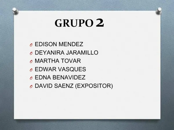
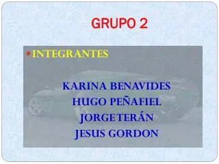
GRUPO No. 2 ESTÁNDARES DE INFORMACIÓN GEOGRAFICA
INTEGRANTES. • CLIRSEN • MRNNR – INIGEMM • UE MAGAP – PRAT • MAGAP-SIGAGRO • MEER • IGM-CONAGE • IGM • SENPLADES • FAE • CONCOPE
OBJETIVO GENERAL • Definir estándares geográficos y especificaciones técnicas para obtener información georeferenciada y estandarizada con fines de interoperabilidad.
OBJETIVOS ESPECÍFICOS • Satisfacer los requerimientos del INEN en cuanto al pronunciamiento de normas ISO TC 211 y normas nacionales. • Conformar el glosario de términos geográficos. • Revisar el documento de especificaciones técnicas para la elaboración de cartografía base. • Elaborar los documentos de ET y estándares para la generación de Geoinformación (Plan Nacional para el Buen Vivir).
NORMAS REVISADAS TC-211- INEN • ISO 19134 Location-based services -- Multimodal routing and navigation • ISO/TC 211 N 2874 Imagery sensor models for geopositioning • ISO/TC 211 N 2847 Geomatics • ISO/TC 211 N 2868 Procedures for item registration • ISO 19138 Data quality measures. • ISO 19138 Encoding • ISO / CD 19117 Geografic information Portrayal • ISO DIS 19149 / Rights expression language for geographic information
RESUMEN DE TRABAJO • Reuniones mensuales. • Preparación de documentos de discusión por cada institución integrante del grupo de trabajo: • GENERALIZACIÓN CARTOGRÁFICA. • REALIZACIÓN DE CARTOGRAFÍA TOPOGRÁFICA A CUALQUIER ESCALA. • BREVE GUÍA DE PROCEDIMIENTOS PARA LA GENERACIÓN DE LA CARTA GEOLÓGICA NACIONAL EN FORMATO DIGITAL. • LIBRERÍA DE SÍMBOLOS GEOLÓGICOS EN EL SIG. continuación…
continuación… RESUMEN DE TRABAJO • Preparación de documentos de discusión por cada institución integrante del grupo de trabajo: • PROTOCOLOS DE COMPILACIÓN DE INFORMACIÓN. • DOCUMENTO PROPUESTO PARA PRECISIONES EN IMÁGENES DE SATÉLITE Y PRODUCTOS LIDAR. • GENERACIÓN DE GEOINFORMACIÓN PARA LA GESTIÓN DEL TERRITORIO Y VALORACIÓN DE TIERRAS RURALES: • USO DE LA TIERRA, PARCELAS Y RIEGO, CLIMA, GEOMORFOLOGIA, SUELOS.
PRODUCTOS A OBTENER • Documento que contiene el Glosario de términos geográficos. • Documentos de ET y estándares nacionales para la generación de Geoinformación a partir de la demanda gubernamental y el Plan Nacional para el Buen Vivir. • Documento de ET para la elaboración de cartografía topográfica a cualquier escala – INEN (formatos y modificación del documento). • Normas revisadas según requerimiento del INEN en lo referente a la ISOTC211.
REQUERIMIENTOS • Compromiso institucional a través de los delegados. • Cumplimiento de presentación de propuestas de los documentos de estándares en base a cronogramas de trabajo.