Download
1 / 1
10 likes | 175 Vues
ASTER Map of Western Australia. A collaborative project between: C3DMM - Western Australian Centre of Excellence for 3D Mineral Mapping GSWA – Geological Survey of Western Australia. Introduction

E N D
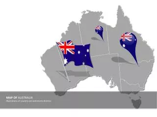
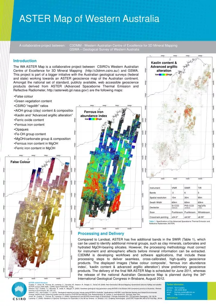
ASTER Map of Western Australia A collaborative project between: C3DMM - Western Australian Centre of Excellence for 3D Mineral Mapping GSWA – Geological Survey of Western Australia Introduction The WA ASTER Map is a collaborative project between CSIRO’s Western Australian Centre of Excellence for 3D Mineral Mapping (http://c3dmm.csiro.au/) and GSWA. This project is part of a bigger initiative with the Australian geological surveys (federal and state) working towards an ASTER geoscience map of the Australian continent. Amongst the national set of standard, publicly available, web accessible geoscience products derived from ASTER (Advanced Spaceborne Thermal Emission and Reflective Radiometer, http://asterweb.jpl.nasa.gov/) are the following maps: Kaolin content & Advanced argillic alteration low high • False colour • Green vegetation content • CSIRO “regolith” ratios • AlOH group (clay) content & composition • Kaolin and “Advanced argillic alteration” • Ferric oxide content • Ferrous iron content • Opaques • Fe-OH group content • MgOH/carbonate group & composition • Ferrous iron content in MgOH • Ferric iron content in MgOH Ferrous iron abundance index low high 7720000 False Colour Table 1: Specifications of the Advanced Spaceborne Thermal Emission and Reflective Radiometer (ASTER) 7700000 7700000 Processing and Delivery Compared to Landsat, ASTER has five additional bands in the SWIR (Table 1), which can be used to identify additional mineral groups, such as clay minerals, carbonates and hydrated MgOH-bearing silicates. However, the processing methodology must correct for instrument and atmospheric effects before mineral information can be extracted. C3DMM is developing workflows and software applications, that include these processing steps to deliver seamless, cross-calibrated, high-quality geoscience products. The displayed images (‘false colour composite’, ‘ferrous iron abundance index’, ‘kaolin content & advanced argillic alteration’) show preliminary geoscience products. The delivery of the final WA ASTER Map is scheduled for June 2011, whereas the release of the national Australian Geoscience Map is planned during the 34th International Geological Congress in Brisbane, August 2012. 470000 450000 ASTER related literature: Cudahy, T., Jones, M., Thomas, M., Laukamp, C., Caccetta, M., Hewson, R., Rodger, A., Verrall, M. (2008): Next Generation Mineral Mapping: Queensland airborne HyMap and satellite ASTER surveys 2006-2008.- CSIRO report P2007/364, 161pp. Hewson, R.D., Cudahy, T.J., Mizuhiko, S., Ueda, K., Mauger, K. (2005): Seamless geological map generation using ASTER in the Broken Hill-Curnamona province of Australia.- Remote Sensing of Environment, 99, 159-172. Hewson, R.D., and Cudahy, T.J. (2010). ‘Geological mapping accuracy issues using ASTER in Australia.’ Applications in ASTER, Land Remote Sensing and Global Environmental Change: NASA’s Earth Observing System and the Science of ASTER and MODIS. Eds. Ramachandran, B, Justice, C, and Abrams M., Springer, New York.. Jones, M., Cudahy, T., Thomas, M., Laukamp, C. (2008): Hyperspectral and ASTER mineral maps of Queensland.- Preview, Australian Soc. of Exploration Geologists, 136, 28-29. Laukamp, C. (2008): Validation of Spectral Techniques for Exploration in the Mt Isa Terrane.- In: Sheldon, H.A.: Enabling Technologies - pmd*CRC Project M4, M9 & F6 Final Rep., 89-94. contact: Tom Cudahy phone: (08) 6436 8630 email: thomas.cudahy@csiro.auweb: http://c3dmm.csiro.au