Download
1 / 19
200 likes | 495 Vues
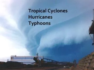
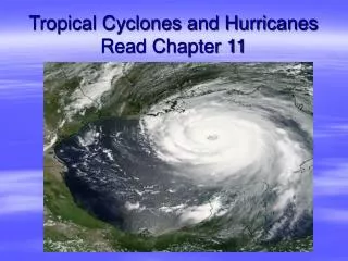
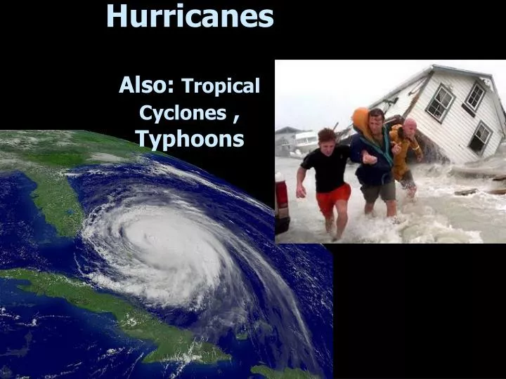
Hurricanes Also: Tropical Cyclones , Typhoons. Tropical Cyclone Ingredients. Light winds instability along I.T.C.Z. High humidity (oceans) fuel (latent heat) Warm surface waters over a vast area (at least 26ºC / 76ºF tropics, < 25 ºN or S)

E N D
Tropical Cyclone Ingredients • Light winds instability along I.T.C.Z. • High humidity (oceans) fuel (latent heat) • Warm surface waters over a vast area(at least 26ºC / 76ºF tropics, < 25 ºN or S) • Will not form within 5o of equator(no Coriolis)
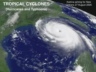
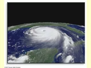
Tropical Cyclone Features • Spiral bands • No Fronts • Eye wall cloud • Eye • Size: 100-600miles, but can be larger Death Toll: 12,000
Tropical Cyclone Formation • Easterly waves (fig. 8-24) • vertical perturbations within the trade winds • about 10% intensify and rotate • Tropical depression (winds < 63 kmph, 39 mph) • Tropical storm (63-118 kmph, 39-73 mph) • naming of the storm • Cyclone (winds > 119 kmph, 74 mph) • Saffir-Simpson scale (Table 8-1) • ranks 1 to 5 (5 is “catastrophic”)
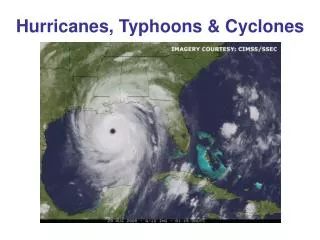
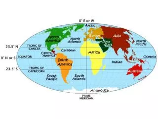
Hurricanes, Typhoons & Cyclones World Map shows locations of Hurricanes, Typhoons & Cyclones Names Reflect Locations All are the Same type Of storm
Paths of Hurricanes: North Atlantic, 1995 North Atlantic hurricanes develop 5 to 10 degrees north of The equator & travel to the west, yet as they move farther North they change directions & move eastward Most do not make landfall
Hurricane Trends? Source: U.S. NCDC, 2009
Hurricanes:CoastalDamage/Death Coastal damage can be extensive as high winds, high Tides And ‘storm surges’ push ocean water far inland Galveston, Texas Was struck in 1900 & 6,000 were killed In 1970 a Hurricane Hit Bangladesh & Killed 300,000; in 1991 200,000 died (Note that many people in Australia, Mexico, and S.E. Asia depend on the hurricanes for live-giving moisture each year.)
Tropical Cyclone Hazards • Storm surge – sea level increase of up to 20 feet! Worse if it coincides with high tide. Why? • winds / friction • pressure (1 cm rise per 1 mb drop in pressure) • rain / floodingcauses mostdamage! • winds • Embedded tornadoes Katrina, 2005
Tropical Cyclone Power • Power • one hour = total USA electricity for one year • one day = nuclear arsenals of USA and Russia • Highest U.S.death toll: Galveston, TX, 1900 - 20 ft. storm surge killed 6,000 (1/6 the population)
2005 Atlantic Hurricane Season • Most named tropical storms in history (28); including most intense ever (Wilma: 882 millibars; 185 mph sustained winds) and most Category 5 storms (4) ever • New Orleans destroyed; worst U.S. hurricane damage ever. Cost estimated at: $100,000,000,000 • Death toll: at least 2048 confirmed dead as of 4/2006; most were among poorest elderly people.
Forecasting and Safety • Tracking • satellites • coastal radar • Prediction • computer modeling • City evacuation plans
Extra-tropical versus Tropical Cyclones Midlatitude cyclones • Form and move outside the tropics and over both land and water• Largest diameter of all storms• No eye• Have distinct fronts Tropical cyclones• Form over tropical oceans. Lose strength over land• Obvious eye and dramatic pressure drop (900 mb or lower) • Has no fronts. • Smaller average size, but much higher winds.