Download

1 / 36
360 likes | 365 Vues
Learn about the climate and vegetation patterns in West Africa, including the Inter-Tropical Convergence Zone (ITCZ) and the impact of air masses. Explore the different types of climates and vegetation, and understand the causes and effects of desertification in the region.

E N D
Atmosphere Unit The Inter-Tropical Convergence Zone
Learning Intentions • The climate and vegetation of West Africa • Air Masses and the ITCZ • The ITCZ • West African rainfall and the ITCZ
Climate and Vegetation • West Africa has a tropical climate – temperatures are over 23°C all year. • With increasing distance from the Equator, there is a greater range in temperature, decreasing rainfall and increasingly distinct wet and dry seasons.
Climate/vegetation patterns DESERT dry all year dry ‘season’ wet ‘season’ SAVANNA wet all year RAINFOREST
The further North of the Equator in tropical Africa:- • the lower the annual rainfall • the more the rainfall is concentrated in the summer months • the more variable the rainfall.
Equator to 10° N&S • The climate is EQUATORIAL • Temperature and rainfall are both high, with little variation all year • This gives rainforest vegetation
Further North and South • Tropical Continental or SAVANNA. • Temperatures are high, rainfall is lower • Distinct wet and dry seasons
Hot desert • In West Africa, this is the Sahara • Daytime temperatures are hot with a large diurnal range • Rainfall is under 250mm. • Vegetation is minimal and farming almost impossible
Air Masses • Large masses of air settle over parts of the Earth’s surface and take on the local climate characteristics • These can move, carrying their characteristics to other areas
West Africa • Two air masses affect the weather and climate of West Africa cT Brings dry, hot, settled weather mT Brings warm, wet, turbulent weather
Tropical Continental (cT) • This air mass is formed over the Sahara desert • It’s associated with the North East Trade winds (Harmattan) • It brings extremely hot temperatures • No rainfall • Poor visibility (dust carried from the desert)
Tropical Maritime (mT) • This air mass is formed over the Atlantic Ocean • It’s associated with the South East Trade winds which are deflected by Corioli’s as they pass over the Equator, becoming the South West Monsoon • It brings hot temperatures • High humidity – lots of rain
Air Masses and the ITCZ • An area where two different winds meet is called a zone of convergence • Where the North East trades meet the South West Monsoons over West Africa, it is called the Inter-Tropical Convergence Zone • It is a zone of low pressure, associated with a band of rainfall
West African Climate and the ITCZ • The location of the ITCZ varies throughout the year • The ITCZ over land moves farther north or south than the ITCZ over the oceans due to the variation in land temperatures.
ITCZ seasonal position ITCZ JANUARY ITCZ JULY
Cont’d • The ITCZ is not stationary but moves north and south of the Equator, following the overhead sun and the thermal equator • In July, the thermal equator is in its most northerly position, bringing rain to West Africa • In January, the thermal equator is in its most southerly position, bringing dry weather to West Africa WHY?
In July, the cT air mass dominates West Africa, so the hot, dry winds of the Harmattan covers most of the area • In January, the mT air mass pushes north into West Africa, bringing the rainy season • As the ITCZ moves south again, the norhtern areas become dry again. Southern coastal areas experience a returning band of rainfall as the ITCZ passes over again, giving a second rainfall peak
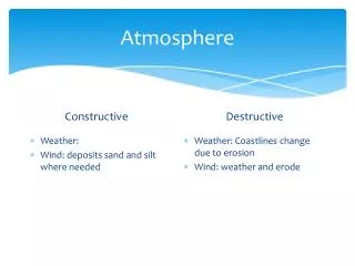
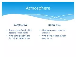
Sahel region • A major impact of the ITCZ is that it brings rain to the Sahel region of western Africa. This is the area south of the Sahara. • In recent years, the ITCZ has not “arrived” so the very short rainy season has all but disappeared. • This has had a major effect on the landscape and the people
The Sahel Region The “Sahel” area of Africa – located to the south of the Sahara desert
Area of erosion – • Little vegetation • Few trees • Bare soil • Gullies starting to form • Severe gullying causes loss of farmland • Trees chopped down for firewood
Effects of desertification: • Villages and farms are abandoned • Lakes and waterholes dry up
Preventing Desertification lattice matting made from twigs and dried grass to stabilise moving dunes
“Magic Stones” seen from the air Prevents run-off and erosion
There are also human causes of desertification More People More crops overcultivation More animals overgrazing DESERTIFICATION More firewood deforestation
Decision-making task • “Give a man a fish and he will eat today. Teach a man to fish and he will eat for life” (proverb) • Some people see giving aid to Sahelian countries as a necessity. In your group, discuss advantages/disadvantages of aid and the practical methods for prevention of desertification.
Group task Planting trees for firewood/shelter belts Planting Marram Grass irrigation Mechanised farming equipment Which methods are most appropriate? fences GM seeds Controlled grazing Windbreaks Crop rotation
2011 Paper 1 Q1 (amended) • Describe the origin, nature and characteristics of the Maritime Tropical and Continental Tropical air masses in detail. • Describe and explain, in detail, the variations in rainfall within West Africa.
Model answer (a) • Maritime Tropical (mT) • Origin – Atlantic ocean/Gulf of Guinea, in tropical latitudes • Weather characteristics – hot, high humidity, warm • Nature – unstable • Continental Tropical (cT) • Origin – Sahara Desert, in tropical latitudes • Weather characteristics – hot/very hot, dry, low humidity, warm • Nature – stable, poor visibility
Model answer (b) • Highlight the marked contrast in precipitation totals, seasonal distribution and number of days between a very dry north (Gao with only 200 mm in a hot desert climate in Mali) and a much wetter south (Abidjan with 1700 mm in a tropical rainforest climate in the Ivory Coast). • Bobo-Dioulasso in Burkina Faso in central West Africa has an „in-between‟ amount of both rain days and total annual precipitation (1000 mm in a Savannah climate). • Also refer to the variation in rain days and seasonal distribution for each station. Gao with a limited amount of precipitation in summer, Bobo-Dioulasso with a clear wet season/dry season regime and Abidjan with a “twin-peak‟ regime with a major peak in June and a smaller peak in October/November.
Explanation should focus on the role of the ITCZ and the movement of the Maritime Tropical and Continental Tropical air masses over the course of the year. For example, Abidjan, on the Gulf of Guinea coast, is influenced by hot, humid mT air for most of the year, accounting for its higher total annual precipitation and greater number of rain days. The twin precipitation peaks can be attributed to the ITCZ moving northwards in the early part of the year and then southwards later in the year in line with the thermal equator/overhead sun.
Gao, on the other hand, is under the influence of hot, dry cT air for most of the year and therefore has far fewer rain days and a very low total annual precipitation figure as it lies well to the north of the ITCZ for most of the year. Bobo-Dioulasso again is in an „in-between‟ position, getting more rain days and heavy summer precipitation from June-August when the ITCZ is furthest north.