Download
1 / 11
110 likes | 289 Vues
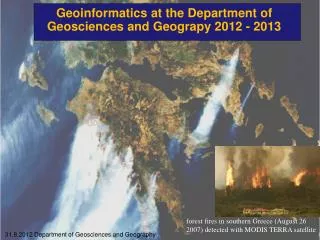
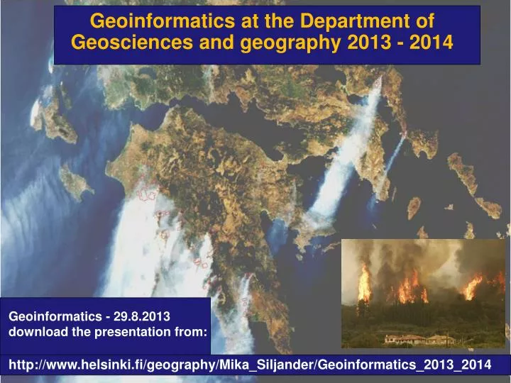
Geoinformatics at the Department of Geosciences and g eography 2013 - 2014. Geoinformatics - 29.8.2013 download the presentation from : http://www.helsinki.fi/geography/Mika_Siljander/Geoinformatics_2013_2014 . Geoinformatics personnel. Tuuli Toivonen : Senior lecturer in GI

E N D
Geoinformatics at the Department of Geosciences and geography 2013 - 2014 Geoinformatics- 29.8.2013 download the presentationfrom: http://www.helsinki.fi/geography/Mika_Siljander/Geoinformatics_2013_2014
Geoinformaticspersonnel TuuliToivonen: Senior lecturer in GI (research leave until August 2014) Mika Siljander: Senior lecturer in GI (until August 2014) Petri Pellikka: Professor • Matti Mõttus : • Postdocresearcher, • docent • Pekka Hurskainen: • -PhDStudent • CHIESA projectcoordinator • - GI-teaching • Janne Heiskanen: • Postdocresearcher, • -BIODEV project Johanna Hohental: PhD. Student Tuure Takala: PhD. Student XiaochenZou : PhD. Student • Maeda, EduardoEiji: • -CHIESA project • Postdocresearcher, Maria Salonen: PhD. Student – now inCopenhagen
Geoinformaticscourses in English2013-2014 2013 – period 1 • 560411 Basics of GIS for English-speaking students (web course), 3 cr. • Starting on 10.09.2013 using mainly Quantum GIS butalsoArcGIS 10.1 software • Web GIS course implemented in Moodleplatform: • https://moodle.helsinki.fi/course/view.php?id=10279 - (opensup on Tue10.09.2013 ) • ennrollmentkey: gisme2013 • Students will make GIS practicals and return final reporttoMoodle • If youwanttotake the course email tomika.siljander@helsinki.fi • and tellyourname and student ID number – thiscourse is not in WebOodi as • I don’twanttogivethiscourse for toomany students outsizeourdepartment – last yearI had students mainlywithoutany ”Geography/Geologybackground” –BIG mistake! • GRADING: Fail/Pass • 562820 Raster GIS(5 cr.) (thiscourse is overbooked!) • but it is possibleto make thiscourseindependentlyifyouhavealreadybasic GIS skills • all course material available from University ofHelsinkiMoodleplatform - https://moodle.helsinki.fi/. Email tomika.siljander@helsinki.fi for more information
Geoinformaticscourses in English2013-2014 2013 – periods 1 and 2 56301 Methods in Remote Sensing 5 cr. 18.09.2013 -17.10.2013 - lectures in Finnish – lecture PDFs in English 18.09.-17.10.13 Wed 12.15-14.00, D 112, Physicum 19.09.-17.10.13 Thu 12.15-14.00, B 121, Exactum 24.09.-17.10.13 Tue 12.15-14.00, D 112, Physicum Remote sensing practicals - Group 2. 30.10.-13.12.2013 (wed 16.15-20.00, Fri 15.15-19.00), classroom A113, Physicum Register in WebOodi moreinfo from prof. Petri Pellikka. Email: petri.pellikka@helsinki.fi
Geoinformaticscourses in English2013-2014 2013 – period2 560761 - Basic hydrological concepts with GIS applications 3 cr. 30.10.2013 -04.12.2013 On Wednesdays 10.15-12.00, BK106, Exactumbuilding, Kumpula –Email Dr. EduardoMaedaeduardo.maeda@helsinki.fi for more information
Geoinformaticscourses in English2013-2014 2014 – period 3 56315 Advanced Course in Geoinformatics 5 cr. (14.01.14 -25.02.14) the course is only in Finnish language - i might make it suitable as a Moodle web course for English speaking students – but not yet sure about it. to pass the course: GIS practicals, final work responsible teacher Mika Siljander 562827 Imaging spectroscopy (4 cr.) (responsibleteacherDr. Matti Mottus) 13.01.14 -11.02.14 - Mon 10.15-12.00 14.01.14 -11.02.14 - Tue 10.15-12.00 2014 – period 4 56455 Advanced remote sensing (4 cr.) (Dr JanneHeiskanen )janne.heiskanen@helsinki.fi 31.03.14 -15.04.14 Mon 10.15-12.00 - lectures 07.04.14 -06.05.14 Tue 12.15-16.00 – practicals
562820 Raster GIS (5 cr.) – advanced GIS course 2013 Teacher: Dr. Mika Siljander04.09.-16.10.2103 Practicals: Wednesday’s 12.15-16.00 GIS-lab A113-A114 A113, Physicum building Course is alreadyfull but it is possibleto make it independently– detailedinstructions and GIS data is available from Moodlee-learningplatform at the University of Helsinki. GIS labcanbeusedwhenthere is no othercourse – at the period 1 thereshouldbesomeavailabletime in GIS lab. See the schedulefound at the GIS labdoor. If you have a fairlygoodbasic GIS skills and you are interested to make the courseindependently - email: mika.siljander@helsinki.fi
562820 Raster GIS (5 cr.) PRELIMINARY KNOWLEDGE: fairly good basic GIS skills. Basic knowledge in Excel, Access and SPSS are appreciated. REGISTRATION for ERASMUS students: emailto mika.siljander@helsinki.fi COURSE DESCRIPTION: The aim of Raster GIS course is to learn how GIS and Remote sens4ing techniques are used in environmental studies. Software used in this course: ArcGIS 10, MS Excel and Access; SPSS (PASW Statistics) 18; Maxent COURSE AIMS AND MAIN THEMES: Students should achieve knowledge how to process and use Raster GIS and Remote sensing data in environmental studies and how to create and handle GIS-databases. Basics of spatial statistics and spatial modeling are also learned. TO PASS THE COURSE: No exam; write a final report GRADING: 1-5
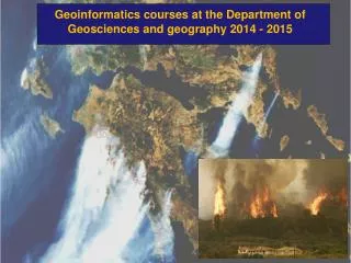
562820 Raster GIS (5 cr.) Practical 1: ArcGIS ModelBuilder and creating GTOPO30 1 km pixel size digital elevation model for Africa. Practical 2: Creating and analyzing environmental raster GIS data using GTOPO30 DEM and land cover data for Africa Practical 3: GIS analysis of wildfires in Russia Practical 4: Raster GIS operators, map algebra and conditional processing Practical 5 and 6: Image georeferencing and creating digitital elevation model (DEM) by on-screen digitizing; grassland fire analysis using ModerateResolutionImagingSpectroradiometer (MODIS) derived remote sensed fire data; introduction to Shuttle Radar Topography Mission (SRTM) 90 m pixel size elevation data. Practical 7: Basics in species distribution modeling (SDMs) using Maxent software and ArcGIS
3 credits 3 lectures (2 hours each) and 3 practicals(4 hours each) Dates and times: 560761 - Basic hydrological concepts with GIS applications Evaluation:The evaluation will be done based on a small pre-course assignment, one exercise after each lecture and short projects that will be carried out during the practical classes.
560761 - Course content (subject to some changes)