Download
1 / 28
291 likes | 894 Vues
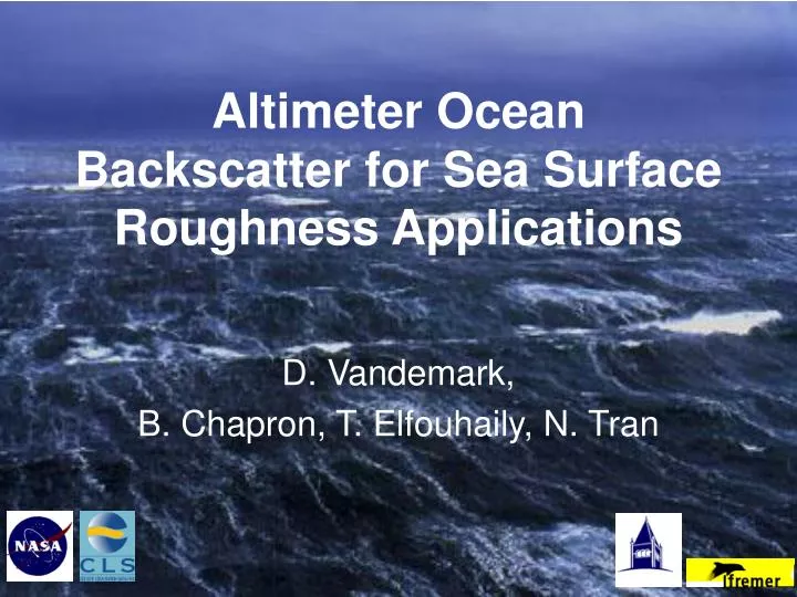
Altimeter Ocean Backscatter for Sea Surface Roughness Applications. D. Vandemark, B. Chapron, T. Elfouhaily, N. Tran. Outline. Background – objectives, approach Areas to highlight dual frequency satellite colocation long wave impacts, wind speed correction

E N D
Altimeter Ocean Backscatter for Sea Surface Roughness Applications D. Vandemark, B. Chapron, T. Elfouhaily, N. Tran
Outline • Background – objectives, approach • Areas to highlight • dual frequency • satellite colocation • long wave impacts, wind speed correction Focus on this group’s efforts – much parallel and previous work acknowledged
Overall Objective for last decade – exploit altimeter surface scattering data • Geophysical retrievals - sea level correction (sea state bias), wind speed, surface roughness, long wave information, mass and momentum flux, wind direction • Understand sensor physics - μwave scattering and emission from ocean - with a simple robust tool; the satellite altimeter with 2 frequencies + radiometer • Improve wind wave and air-sea interaction models • Advance a theory-guided approach to synergistic air-sea studies where colocated model, in situ, and multiple satellite sensor measurements (passive, active) are combined to devise a “global ocean laboratory”
Altimeter backscatter - o Microwave altimeter sounding 2.3 nsec pulse Amp. Maximum inverse of wind speed (via short wave ‘speckle’) Amplitude P(t) Plan view at surface Time 0 = normalize radar cross section inverse of surface slope variance Radar return P(t)
Standing problems in satellite ocean wind wave remote sensing Can’t resolve within-footprint physical processes from space Limited field and time series studies – insufficient sampling Often lacking accurate and coincident flux, wind, and directional wave spectra measurements Models for the sea surface and EM scattering are inadequate and under constrained
Ocean waves and multiple scales • Random superposition of all wave lengths in linear wave theory – adequate for long waves • Real surface enfolds breaking waves, nonlinear wave-wave, and small-scale wave dynamics -> remote sensing often focuses on these steeper short-scale processes Swell: non-local Making a 3-scale split Grav. Capill. waves = 2-10 cm Short grav. waves (high freq.) = 1 m and less Long waves (low freq.) = 1 m and longer Developing Sea Intermediate-scale gravity waves (1-10 m) Gravity-capillary waves (10 cm- 5 mm)
Facets of the approach • Build on the unique point of a radar backscatter at nadir, a view that is most sensitive to the statistical characteristic function for the two-point elevation difference related to the structure function of ocean waves - and combine this with coincident SWH data • Examine the unique potential offered by a dual-frequency instrument - Does it really provide two differing filters for this sea surface structure? • Co-locate numerous and various sources of satellite data (passive, active, incidence angle, wavelength) to advance ocean microwave remote sensing capabilities • Cross-check with numerical wind/wave models to asssure robust assimilation of satellite data
Sensor physics interpretation – dual frequency • Starting point: Specular point reflection model – assume a surface with roughness on scales large compared to the radar wavelengths: • Does not strictly apply for ocean surface, and as a consequence, the NRCS for nadir backscatter should be radar frequency dependent • 2. The scattering mechanism near nadir is well approximated by PO Kirchhoff solutions • TOPEX gives 1st dual-frequency Ku & C-band capability to ‘filter’ and infer diffraction from the sea surface waves at scale of 5-10 cm • Agnon and Stiassnie (1991) • wind stress, gas exchange
Some results – dual frequency • Chapron et al. (1995) first directly compared T/P C-band and Ku-band odata • To reveal a well-defined transition, observed near 7 m/s, presumably associated with the onset of active boundary-layer flow separation and wave breaking events • To propose an empirically-derived surface wave elevation spectral model, the Elfouhaily et al. spectrum (1997) To propose a wind stress estimation using the dual-frequency TOPEX data (Bliven et al., 1997, Elfouhaily et al., 1998), and the concept of a zw parameter to stand for an ‘effective’ measurable roughness parameter zo (Gourrion et al.)
(from Elfouhaily et al., 1998) Results – dual frequency C-Ku differences • Clear new information • - Hs impact • - short waves • Hinge point at 7 m/s – onset of breaking? • Mean lower difference = 3.2 dB?
More results – dual frequency • Well-defined transition, observed near 7 m/s, has further been exploited to derive air-sea gas transfer velocity estimates and climatologies (Frew et al., 1997, Glover et al., 2002) • Robust relationship between C- and Ku-band measurements also exploited to improve the detection of rain induced effects on the Ku-band measurements, to further help derive global climatologies (Chen et al., 1997, Quartly, 1998) The global data also clearly showed the sea state impact on the nadir NRCS, and the need to go beyond the univariate relationship NRCS = wind speed
Satellite-to-satellite crossover data sets • Colocating different views of the same ocean • Method to acquire huge amount of nearly simultaneous (formation flight) data from two differing platforms and sensors • For surface ocean remote sensing it provides: • access to new global laboratory on the transient wind-wave processes O(hours) with numerous immediate benefits – can now see the 2nd order • ability to cross calibrate remote sensing retrievals (e.g. wind speed) and physical models
Cross-sensor, cross-platform investigations • Altimeter (T/P, Jason-1, Envisat) with: • NSCAT scatterometer • T/P TMR radiometer • SSM/I radiometers • TRMM precipitation radar • QuikSCAT scatterometer • ERS, RADARSAT, ENVISAT SAR • Few of the applications – • Altimeter wind speed algorithm • Wave impact on scatterometer wind stress • Passive microwave wind vector retrieval • Storm wind, wave and precipitation • Physical modeling of the sea surface
Satellite-to-satellite crossover data sets http://www.ifremer.fr/cersat/en/data/colocss.htm
The ‘co-location engine’ to reveal 2nd order effects Measurable directional wind( short wave) information in both T/P reflectivity (radar altimeter) and emissivity (TMR) using co-located scatterometer wind direction (Tran et al., 2002, Tran and Chapron, 2005)
The ‘co-location engine’ to derive GMF Rain-free TRMM PR measurements (Freilich and Vanhoff, 2003) co-located with ECMWF wind speed and JASON and ENVISAT altimeter measurements
The ‘co-location engine’ to investigate Ku-band sea state impact at low incidence angles Mean TRMM PR NRCS measurement differences between JASON and ENVISAT Hs derived 1 m and 4 m classes co-located with ECMWF wind speed
Altimeter ambig. for range of wave heights NSCAT wind speed (m/s) Cross-satellite wind algorithm improvements • Used NSCAT-TOPEX-ECMWF crossovers to: • ______________________ • Create large & global calibration dataset • Quantify strong Hs impact on altimeter U10 (0) • Develop new operational altimeter wind speed algo. method (T/P, Jason-1) • Show long waves weakly alter scatterometer U10 • Just one example of satellite-to-satellite synergy
Altimeter backscatter and the long-wave mean square slope • We’ve been able to detect and quantify long wave impacts within satellite altimeter backscatter (Barrick 1974; Glazman and Pilorz, 1990; Hwang et al., 1997; Gommenginger et al. 2002; Gourrion et al., 2002a,b, numerous others…) • - new wind speed and long-wave mss models f(o, Hs) • Improved upon and refined the Cox & Munk (1956,1958) field evidence and models regarding short and long wave mean square slope with implications for • - passive and active ocean sensor modeling • - particularly L-band missions (GPS, salinity) • - wind stress carried by form drag of longer waves • - dissipation term in wind wave modeling
Intermediate scale gravity waves and their variability are an apparent and important part of the ocean remote sensing picture (field data from Vandemark et al., 2004) + Open * Coastal Inland mss via radar +- 18% variation mssl via lasers mssh via mss-mssl
Buoy surface vertical acceleration vs. Wind/SWH (Gourrion et al., CJRS) ties C-band o to long wave mean square slope - led to new neural network altimeter algorithm for wave acceleration (Gourrion et al.,2002; Feng et al. 2005) now assesed against WW3 model
SUMMARY Behaviour of radar cross-section under EWE conditions • SOME OF WHAT WE’VE LEARNED: • dual frequency gives much besides the ionospheric correction • steepness and variability of 0.1-20 m gravity waves play bigger role in near-nadir remote sensing than anticipated • one valuable means to learn about sea surface dynamics is through coincident satellite observations; data source with a bright future
EXTRA SLIDES Behaviour of radar cross-section under EWE conditions
EXTRA SLIDES Behaviour of radar cross-section under EWE conditions
Improved geophysical parameters • To introduce a Hs correction to best correct for large wave impacts on nadir NRCS, Gourrion et al. (2002) propose a neural-based wind speed algorithm for TOPEX • The in situ buoy network helped to better assess this mean relationship between the Hs and the vertical acceleration variance (Gourrion et al., 2002) • High (anti-)correlations have been found between C-band NRCS and buoy vertical acceleration variance measurements to help the definition of better constrained altimeter ‘mean period’ estimation (Gommenginger et al., 2003, Quilfen et al., 2004) • To help to compare and assess the use of numerical wave model outputs (Caires et al., 2005), to open the opportunity to advance in sea state bias corrections
Trouble shooting with absolute calibration • While consistent in terms of relative variations, the different altimeters (Geosat, ERS, TOPEX, JASON, ENVISAT) exhibit large differences in power measurements • To strongly inhibit further physically-based model development In particular to analyze the potential signature related to the anticipated non-uniform local NRCS distribution over the sea surface, in particular between crests and troughs • Chapron et al. (2000) proposed a generic compound model based on a thorough reanalysis of the sea surface slope statistics (Cox and Munk, 1956), and an absolute calibration NRCS has been predicted (Vandemark et al., 2000)
Trouble shooting with absolute calibration • Investigations and experimental efforts led by ESA team to solve for the absolute calibration for ENVISAT (Greco et al., 2001, Roca et al., 2004) provide very good agreement with predictions for Ku-band measurements • To coincide with TRMM/PR NRCS rain free measurements. Tran et al. (2005) then used global co-located rain-free TRMM/PR, JASON and ENVISAT Ku-band NRCS measurements to demonstrate the consistency between the 3 instruments, and the potential to derive absolute Ku-band NRCS. • Unfortunately, S-band ENVISAT absolutely calibrated measurements fall below the Ku-band ENVISAT measurements (!), and C-band data did not receive any attention • Questions remain on the non-Gaussian corrections to apply (Caudal et al., 2005)
Sensor physics interpretation – dual frequency • Agnon and Stiassnie (1991) first proposed and analytical interpretation based on a fractal roughness sea surface description • The nadir NRCS is proportional to • with alpha = Spectral slope (3.5 for Phillips) • Unique opportunity to use the dual-frequency capability to ‘estimate’ the sea surface elevation spectral slope … unfortunately TOPEX C-band and Ku-band are not calibrated Based on NRCS relative variations with wind speed, ‘effective’ alpha is estimated to be about 3.8 and the expected ratio between C and Ku NRCS to be about 1 dB