Download
1 / 35
350 likes | 514 Vues
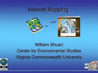
Institutional Controls Registry Internet Mapping Application. An Introduction Monday, October 1, 2001. What is the ICR Web Application?. An internet mapping service that utilizes internet technology, good design, and static data from the ICR database in an informational web site

E N D
Institutional Controls RegistryInternet Mapping Application An Introduction Monday, October 1, 2001
What is the ICR Web Application? • An internet mapping service that utilizes internet technology, good design, and static data from the ICR database in an informational web site • Web Access to sites listed in ICR database • The public’s and local government’s mechanism for monitoring the status of these controls and the department’s plans for protection of people and the environment in relation to these sites
What does static data mean? • The website is not interactive, meaning that you cannot update or add records to the registry through the website • The sites being displayed are not automatically updated when the ICR database is changed • Updates are manual but frequent
Sites located in designated brownfield areas Petroleum cleanup program sites Drycleaning solvent cleanup program sites Superfund sites RCRA or HSWA sites Non-program sites (state enforcements, voluntary cleanups, etc.) What types of sites are included?
How can you benefit from web access? • You can obtain quick access to sites listed in the registry, lookup the types of controls used, the contamination found, and the medium affected • Environmental project managers may find it useful to compare the location of new program sites to those with institutional controls on them • FDEP can now provide the most current and accurate data possible to local governments and the public
What do you need to get started? • Netscape Navigator or Internet Explorer 4.0 or higher • A browser set to allow JAVA Virtual Machine so that your browser will create all JAVA applets automatically by using its internal Virtual Machine compiler • FDEP Division of Waste Management (DWM) home page: http://www.dep.state.fl.us/waste/ Start Browser
How do you access the site? • FDEP Division of Waste Management (DWM) home page: http://www.dep.state.fl.us/waste/ • Follow the hyperlink to “Institutional Controls Registry & Procedures Guidance” on the leftmost sidebar • Review and accept disclaimer, which indicates the level of legal liability or responsibility of the department for the accuracy, completeness, or usefulness of the information in the registry
DISCLAIMER The following contains the Florida Department of Environmental Protection (FDEP)Institutional Controls Registry prepared by the FDEP for the FDEP and its Districts to assist with tracking those properties upon which an institutional control has been imposed pursuant to the provisions contained in Chapters 376 or 403, F.S. Additionally, for brownfield sites the Registry has been prepared for the public and local governments to monitor the status of those controls. The information in this Registry summarizes certain information regarding these properties and controls and is, therefore, an incomplete analysis of the conditions on these properties. This Registry is periodically updated without notice. Additionally, due to data entry limitations, potential unauthorized access to the data or transmission errors, this Registry may contain errors and should not be exclusively relied upon. The Department recommends that you contact the appropriate FDEP office for more complete information regarding a property and the institutional control(s) that may be in place. Neither the State of Florida, nor the FDEP, makes any warranty, expressed or implied, including the warranties of merchantability and fitness for a particular purpose arising out of the use or inability to use the data, or assumes any legal liability or responsibility for the accuracy, completeness, or usefulness of any information, apparatus, product, or process disclosed, or represents that its use would not infringe privately owned rights. Use of information contained on the FDEP web pages constitutes understanding and acceptance of our disclaimer.
What to expect on the initial screen? • You will see a full extent view of the state with each site listed within the registry represented by black dots • The screen is broken up into frames — the tools and documentation on the left, the “Quick Start” summary of what those tools do on the right, the GIS map itself, and the bottom frame (which contains the records of the selected sites) • The lat/long decimal coordinate system in the browser’s status bar lets you know the location of your mouse within map
How do you use the IMS Tools? • Basic Mapping Tools • Zoom In • Zoom Out
How to select a tool? • By default, the Zoom In tool is selected first • You can identify the current tool by the yellow box around the tool icon and the text in the bottom left-hand corner of your screen • Be sure to select the icon, not the text • And you must select a tool to activate it before you can use it
How to use the Zoom Tools? • The Zoom In and Zoom Out tools function the same • You can click to focus in or out of a particular area,…or you can draw a box (called marquee selecting) around the area to see more or less accordingly • The higher the level of zoom, the more details you will see surrounding the site • In the ICR web application, detailed layers (like local roads) are automatically activated and labeled, depending upon the extent of your zoom
How to view the layer names? • Once you’ve reached a satisfactory level of zoom, you can turn on the legend by clicking the Display Legend tool on the toolbar • The legend appears in a window that can be repositioned on the screen, just like any other window, by dragging its title bar • The HIDE LEGEND button or window’s close button will close the legend window
How do you use the IMS Tools? • Basic Mapping Tools • Zoom In • Zoom Out • Full Extent • Pan
How to use the Pan and Full Extent tools? • Once you’ve reached a satisfactory level of zoom or you want to return to the larger picture, the Full Extent tool will return you to the full view of the state (see next slide) • The Toggle Locator tool will allow you to see which area you are zoomed into in relation to the state map • The Pan tool allows you to literally drag the map across the screen so that you can center or rearrange the portion of the map you wish to see while maintaining the same level of zoom
How do you use the IMS Tools? • Basic Mapping Tools • Zoom In • Zoom Out • Full Extent • Pan • Search Tools • Search by County
How to find a site in the registry? • The approach more likely to be taken when seeking sites within the registry is the Search method • There are three methods for searching: search by county, zip code, or section township and range • Each search method is represented by a tool on the toolbar • Each search tool basically works the same
How to search by county? • The Find by County tool allows you to choose a county from the drop-down list on the right • You can also type the first letter of the county to scroll to the selection • Press the FIND IT button to select the registry sites within that county • The sites will appear in the bottom frame with hyperlinks that provide more details about the controls in place
What do the hyperlinks mean? • Note the record number and site name hyperlinks at the bottom of the screen • The hyperlink from the number of the record in the Rec column specifies the chosen site and marks it with a RED star to identify the site chosen within the selected sites (see the next slide) • The hyperlink from the site name provides related details about the controls on the site
How do you use the IMS Tools? • Basic Mapping Tools • Zoom In • Zoom Out • Full Extent • Pan • Search Tools • Search by County • Search by ZipCode
How to search by zip code? • Enter the five-digit zip code and press the FIND IT button • All sites within the registry that fall within that zip code will be selected and listed in the bottom frame • Those records that do not contain zip codes are automatically queried based on their lat/long values to verify all records are displayed within the chosen zip code
How do you use the IMS Tools? • Basic Mapping Tools • Zoom In • Zoom Out • Full Extent • Pan • Search Tools • Search by County • Search by Zip Code • Search by Section Township & Range
How to search by STR? • The Find by STR (Section Township & Range) tool will be used predominantly by county appraiser’s offices or a person preparing to purchase a plot of land • You can enter the Township and Range without the Section when using this tool to search, then press the FIND IT button • The records found will be displayed in the bottom frame
How to add new sites to the registry? • Review online Procedures Guidance documentation • Send site information and hard copy of final institutional controls to Division Director’s Office Gayle Lamkin Division of Waste Management Director’s Office 2600 Blairstone Road, Mail Station 4500 Tallahassee, FL 32399-2400 Email: Gayle.Lamkin@dep.state.fl.us Phone: (850) 922-5503 Procedures Guidance
What site information is needed? • Site Name • Address • Facility ID# • Type of Contamination (e.g. petroleum, etc.) • Contaminated medium or media (e.g. soil, groundwater, etc.) • Type of institutional control • Type of engineering control, if any • General Location of the remaining contamination • Restrictions contained in the control (e.g. no potable wells; caps; etc.) • Project Manager’s Name
What are the future goals for ICR? • Include ICR data in nightly refresh process for real-time or day-old data • Add online HELP features • Increase flexibility in navigation and simplicity • Make IMS technology compatible with all internet browsers • Display ICR sites as polygons in the Spatial Data Engine (SDE)
Who to contact with questions? • For additional site information, contact the applicable District Office or Program Area contact person in Tallahassee • Click the Contacts tool on the website’s toolbar or follow the hyperlink below to view the contacts document Contact Information in Adobe Acrobat