Download
1 / 20
200 likes | 309 Vues
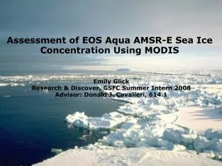
AMSR-E Sea Ice Products. Thorsten Markus NASA Goddard Space Flight Center Greenbelt, MD Thorsten.Markus@nasa.gov. Footprint size 58 km 37 km 21 km 11 km 5 km. Footprint size 58 km 37 km 21 km 11 km 5 km. AMSR Bootstrap/ Ice temperature. Footprint size 58 km 37 km 21 km

E N D
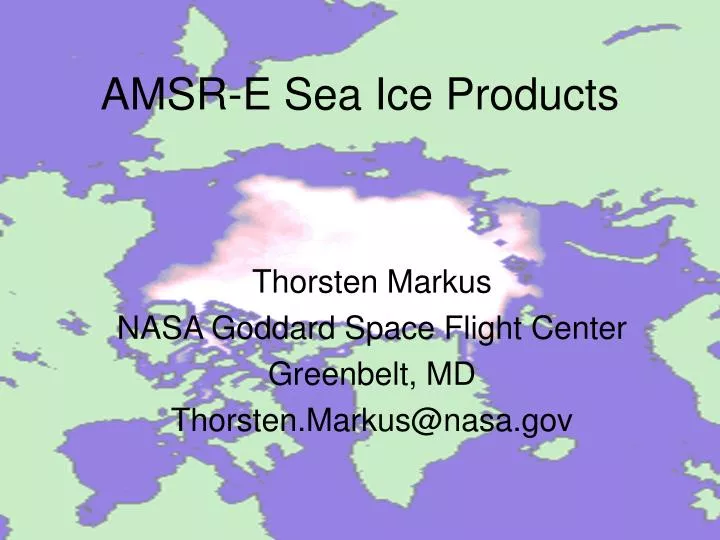
AMSR-E Sea Ice Products Thorsten Markus NASA Goddard Space Flight Center Greenbelt, MD Thorsten.Markus@nasa.gov
Footprint size 58 km 37 km 21 km 11 km 5 km
Footprint size 58 km 37 km 21 km 11 km 5 km AMSR Bootstrap/ Ice temperature
Footprint size 58 km 37 km 21 km 11 km 5 km AMSR Bootstrap/ Ice temperature Bootstrap
Footprint size 58 km 37 km 21 km 11 km 5 km AMSR Bootstrap/ Ice temperature Bootstrap NASA Team 2/ Snow depth
Ice temperature • Approach: Part of the AMSR Bootstrap (ABA) ice concentration algorithm • Input data: TB(6.9V), ABA ice concentration • Notes: • Temperature of (or close to) • snow-ice interface • 25 km grid product
Snow depth on sea ice • Approach: Similar to snow on land; difference in snow scattering between • 19 and 37 GHz • Input data: TB(19V), TB(37V), NT2 ice concentration • Notes: • 12.5 km grid product • 5-day averages; temporal • information is used to flag • wet snow • no snow depth retrievals • over multi-year ice • maximum retrievable • snow depth about 50 cm • (penetration depth @37GHz)
Ice concentration algorithms Algorithms: NASA Team 2: 19V, 19H, 22V, 37V, 89V, 89H Bootstrap: 19V, 37V, 37H AMSR Bootstrap: 6V, 19V, 37V Products: Sea ice concentration and difference between algorithms in 12.5 km and 25 km grids; Daily maps, and maps of ascending and descending orbits separately Arctic: 25 km 12.5 km NT2 NT2 NT2 + Diff = AMSR Bootstrap NT2 + Diff = Bootstrap Antarctic: 25 km 12.5km AMSR Bootstrap (ABA) Bootstrap ABA + Diff = NT2 Bootstrap + Diff = NT2
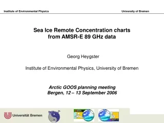
AMSR sea ice validation campaign March 2003 (D. Cavalieri, T. Markus, J. Maslanik, M. Sturm, J. Stroeve, J. Heinrichs, A. Gasiewski) Validation of mainly snow depth and ice temperature Validation of mainly ice concentration
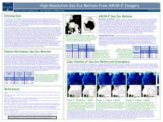
Coincident satellite and aircraft data during AMSR-03 AVHRR PSR 18V Landsat 7 AMSR grid cell
Validation off Aurora Australis Sep./Oct. 2003 • Main objectives: • Validation of AMSR(-E) sea ice products, • Particularly snow depth on sea ice (PI: Rob Massom) • b) Testing snow depth radar concept using a • sled-mounted system (PI: P. Gogineni)
Antarctic aircraft sea ice validation campaign October 2004 PI: J. Comiso
Outlook Continue to analyze validation data sets - sea ice concentration (airborne microwave measurements and data from other satellites) - snow depth (in-situ data) Arctic-wide measurements? Airborne snow radar (2006) - ice temperature (in-situ data) Perform radiative transfer modeling to better understand observed microwave signatures Adjust/modify/enhance algorithms
Questions?? Are the products, their quality, their accessibility, their format satisfactory? Are there any problems/errors with algorithms/products? Is there anything else that should be archived (additional information, additional parameters)?