Download
1 / 31
310 likes | 542 Vues
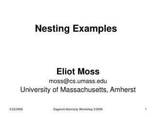
Nesting. Eta Model. ground. Ptop. = 0. Eta Coordinate And Step Mountains. = 1. MSL. Horizontal resolution of 12 km. 12-km terrain. Drawbacks of the Eta Coordinate. The failure to generate downslope wind storms in regions of complex terrain

E N D
ground Ptop = 0 Eta Coordinate And Step Mountains = 1 MSL
Horizontal resolution of 12 km 12-km terrain
Drawbacks of the Eta Coordinate • The failure to generate downslope wind storms in regions of complex terrain • Weak boundary layer winds over elevated terrain when compared to observations • The displacement of precipitation maxima too far toward the bottom of steeply sloping terrain as opposed to the observed location near the top half of the terrain slope • The reduction in the number of vertical layers used to define the model atmosphere above elevated topography particularly within the boundary layer
WRF Model Family A Tale of Two Dynamical Cores
Why WRF? • An attempt to create a national mesoscale prediction system to be used by both operational and research communities. • A new, state-of-the-art model that has good conservation characteristics (e.g., conservation of mass) and good numerics (so not too much numerical diffusion) • A model that could parallelize well on many processors and easy to modify. • Plug-compatible physics to foster improvements in model physics. • Designed for grid spacings of 1-10 km
Two WRF Cores • ARW (Advanced Research WRF) • developed at NCAR • Non-hydrostatic Numerical Model (NMM) Core developed at NCEP • Both work under the WRF IO Infrastructure NMM ARW
The NCAR ARW Core Model: (See: www.wrf-model.org) • Terrain following vertical coordinate • two-way nesting, any ratio • Conserves mass, entropy and scalars using up to 6th order spatial differencing equ for fluxes. Very good numerics, less implicit smoothing in numerics. • NCAR physics package (converted from MM5 and Eta), NOAH unified land-surface model, NCEP physics adapted too
The NCEP Nonhydrostatic Mesoscale Model: NMM (Janjic et al. 2001) • Hybrid sigmapressure vertical coord. • 3:1 nesting ratio • Conserves kinetic energy, enstrophy and momentum using 2nd order differencing equation • Modified Eta physics, Noah unified land-surface model, NCAR physics adapted too • Parallelized within WRF infrastructure
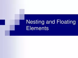
ground ground Hybrid and Eta Coordinates Ptop Ptop = 0 Pressure domain = 0 Sigma domain = 1 MSL = 1
WRF Software Infrastructure Dynamic Cores Mass Core NMM Core … Static Initialization Post Processors, Verification Obs Data, Analyses 3DVAR Data Assimilation Standard Physics Interface Physics Packages WRF Modeling System
Top-level “Driver” layer Isolates computer architecture concerns Manages execution over multiple nested domains Provides top level control over parallelism patch-decomposition inter-processor communication shared-memory parallelism Controls Input/Output “Mediation” Layer Specific calls to parallel mechanisms Low-Level “Model” layer Performs actual model computations Tile-callable Scientists insulated from parallelism General, fully reusable Mediation Layer uv prep filter scalars physics big_step recouple decouple advance w advance Model Layer WRF Hierarchical Software Architecture Driver Layer wrf initial_ config alloc _and_configure init _domain integrate solve_interface solve
The National Weather Service dropped Eta in 2006 as the NAM (North American Mesoscale) run and replaced it with WRF NMM. • The Air Force uses WRF ARW. • Most universities use WRF ARW
WRF-NMM • Same domain as Eta • Sixty levels like Eta • Essentially same physics as ETA • Much better in terrain…doesn’t share the eta’s problems. • Clearly inferior synoptic initialization and synoptic forecast than GFS
NMM WRF NAM NMM upgrades December 2008, include • GDAS (GFS analysis) as initial first guess. use of global analysis (GDAS) for first guess at t-12 hour (the start of the analysis cycle) improves the evolution of synoptic scale features in the new NAM-WRF. This is found consistently throughout the 84-hour forecast. • Improved physics higher resolution snow analysis and changes to snow impact on surface energy budget, increased absorptivity of model clouds
NMM • Generally inferior to GFS
RUC • A major issue is how to assimilate and use the rapidly increasing array of offtime or continuous observations (not a 00 and 12 UTC world anymore! • Want very good analyses and very good short-term forecasts (1-3-6 hr) • The RUC ingests and assimilates data hourly, and then makes short-term forecasts • Uses the MAPS mesoscale model…which uses a hybrid sigma/isentropic vertical coordinate • Resolution: 13 km and 50 levels
13km RUC Terrain elevation - 100 m interval • Improvements expected from 13km RUC • Improved near-surface forecasts • Improved precipitation forecasts • Better cloud/icing depiction • Improved frontal/turbulence forecasts NCEP computer upgrade allows RUC13 to run in same time as current RUC20
Observations used in RUC Data Type ~Number Freq. -------------------------------------------------- Rawinsonde 80 /12h NOAA profilers 30 / 1h VAD winds 110-130 / 1h Aircraft (V,temp) 1400-4500 / 1h Surface/METAR 1500-1700 / 1h Buoy/ship 100-150 / 1h GOES precip water 1500-3000 / 1h GOES cloud winds 1000-2500 / 1h GOES cloud-top pres 10 km res / 1h SSM/I precip water 1000-4000 / 6h -------------------------------------------------- GPS precip water ~300 / 1h Mesonet ~5000 / 1h METAR-cloud-vis-wx ~1500 / 1h -------------------------------------------------- Cloud analysis variables NCEP RUC20 operational RUC13 (at NCEP June 2005)
RUC History – NCEP (NMC) implementations • - First operational implementation of RUC • - 60km resolution, 3-h cycle • 1998 – 40km resolution, 1-h cycle, • - cloud physics, land-sfc model • 2002 – 20km resolution • - addition of GOES cloud data in assimilation • 2003 – Change to 3dVAR analysis from previous OI • (April) • 2004 – Vertical advection, land use (April) • PBL-depth for surface assimilation (September) • 2005 – 13km resolution, new obs, new model physics • (June) • 2007 – WRF-based Rapid Refresh w/ GSI to replace RUC
20km RUC 13km RUC Soil moisture – 22z - 21 Feb 2005 Dark blue = water More detailed coastline with 13km resolution
WRF RUC • A new version of RUC has been developed, but not yet operational that uses the WRF model instead of the MAPS model.