Download

1 / 19
190 likes | 311 Vues
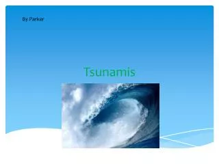
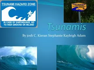
Progressive K-12 Science Instruction on Tsunamis in Alaska Developed by the Geophysical Institute through a grant from the U.S. Department of Education. Tsunamis in Alaska. Alaska has experienced 37 tsunamis since the 1800s.

E N D
Progressive K-12 Science Instruction on Tsunamis in Alaska Developed by the Geophysical Institute through a grant from the U.S. Department of Education
Tsunamis in Alaska • Alaska has experienced 37 tsunamis since the 1800s. • In the past century, 5 generated off Alaska’s coast were large enough to destroy lives and structures on shore. Three of these are known around the world for the amountof damage caused: • 1964 Alaskan Tsunami • 1958 Lituya Bay Tsunami • 1946 Aleutian Tsunami
Education and Tradition • Education and tradition have been interwoven in the Alaska Tsunami Education Program to create a powerful teaching tool that impacts entire communities. • Public K-12 education and Native ways of knowing about tsunami physics saved lives during the 2004 Indian Ocean tsunami.
Alaska Tsunami Education • Funded by US Department of Education • Incorporates community involvement and Native ways of knowing • Provides three-years of K-12 Science, Math, and GIT (geospatial information technology) instruction on tsunamis
Schools involved in ATEP Kodiak Island,Lake and Peninsula, Aleutians East and Aleutian Region
What does ATEP fund? In the Classroom • Lesson Supplies • Science and Math Curriculum • GIT Community-based Activities Professional Development • Professional Development Workshops • Professional Development Credits • Scientist and Borough Official Mentorship
Curriculum Resources Hands-on Classroom Lessons • 30 K-12 science and math lessons per year, plus • At least 10 additional science and math lessons that include Native language terms, and cultural ways of knowing ATEP Web site • Lessons available for download in PDF files Interactive Multimedia Module Mentor Lectures
Standard-based Lessons ATEP K-12 teacher-friendly hands-on classroom lessons contain: • easy-to-photo copy activity instructions • student worksheets • answer guides • background science information and specific reference to • Alaska Science GLEs • Alaska Math GLEs • Alaska Standards for Culturally Responsive Schools
GIT Community Mapping Projects Borough officials and GIT Experts provide maps of rural areas in Lake and Peninsula, Kodiak Island, Aleutian Regionand Aleutians East. K-12 students work with Elders to map local communities. Students work together to: • Identify existing structures and add new structures • Circle structures to show which no longer exist • Determine structure use (residential, commercial, public, government) • Interview Elders to find places of traditional and/or cultural importance • Interview Elders to identify established historic trails still in use
GIT Mapping Exercises • Mapping projects bring scientists and government officials together with teachers and students to build an enduring network that connects the government, the school, and the local community. • Working together with scientists and government officials on projects of interest to local communities helps students practice workforce-related technology skills in the classroom and gain career focus through mentoring. Alaska Earthquake Information Center Scientist Elena SuleimaniStudents working on a 3-D mapping experiment
Interactive multimedia components help students visualize difficult scientific concepts.
Cultural Ties Native Organizations and Elders provide: • Unangan and Alutiiq words related to tsunamis • Traditional stories about tsunamis • Native Waysof Knowing about tsunamis • Local expertise for student mapping projects Elders who participated in ATEP are provided with honorariums to show appreciation for their contributions.
Professional Expertise Alaskan scientists and government officials contribute to ATEP by providing expertise and data.
Mentorship Scientists, and government officials provide mentorship for teachers at workshops, via email and through the ATEP Web site. Local officials may be able to visit classrooms and participate in community events. State seismologist Roger Hansen and AEIC Scientist Elena Suleimani
Professional Development Credits Teachers earn up to 3 PD credits each year for: • participating in ATEP professional development workshops • teaching ATEP lessons in local K-12 classrooms • providing feedback on ATEP classroom lessons
Curriculum Distribution At grant end, curriculum will be distributed by: • Geophysical Institute • West Coast and Alaska Tsunami Warning Center • AK Dept. of Homeland Security and Emergency Management • National Tsunami Hazard Mitigation Program • International Tsunami Information Center
Contact Us Geophysical Institute Information Office PO Box 757320, Fairbanks, AK 99775 907-474-7558 Kathy Bertram, Principal Investigator 907-474-7798 kbertram@gi.alaska.edu Glenda Findlay, Program Manager 907-474-2722 glenda.findlay@gi.alaska.edu