Download

1 / 13
200 likes | 582 Vues
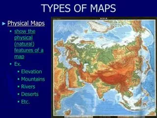
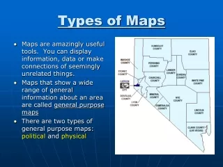
Types of Maps. Maps that show a wide range of general information about an area . General Purpose Maps. Physical Maps Demonstrate the landforms and water features Elevation Use: color, patterns , relief. General Purpose Maps could be:. Shows elevation with contour lines. Contour Maps .

E N D
Maps that show a wide range of general information about an area General Purpose Maps
Physical Maps Demonstrate the landforms and water features Elevation Use: color, patterns, relief General Purpose Maps could be:
Shows elevation with contour lines Contour Maps
Political Maps Show the names and boundaries of countries, the location of cities and other human-made features of an area, divisions of states and territories General Purpose Maps could be:
General Purpose maps • Political maps use: • Color • Symbols of different size and shape • Different styles and sizes of lettering • Bold faced • Italics
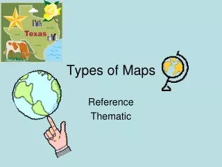
Demonstrate specific kinds of information on certain themes or topics Special Purpose Maps
Special Purpose Maps could be: • A climate map
Special Purpose Maps could be: • A historical map
Special Purpose Maps could be: • A population density map
Road Maps Special Purpose Maps could be:
Special Purpose Maps could be: • Rainfall • Land Use • Resource/product • Growing season • Elevation • Population • Shown by: color, symbols, and patterns
Special Purpose Maps could be: • In the form of a flow chart • Cartograms- the size of the country referes to the information about it • Cartograms are useful for studying and comparing information