Download
1 / 35
350 likes | 494 Vues
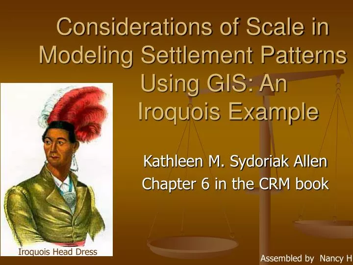
Considerations of Scale in Modeling Settlement Patterns Using GIS: An Iroquois Example. Kathleen M. Sydoriak Allen Chapter 6 in the CRM book. Iroquois Head Dress. Assembled by Nancy H. Spatial Scale History (literature).

E N D
Considerations of Scale in Modeling Settlement Patterns Using GIS: An Iroquois Example Kathleen M. Sydoriak Allen Chapter 6 in the CRM book Iroquois Head Dress Assembled by Nancy H
Spatial Scale History (literature) • Archaeologists have known that scale needs to be considered when settlement patterns are modeled • Clarke (1977) – introduced terms such as “micro”, “semi-micro” and “macro” – to refer to within-site and intersite levels • Butzer (1982) – included the term “mesoscale” used for within-site structure aggregation areas and “macroscale” for intersite patterning that is related to environmental features • Both emphasized patterning at the local level despite the difference in terminology used
Definitions (this chapter) • Global - Broad regional level that could include 10,000 km2 plus - Most useful for studying the broad effects of environmental variables on settlement and adaptive patterns - Relationships between the environment and settlement location - Specific locations may be less important –
Definitions • Regional – Areas that are larger than the site level – 5,500 km2 - Focus on more specific variables of importance – smaller focus produces more detailed results for comparative data – soil types, temperature regimes, vegetation, & proximity to different ethnic groups - Often specific locations are less important
Definitions • Local - Studies of approximately 100 km2 • Specific resources identified and assessed for their importance based on their proximity to the location choice • – consider clay deposits, close wetlands, & routes between the site and its resources. • Lower tolerance for errors
Spatial Scale Issues • REMEMBER Map scale is the relationship between a a map distance and its distance on Earth’s surface. • Digital products from the USGS provide maps at scales of 1:24,000, 1:100,000 and 1:250,000. (examples follow next) • Concerns of data quality, resolution of the data layers and the size of the GIS is important • Accuracy of the mapped area required varies depending on the research questions at the spatial level of interest • Spatial scale issues through Iroquois example – show the effect of spatial scale and data resolution on settlement analyses
Other Related Considerations • Map Scale: from small scale (1:250,000) to large scale (1:24,000). • Resolution: the accuracy or level of uncertainty in point location or distance measurement data • Cell Size: Should be as small as the smallest unit area in which one is interested
Iroquoian Example • Global – those who share the basic Iroquoian cultural pattern – number of different tribal groups in the eastern Great Lakes region • Regional – subareas that correspond to tribal groups – Tribal settlements • Local or Subregional – particular drainages or clusters of settlements in close proximity to each other
Iroquois Nations • Seneca • Cayuga • Onondaga • Oneida • Mohawk • Tuscarora
Iroquoian Example • Many different studies have been conducted in the Iroquoian area that have helped in the understanding of the location of settlements in relationship to environmental features (listed in slide after next) • Many different researchers and research interests – soils, defensibility, external forces • Understanding similarities and differences in addressing evolution of tribal forms of organization-global view tends to obscure differences in order to understand overall settlement patterning and subsistence
GIS, Spatial Scale and Archaeology • John Knoerl – (global scale of Iroquois settlement location) identified 3 kinds of scale: spatial, temporal and phenomenological - Archaeological units start at the lowest level with behavior and are combined into larger units – random/non random patterns - Archaeological scale (included in phenomenological)- the combination of space, time, and the behavioral grouping that is correlated to the archaeological unit of interest - Important to understand the methods that archaeologists use for analysis and know what scales the archaeologist is using – look at the same level - Knoerl’s work important – encourages identification of local as well as global and regional patterns in settlement location – important for all archy studies to look at holistic applications
Scale applied to cultural patterns • Global- groups that share cultural patterns (New York State and Southern Ontario) • Regional- subareas that correspond to tribal groups (Hudson Settlements in the Lake Simcoe Region) • Local- particular drainage or cluster of settlements
Prior studies • Focused on regional and local scales • Identified some regions of population concentrations • Identified how groups differ Soil depletion villages moved every 15-20 years pattern of village sequences
Seneca Village • Agricultural soils • Defensibility • Proximity to other resources • Where the previous village was located • Relationships with other groups
John Knoerl “Archaeological scale is the combination of space, time, and behavior grouping that is correlated to the archaeological unit of interest.” 5 km grid cell GIS Trend surface analysis identify regional, subregional, and local trends Maize suitability map 38% overlap with archaeological sites
0.5 km^2 cell size • Focused on the movement of sites in relation to external forces • Examined three regions (Lake Plain, Central River Valley, and Allegheny Plateau) • Compared archaeological data to wetlands, canoe-navigable waterways, diversity and soil • Movement is caused by resource depletion
Eleanzer Hunt • Western Region of New York State • Regional and local approach • Same scale as Hasenstab (0.5km) • Regional: frost-free days, precipitation, soil • Local: focus on soil • Sites were located in horticulturally productive but before horticulture was in use. • Didn’t look at other factors
Bond • Old school • 1:20,000 soils map • All sites in productive soils and defensive positions • Not the best soils • Access to hunting and fishing
Classic Mixed Cropping: Three Sisters -- an example of mixed (inter) cropping of maize, beans, and curcurbits (squash and pumpkins). These 3 plants, domesticated at different times, were together a major component of Native Amer. agriculture, historically documented by the Seneca and Iroquois, starting sometime after 1000 AD. All 3 seeds are planted in the same hole. The maize provides a stalk for the beans to climb, beans are nutrient-rich to offset that taken out by the maize, and the squash grows low to the ground to keep weeds down and water from evaporating from the soil in the heat.(about.com, reworded some)
Lake Cayuga • 5 watersheds (included Seneca River, Paines Creek, Salmon Creek, Great Gully, and other smaller creeks) • Low forest productivity • Frost-free days just above the limit (120 days) • Poor soil • Concern for defense was important to some villages
Reviewing Study Scales • Local level: support Hasenstab’s hypothesis • Global: global level population influences • Regional: Not just agriculture but defense is a factor in population movement
Spatial Scale Themes:(Clarke) • “Micro” refers to studies at a structure • “Semi-micro” refers to studies within a site • “Macro” refers to studies on the intersite level
Butzer: • Uses Micro and Semi-micro in a similar way to Clarke • “Mesoscale” refers to within-site structure aggregation areas • “Macroscale” is used for intersite patterning related to environmental features in or around a central point for administrative, economic, or ceremonial practice.
Knoerl’s Scale Types • Spatial Scale • Temporal Scale • Phenomenological Scale (includes populational, behavioral and archaeological scale) • * Patterns that appear random at one level may have meaning at another.
Allen’s Terms • Local analysis looks at particular resources available in the IMMEDIATE area (within 100 sq. km) such as clay deposits, that may contribute to site selection. • Regional (macroscale) studies include areas larger than site level (5,500 sq. km) involving intersite analysis. • Global analysis looks at areas of 10,000+ sq. km encompassing a broader regional area.
Applications • The question at hand will determine the map scale, resolution and cell size, as well as the spatial scale (local, regional or global) we use. • In this case researchers are interested in knowing why the Iroquois chose certain locations to establish villages. • They examined the issue from local, regional and global perspectives.
Questions that arise: • What factors other than soil quality were important to the tribes in choosing a location for settlement? • What are the differences between tribal areas? • Are certain resources more available in one area than in another? • How does the availability of resources affect interaction between groups?
Considerations for Settlement: • Soil suitable for horticulture, particularly maize, beans and squash. • Access to fishing and hunting defensive positioning • Precipitation and snowfall • Number of frost free days • Previous location - ease of transition.
Conclusion: re Scale • Large scale data provide great flexibility and accuracy regarding specific environmental characteristics critical to decision making • Small scale data helps us to look at environmental factors of broad importance and helps us understand what is possible in a given environmental framework