Download
1 / 71
730 likes | 1.32k Vues
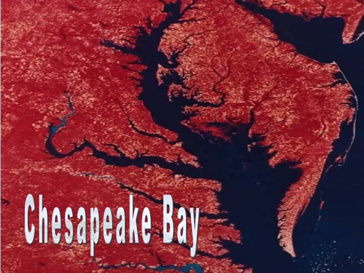
Chesapeake Bay. CHESAPEAKE BAY. Formed by the drowning of the Susquehanna River when sea levels rose after the last ice age. Its fresh water comes from the slopes of the Appalachian Mountains. 200 miles long and 30 miles wide. It has a surface area of 11,500 km 2.

E N D
CHESAPEAKE BAY Formed by the drowning of the Susquehanna River when sea levels rose after the last ice age Its fresh water comes from the slopes of the Appalachian Mountains 200 miles long and 30 miles wide It has a surface area of 11,500 km2 But an average depth of only 6.5m It has over 11, 600 miles of shoreline (more than the US west coast) Approximately 15 million people live near the estuary Over 5000 factories discharge waste into the estuary
CHESAPEAKE BAY The Bay is a SLIGHTLY STRATIFIED estuary i.e. salinity increases the deeper you go.
CHESAPEAKE BAY Due to the coriolis effect –seawater entering the bay tends to hug the east coast of the bay Freshwater tend to hug the western side of the bay The water in the estuary has a high RESIDENCY TIME i.e. it takes 1.16 years for the water to be flushed out of the estuary Maximum river flow occurs in the spring During this period a strong there is a layer of low density freshwater, above saline seawater
CHESAPEAKE BAY Differences in densities in the freshwater and saltwater bodies prevents (fresh) surface water and deeper (salt) water from mixing There is therefore a lack of access to oxygen for the deeper water layer. Decomposition of organic matter by bacteria in this deeper water layer leads to ANOXIA (oxygen deficiency) from May - August High levels of nutrients (from domestic, agricultural and industrial waste) entering the bay nutrients in the bay lead to algal blooms Dying algae → increase in decomposition → increase in anoxia
Anoxic Hypooxic (low oxygen)
Nutrient Pollution Historically the Bay was surrounded primarily by forest and wetlands - very little nitrogen and phosphorus ran off the land into the water. Most of it was absorbed or held in place by the natural vegetation. Loss of forests and wetlands to development and agriculture has increased the amount of nutrient pollution. In addition to increasing anoxia, algal blloms resulting from nutrient pollution reduce the amount of sunlight available to Submerged Aquatic Vegetation (SAV). Death and decomposition of this SAV increases anoxia further.
Sources of nutrients for the Chesapeake Bay include natural sources (phosphate-containing rock erosion) as well as: sewage treatment plants, industries, vehicle exhaust, acid rain, and runoff from agricultural, residential and urban areas. Virtually all individuals and industries in the watershed, and some even beyond the watershed, contribute the nutrients that ultimately reach the Bay. Point Source pollution – e.g. wastewater treatment plants, industrial discharges Nonpoint Source pollution - croplands, feedlots, lawns, parking lots, streets, forests, air pollution, leaching from septic tanks.
Recent research has shown that nutrients from septic systems are increasing throughout the watershed - development spreading into the countryside, beyond the reach of sewer systems. Stormwater runoff from urban and suburban areas is increasing as more land is developed. Urban and suburban lands currently contribute, per acre, the largest amount of nutrients to the Bay. Nitrogen from wastewater treatment plans is declining in rivers where biological nutrient removal (BNR) technology is being used. But it’s increasing in other rivers. Phosphorus from sewage treatment plans has declined sharply - results of a phosphate detergent ban. Runoff from farms is generally declining - nutrient management and runoff control techniques. Plus - the amount of farmland is declining.
The Chesapeake Watershed A watershed is an area of land that that drains (via streams etc) into a larger body of water. 1000s of creeks, streams and rivers in Pennsylvania ultimately drain into the Susquehanna River ( = the Susquehanna River watershed) . About 64,000 square miles of land drained by hundreds of thousands of rivers, creeks and streams comprises the Chesapeake Bay watershed. The watershed includes parts of six states: New York, Pennsylvania, Delaware, Maryland, Virginia and West Virginia and also includes all of the District of Columbia. More than 15 million people live in the Bay watershed, and it's estimated that the population could grow to 18 million people by 2020.
Sediment Pollution Runoff from the land adds sediment to the estuary. Soil erosion caused by wave/current action along shorelines also contributes to sediment in the Bay. Sediment can smother benthic (bottom-dwelling) plants and animals e.g. oysters & clams. Suspended sediment increases turbidity, preventing light from penetrating to the leaves and stems of submerged aquatic vegetation (SAV). High concentrations of toxic materials or nutrients also may be present in sediment, which further contaminate waterways. Accumulations of sediment can clog waterways and ports, making traffic difficult or hazardous, and requiring dredging.
Sediment Pollution In 2000, the ‘Chesapeake Agreement’ the committed local authorities to correcting sediment-related problems in the Bay. This includes trying to prevent the loss of the sediment ‘trapping’ capabilities of the lower Susquehanna River dams. Currently, these dams trap about 50 % - 70% percent of the sediment that flows downriver and prevents it from entering the Bay. Agriculture operations can also help reduce sediment by: • Implementing soil conservation plans e.g. planting cover crops after harvesting and no-till farming; • Constructing stream bank fencing; • Planting vegetated buffers areas at the edge of crop fields; and • Strip cropping - alternates different crops in rows throughout the same field.
Sediment Pollution In urban areas, stormwater runoff adds to the sediment problem in waterways. Urban communities can control the amount of runoff by: • Reducing impervious surfaces (e.g. roads and parking areas); • Creating “rain gardens”, which are designed to capture and filter runoff from impervious sites; • Planting streamside buffers zones, which allow plants to filter water and trap sediments; • Creating and implementing storm water management plans – identifying and protecting protect natural areas that control runoff (and possibly restore such areas).
Air Pollution Air pollution also contributes topollution of the bay Since the passing of the Clean Air Act and the Clean Water Act in the early 1970's, air pollution and water pollution were largely considered two separate problems. BUT pollutants released into the air will eventually make their way back down to the earth's surface by: • wet deposition (e,g in rain) or • dry deposition (e.g. particles) and can enter the bay via, streams, runoff or through groundwater flow.
Air Pollution Computer models estimate that the primary nitrogen oxide (NOx) emissions “AIRSHED” for the Bay is approximately 418,000 square miles • this is 61/2 times larger than the Chesapeake Bay watershed. Airborne nitrogen deposits into the Bay and its watershed come from local emission sources, as well as from sources in places far away, such as Kentucky, Indiana, and Canada. A QUARTER of the total nitrogen load to the Bay comes from atmospheric deposition 75% of that load is deposited on land (and later transported to the Bay by surface water runoff and groundwater flow). The remaining 25 percent is deposited directly on the Bay.
Sources of Air Pollution Stationary and Area Sources • A stationary source of air pollution refers to an emission source that does not move (i.e., power plants, chemical and manufacturing industries). • Often stationary sources are defined as large emitters who release relatively consistent qualities and quantities of pollutants. • The term AREA SOURCE is used to describe the many smaller stationary sources located together whose individual emissions may be low but whose collective emissions can be significant. • Typically area sources are those that emit < 25 tons per year of any combination of hazardous air pollutants, or < 10 tons per year of any single hazardous air pollutant.
Sources of Air Pollution Mobile Sources • A mobile source of air pollution refers to a source that is capable of moving under its own power. E.g. cars & trucks etc. • Also there is also a non-road or off-road category that includes gas-powered lawn tools and mowers, farm and construction equipment, recreational vehicles, boats, planes, and trains.
Sources of Air Pollution Agricultural Sources • Livestock produce large amounts of manure which emits various gases esp. ammonia. • This ammonia can be emitted from the animal barns, manure storage areas, or from the land after the manure is applied. • Also, fertilizers, herbicides, and pesticides etc can be transported aerially.
Sources of Air Pollution Natural Sources • Natural sources include: • erupting volcanoes emits particulate matter and gases; • forest and prairie fires can emit large quantities of pollutants; • plants and trees emit hydrocarbons; and • dust storms can create large amounts of particulate matter. • Wild animals in their natural habitat are also considered natural sources of pollution – decomposition gases, waste and flatulence.
Impacts of Air Pollution Acid Rain • Nitrogen and sulphurous oxides from nitric acid and sulphuric acids. • Acid deposition increase the acidity of water and soils. -damaging to fish and trees -causes the release of toxic ions (e.g. Al3+) Eutrophication Nitrogenous gases (NOx) add to nutrient pollution When air pollution deposits onto the Bay water surface, it’s called a "direct load" because it comes directly from the air to the water. When air pollution deposits onto the watershed (land) surface, it can be transported to the Bay water via runoff or groundwater flow = "indirect load" because it has an intermediate stop before getting to the Bay.
Over 3100 tons of heavy metals have been dumped into the Bay Another major stressor to the Chesapeake Bay are TOXIC CHEMICALS e.g. DDT, TBT, PCBs etc. In 1999, a PCB advisory was placed on a portion of the tidal Potomac River for channel catfish larger than 18 inches, and caution was also recommended when eating carp and eel. In 1998, Virginia designated a section of the lower tidal James River as "threatened" due to chemical contamination A few areas, called Regions of Concern, have serious, localized problems. However, some other regions, previously thought to be uncontaminated, have shown some toxic effects. Nonpoint sources (e.g urban and suburban storm water runoff) are probably major significant sources of chemical contaminants.
Submerged Aquatic Vegetation Underwater Bay Grasses Underwater bay grasses, also called submerged aquatic vegetation or SAV, once grew in abundance - covering an estimated 200,000 acres - along the shallows and shorelines of the Chesapeake Bay. SAV provides protection and nursery habitat for a broad range of aquatic organismsThey also contribute to the oxygenation of the water and prevent erosion and sedimentation. In 2003, a total of only 64,709 acres of grasses were estimated to be present in the Bay-represents a 30 % decline from the previous year.
SAV as Bay Habitat - The blade surface of SAV serves as substrate for microscopic algae and protozoa, which minnows graze on; - Zooplankton feed on decaying SAV particles and provide food for larger organisms; - Bay barnacles, sea squirts, sponges, isopods, amphipods, snails and sea slugs also use SAV leaves as substrate and food; - Crustaceans and juvenile fish seek cover from larger predators among SAV leaves; and - Migrating waterfowl, such as the American wigeon, green-winged teal and canvasback duck, forage along the base of SAV plants for seeds, roots and tubers, while resident waterfowl feed year-round on SAV.
SAV FunctionBay grasses support the Bay's health by: -Generating food and habitat for waterfowl, fish, shellfish and invertebrates; -Adding oxygen to the water column during photsynthesis; -Filtering and trapping sediment that otherwise would bury benthic organisms and cloud the water column; -Inhibiting wave action that erodes shorelines; and-Absorbing excess nutrients (which they require for growth), such as nitrogen and phosphorus, that may fuel the growth of unwanted algae in surrounding waters.
Types of Underwater Bay Grasses 16 of SAV can be found in the shallows of the Bay and its tributaries. Salinity is the primary factor affecting their distribution. -Tidal-fresh species require salinity levels of between 0 and 0.5 parts per thousand. -Oligohaline (slightly brackish) species require 0.5 to 5 ppt. -Mesohaline (moderately brackish) species require 5 to 18 ppt. -Polyhaline (high salinity) species require 18 to 30 ppt. Eelgrass (Zostera marina) and widgeon grass (Ruppia maritima) are most commonly found in high salinity areas; redhead grass (Potamogeton perfoliatus) and sago pondweed (Potamogeton pectinatus) occur in low salinity areas.
Forests Forests once covered 95 % of the watershed. Today, they cover about 60 %. More than 50 major tree species and more than 2,700 different plant species grow in the Chesapeake Bay watershed. Forests perform crucial functions that benefit the plants and animals throughout the Bay watershed: • Protect Water Quality: Forests act as ‘sponges’ by capturing rainfall, reducing runoff. Forests that buffer streams significantly reduce the amount of excess nutrients that enter the water, sometimes by as much as 30 to 90 %. Mature trees also provide deep root systems that hold soils in place, helping to stabilize streambanks and reduce erosion & resulting sediment etc.
Forests • Create Habitat for Fish and Wildlife: Healthy forests provide food, shelter, nesting sites and safe migration paths for the Chesapeake Bay’s aquatic and land animals. Streamside forests shade the water beneath their canopies, maintaining cooler water temperatures in summer, an important factor for spawning fish. Decaying leaves and wood also are essential links in the Bay’s food chain. • Improve Air Quality: Forests absorb or trap nitrogen, particulates and other pollutants in the atmosphere that are released by cars, factories, farming and construction.
Forests • Encourage Recreation: They foster active outdoor recreation, such as fishing, hiking, camping and cross-country skiing - contributing to the region’s economy. • Contribute to the Economy: Forests produce wood for paper, building materials, fabrics such as rayon, food and medicines. The forest products industry is an important source of jobs for rural areas and small cities in the Bay watershed. In Virginia alone, wood products contribute $9.8 billion annually to the state’s economy. Pennsylvania is the nation’s largest hardwood producer. And in Maryland, more than 41,000 people work in the wood products industry.
Forests • Before John Smith arrived in the 17th century, forests covered an estimated 95 %of the watershed of the Chesapeake Bay. • By the mid-1800s, more than 50% watershed’s forested land had been converted to other uses. • Although the amount of forested land has recovered since the lows of the mid-19th century, less than 60% of the original forest remains today. • 29% of the watershed is now devoted to agriculture. • 12 %has been developed in the form of houses, roads and businesses. • Currently the main threat to forests comes from urban development and sprawl. • Over the past 25 years, forests were lost to urban expansion at a rate of nearly 100 acres per day.
Aquatic Reefs Aquatic reefs are solid, three dimensional, highly structured ecological communities. In the Bay reefs composed of oysters as their dominant species, and particularly important habitats for other Bay species: fish, bivalves, crustaceans etc. Aquatic Reef development in the Chesapeake Bay occurred over many thousands of years and reefs evolved into self-establishing and self-sustaining systems. Reefs occur throughout the Chesapeake Bay and are predominantly subtidal in 2-10m of water, but can range between intertidal regions and 30m in depth. In the Chesapeake, aquatic reefs are typically found in the greatest aggregations at the mouths of rivers and creeks on hard substrate bottom.
Ecological Role of Aquatic Reefs Ability of oysters to filter water and consume phytoplankton leads to increased water quality, water clarity, and light penetration Provide habitat for numerous species including ecologically, commercially and recreationally important finfish Creates a refuge from predation for numerous species Slows suffocation and burial of oysters by sediment Important substrate for young oyster settlement & protection
Ecological Role of Aquatic Reefs Three categories of fish utilize oyster reefs: • Reef residents: including gobies, blennies and toadfish, utilize the reef as their primary habitat. • Facultative residents, including black sea bass and pipefish, are attracted to the structure and vertical relief of the reef. • Transient species utilize the reef as a food source and for refuge but are wide-ranging and include seahorse, weakfish, striped bass, blue crab.
Ecological Role of Aquatic Reefs • There has been a dramatic decline in aquatic reef structures throughout the Chesapeake Bay over the last 200 hundred years. • Factor that have contributed to this decline include: • Pollution and decline in water quality • Oyster diseases • Historical Harvesting Pressure • Silting
Oysters Crassostrea virginica - the eastern, American or Atlantic oyster (but known in the Chesapeake Bay region as the native oyster), once yielded seasonal harvests in the Chesapeake Bay that reached millions of bushels. As recently as 100 years ago oyster reefs were so massive that they posed a navigational hazard to ships. And as one traveler commented in 1701: "The abundance of oysters is incredible. There are whole banks of them so that the ships must avoid them…“ Today, the oyster population is reduced to about 1% of its historic level. Oyster harvest reduced to 30% of 1950s by 60s-80s
Oysters The oyster several vital functions in the Bay's ecosystem: Filtering Water - Healthy oysters consume algae and other water-borne nutrients - each one filtering up to five liters of water per hour. The historical levels of oysters in the Bay could have filtered the estuary's entire water volume of excess nutrients every three or four days. Providing Habitat - An oyster reef, with its many convolutions, can encompass 50 times the surface area of an equally extensive flat bottom. Feeding Bay Creatures - Oysters that lie exposed on intertidal flats provide food for some shorebirds, including the American oyster catcher (Haematopus palliatus).
The native oyster usually inhabits water depths of between 8 and 25 feet. • An oyster's mature shape often depends on the type of bottom to which it originally attached. It orients itself with its outer, flared shell tilted upward. • Oysters usually mature by one year of age. They are protandric - during their first year they spawn as males (releasing sperm into the water). • As they grow larger over the next 2 to 3 years and develop greater energy reserves, they release eggs, as females. • Bay oysters are usually begin to spawn by the end of June. • An increase in water temperature prompts a few initial oysters to spawn. This triggers a spawning 'chain reaction', which clouds the water with millions of eggs and sperm. • A single female oyster can produce 100 million eggs annually. • The eggs become fertilized in the water and develop into larvae, which eventually find suitable sites on which to settle, such as another oyster's shell. • Attached oyster larvae are referred to as 'spat'.
Oyster Decline Factors which have caused Chesapeake oyster decline include: • Years of over-harvesting, during which high volumes of large oyster shells removed from the benthic zone, destroying reef habitat and potential sites for oyster spat settlement. • Two parasites, harmless to humans but deadly to oysters in their first two years of life: • MSX (Haplosporidium nelsoni), which thrives in higher salinity brought on by dry years, and • Dermo (Perkinsus marinus), which tolerates low salinity and is therefore the more damaging to the oyster population; • Loss of habitat and reduced growth due to environmental pollution, such as: • Algal blooms deplete the water of oxygen, hindering the development of oyster larvae • Toxic chemicals and metals threaten the development of juvenile oysters • Siltation from eroded soil at land development sites, agricultural sites and forestry harvesting smothers oysters.
Wetlands • The Chesapeake Bay is the largest and most productive estuary in the United States. • But the Bay’s productivity has declined sharply in recent partly due to the destruction of wetlands. • Until recent years, wetlands were viewed as undesirable, unappealing infestations harboring snakes, insects and rodents. • Between the mid-1950s and the late 1970s wetland losses averaged more than 2,800 acres per year. • In agricultural areas, wetlands were drained, cleared and put into crop production. • In expanding urban areas, wetlands were filled to provide land for more houses, office buildings, industrial facilities and waste landfills.
Wetland Types • ‘Wetland’ refers collectively to marshes, swamps, bogs and similar areas found between dry land and water along the edges of streams, rivers, lakes, ponds, and coastlines. • Although most wetlands have standing or flowing water, many are dry for part of the year. For example, estuarine wetlands that are influenced by the tides may be dry twice a day. • Several wetland types occur throughout the Chesapeake watershed due to its variability in typography, climate, soil, hydrology, salinity, vegetation and other factors. • Wetlands can be divided into two main groups: • estuarine or palustrine (freshwater) wetlands: • Estuarine wetlands are tidally flooded by salt or brackish water.
Wetland Importance • Wetlands cover only about 4% of the 64,000-square mile Bay watershed, but they are vital to the health and productivity of the Chesapeake Bay and its tributaries. Wetlands Protect and Improve Water Quality • Healthy wetlands remove and retain excessive nutrients, such as nitrogen and phosphorus, from the water. • Forested riparian (or streamside) wetlands remove about 80% percent of the phosphorous and 90% of the nitrogen from water, which act as water contaminants and may result in unhealthy algae blooms. • Wetlands also can minimize sediment loads and absorb chemical and organic pollutants before they can enter the Chesapeake Bay.
Wetland Importance Wetlands Help Control Flooding and Erosion • Wetlands often have been referred to as natural sponges that absorb flooding waters. • By temporarily storing floodwaters, wetlands help protect adjacent and downstream areas from flooding. • Wetlands in urban areas are especially valuable for flood protection, since urban development increases the rate and volume of surface water runoff, thereby increasing the risk of flood damage. • Wetlands are often located between rivers and high ground and, therefore, are in a good position to buffer the land against erosion. • Wetland plants can reduce erosion by binding soil with their roots. • Wetlands Provide Habitat for Terrestrial and Aquatic Wildlife • Tidal estuarine and palustrine wetlands provide vital habitat for fish, shellfish, waterfowl, wading birds and mammals. • Striped bass, menhaden, flounder, oysters and blue crabs are among the most commercially important fish and shellfish that depend on estuarine wetlands. • Palustrine wetlands also provide valuable fish habitat and support a variety of birdlife, including ducks, geese and many songbird species. • Mammals that are commonly found in wetlands include muskrat, white-tailed deer and beaver. • Wetlands foster the production of many species including fish, shellfish and waterfowl, and plants such as wild rice and blueberry. Forested wetlands, which are the most common type of palustrine wetlands, supply valuable timber products. • Recreation in Wetland Areas • Waterfowl hunting, fishing, and crabbing are popular activites in these areas, but wetlands also provide rich opportunities for bird-watching, swimming, boating and nature photography.
Wetland Importance Wetlands Provide Habitat for Terrestrial and Aquatic Wildlife • Tidal estuarine and palustrine wetlands provide vital habitat for fish, shellfish, waterfowl, wading birds and mammals. - Striped bass, menhaden, flounder, oysters and blue crabs are among the most commercially important fish and shellfish that depend on estuarine wetlands. - Wetland mammals include: muskrat, white-tailed deer and beaver. Recreation in Wetland Areas • Waterfowl hunting, fishing, and crabbing are popular activities in wetland areas. • But wetlands also provide rich opportunities for non-consumptive activities such as bird-watching, swimming, boating and nature photography.