Download
1 / 44
460 likes | 739 Vues
Glacier Monitoring Using InSAR. Heather Owen University of Kansas. Agenda. Motivation Nabesna Glacier (Alaska) “Motion patterns of Nabesna Glacier (Alaska) revealed by interferometic SAR techniques” Aletsch Glacier (Swiss Alps)

E N D
Glacier Monitoring Using InSAR Heather Owen University of Kansas
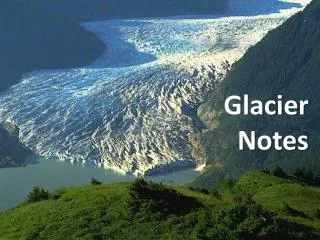
Agenda • Motivation • Nabesna Glacier (Alaska) • “Motion patterns of Nabesna Glacier (Alaska) revealed by interferometic SAR techniques” • Aletsch Glacier (Swiss Alps) • “Estimation of the Surface Velocity Field of the Aletsch Glacier Using Multibaseline Airborne SAR Interferometry” • Conclusions
Motivation • Goal • Determine glacier flow rates and patterns • Motivation • Inputs to models for mass balance • Monitoring global warming changes • Prediction of changes in glaciers
Nabesna Glacier (Alaska) • Source: • “Motion patterns of Nabesna Glacier (Alaska) revealed by interferometric SAR techniques,” S Li, C Benson, R Gens, C Lingle, Remote Sensing of Environment (2008) 112, 3628-3638. • Geophysical Institute, University of Alaska Fairbanks
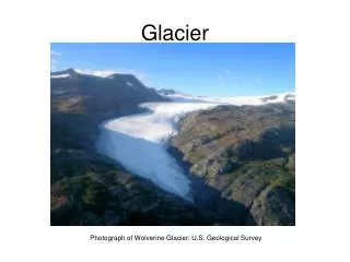
Nabesna Glacier • One of the largest land-terminus glaciers in North America (1040 km2) • Significantly lower thinning rate (0.17 m/yr) than other glaciers in Alaska (0.54 m/yr average) • Motion patterns not previously studied Mount Blackburn and Nabesna Glacier, George Herben, www.nps.gov
Nabesna Glacier MW: Mt. Wrangell MB: Mt. Blackburn MR: Mt. Regal
Sensors • First and Second European Remote Sensing Satellites (ERS-1 and ERS-2) • Near circular, polar, Sun-synchronous orbit • Altitude: 782 to 785 km • SAR wavelength: 5.65 cm ERS-1, http://earth.esa.int/ers/
Repeat Pass InSAR • Two SAR images acquired from repeat pass observations • Small (~5m) and large (~40m) baselines • 1 or 3 day temporal baselines • Interferogram derived from SAR images • Stereo topographic effects removed using an existing digital elevation model (DEM)
Digital Elevation Model (DEM) • Derived from topographic maps surveyed in the 1950s • 1-degree DEM units • Generated by National Imagery and Mapping Agency • Archived by the United States Geological Survey
Data Winter Winter Winter Spring Spring
Interferograms Deformation related phase patterns cropped from slant range interferograms with appropriate color coding, flipping, rotation and trimming: (a) 1994-01-20–23, (b) 1994-03-03–06, (c) 1995-12-08–09, (d) 1996-03-31–04-01, (e) 1996-05-15–16, and (f) an enlargement of the area outlined in (a)
Conversion to Motion Vector • Results from processing are the projection of glacier flow along the radar beam’s line of sight • Assumptions to obtain estimates of motion vectors of glacier flow: • Glacier motion parallels surface topography • DEM provides approximate glacier surface topography • Surface elevation changes between SAR acquisitions are negligible • Atmospheric effects are negligible
Conversion to Motion Vector Angle between LOS and glacier motion Radar incidence angle Surface slope Relative azimuth angle DMagnitude of displacement ΔlDisplacement along LOS λWavelength NfrNumber of fringes between point and bare rock Relation between InSAR measured displacement (red vector) and true displacement (blue vector).
Error Analysis • Errors arise from: • Phase bias (ΔD1) • Elevation error in the DEM (ΔD2) • Error in estimation of α(ΔD3)
Temporal Variation Comparison of Nabesna Glacier flow in winter and spring 1994–1996
Nabesna Glacier Regions • Upper • Random glacier flow • Upper-Middle • Relatively steady flow of 0.27 to 0.4 m/day • Middle • Stable acceleration to 0.7 m/day and then deceleration • Lower • Generally slow but highly variable flow
Study Summary • Glacier motion patterns can be derived from InSAR methods • Satellite baseline is not large • Displacement along LOS between two SAR acquisitions is within a few meters • Stereo topographic effects can be removed using a DEM
Aletsch Glacier (Swiss Alps) • Source: • “Estimation of the Surface Velocity Field of the Aletsch Glacier Using Multibaseline Airborne SAR Interferometry,” P Prats, R Scheiber, A Reigber, C Andres, R Horn, IEEE Transactions on Geoscience and Remote Sensing (Feb 2009), Vol. 47, No. 2, 419-430. • Microwaves and Radar Institute, German Aerospace Center
Aletsch Glacier • Largest glacier in the Swiss Alps (171 km2) • Divided into the main glacier and two smaller branches • Main glacier is 24 km (15 mi) long “Aletsch Glacier." Encyclopedia Britannica. 2009. Encyclopedia Britannica Online. <http://www.britannica.com/EBchecked/topic/13903/Aletsch-Glacier>.
Sensor Platforms • Ground-based • Difficult to take measurements because of high-altitude, remote locations • Airborne • Flexibility with data-acquisition geometry and wavelength, spatial resolution • More complex processing, motion errors • Satellite-based • Proven to measure surface velocity fields • Lack of flexibility, fixed revisit time
Residual Motion Error (RME) • Drawback of airborne platforms • Result from inaccuracies in the navigation data (on the order of cms) • RMEs cause baseline errors • Azimuth displacements • True Coregistration Error (TCE) • Real azimuth displacement in the scene between acquisitions
3-D Surface Velocity Field • Have only two measurements • Line-of-sight displacement • Along-track displacement • Assumption: • Glacier flows in the direction of the maximum slope • Slope can be found from the DEM • Coordinates transformed to a global reference system
Standard Deviation of Estimates • Standard deviation is an order of magnitude higher for along-track displacement • Airborne flexibility means several tracks can be flown to obtain better estimations
System Parameters • Data acquired by the Experimental SAR (E-SAR) system of the German Aerospace Center (DLR)
Digital Elevation Model • External DEM (X-band) • Computed from single pass InSAR data acquired by E-SAR • Used for motion compensation
2-D SVFs (2003 and 2006) 2003 2006
Coherence Generally High Coherence Higher Coherence at Higher Elevations Generally Low Coherence
Accuracy • Evaluated using corner reflectors
Combining Configurations • FISA and JUJO configurations combined to form 3-D SVF • Different flight lines • No slope assumptions
Combining Configurations • Second Technique • Only more accurate DInSAR measurement from each configuration used • Slope information needed
Performance Limitations • Data Processing • Errors in the external DEM • Residual Motion Errors • Reduced to a large extent • Reduced further with DEM or CRs • Coherence • Along-track and line-of-sight measurements subject to coherence • Along-track measurements more sensitive
Study Summary • 2-D and 3-D SVFs of the Aletsch glacier retrieved using airborne SAR interferometry • RMEs reduced by estimating baseline errors • Different configurations combined to create 3-D SVFs
Conclusions • In both cases, Surface Velocity Fields were successfully generated using: • SAR Images • External Digital Elevation Models • Nabesna Glacier • Two SAR Images + External DEM • Aletsch Glacier • Three SAR Images + External DEM