Download
1 / 14
140 likes | 245 Vues
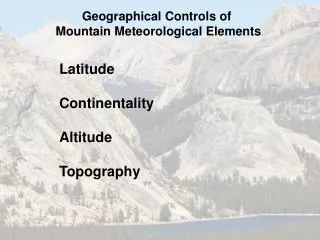
Geographical Controls of Weather and Climate. Latitude Continentality Altitude Topography Terrain dimensions Relief Slope and aspect. Latitude. Net radiation and temperature decrease as latitude increases Elevation of treeline/snowline decreases poleward

E N D
Geographical Controls of Weather and Climate • Latitude • Continentality • Altitude • Topography • Terrain dimensions • Relief • Slope and aspect
Latitude • Net radiation and temperature decrease as latitude increases • Elevation of treeline/snowline decreases poleward • Belt of alpine vegetation and permanent snow and ice are lower on mountains at high latitude versus the tropics
Day Length Whiteman (2000)
Altitude Angle of the Sun Whiteman (2000)
Continentality • Arises from differences in heat capacity and heat conduction of soils vs. water • Water able to store more heat • Soils less • Degree of continentality expressed by annual range of mean monthly temperature
Temperature: Annual vs. Diurnal Austria Java Barry (1992)
Altitude • Distribution of state variables (p,r,T,u) depends strongly on height in free atmosphere and as function of terrain height • Vapor pressure of water and radiation also vary strongly with height Whiteman (2000)
Hydrostatic Atmosphere pT zT • dp/dz = - rg • p= rRT • ln(pB/pT )=RgTave (zT – zB ) Tave pB zB Whiteman (2000)
Actual vs. Standard Atmosphere Whiteman (2000)
Vapor Pressure Mt. Fuji • Vapor pressure (e)- partial pressure of water vapor • Absolute measure of water content in atmosphere • Saturation vapor pressure (es)- saturation vapor pressure • Maximum amount of water vapor atmosphere can hold for given temperature (m) 3776 1000 0 e:(mb) 3.3 11 14.5
Impacts of Vapor Pressure • Higher vapor pressure reduces transmission of IR • Refracts/absorbs solar radiation • Flux of water vapor proportional to (es –e); so, for given temperature, lower vapor pressure increases evaporation • Compared to free air, vapor pressure is higher usually near mountain • Reduces transmission of IR, which may increase temperature • Lowers condensation level • lowers drying power, i.e., ability to transfer water from clothing/plants into atmosphere
Physiological Factors of Altitude: Oxygen Deficiency • Proportion of Oxygen in atmosphere- 21% • Partial pressure of Oxygen decreases with height in proportion to other gases • Lungs saturated with water vapor; reduces available oxygen • Oxygen in lungs: (ambient pressure – saturation water vapor pressure at body temp (37C) (63 mb)) * .21 • Sea level (1013 – 63 ) * .21 = 200 mb; 5000 m (540 – 63 ) * .21 = 100 mb • Hypoxia- intolerance to oxygen deficiency • Humans can tolerate half sea level value indefinitely • Symptoms significant above 3000 m (133 mb) • Standard Atmosphere varies with latitude (4000 m roughly 630 mb equatorward of 30o; 593 mb (winter)-616 mb (summer) at 60o • Cyclone could drop pressure 10-20 mb; equivalent to several hundred meters in elevation • Grover (1974); Man living at high altitudes. Arctic and Alpine Environments.
Inspired Oxygen as a Function of Elevation 200mb 100mb Grover (1974)