Download
1 / 14
140 likes | 378 Vues
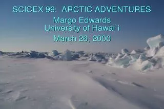
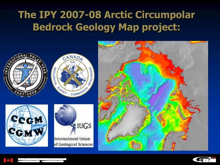
The IPY 2007-08 Arctic Circumpolar Bedrock Geology Map project:. Background. July 2003 : Proposal for an “Atlas of geological maps of the Circum-polar Arctic at 1:5,000,000 scale Contributing maps and lead nations to include bedrock geology (Canada); gravity and magnetics (Norway);

E N D
The IPY 2007-08 Arctic Circumpolar Bedrock Geology Map project:
Background July 2003: Proposal for an “Atlas of geological maps of the Circum-polar Arctic at 1:5,000,000 scale Contributing maps and lead nations to include bedrock geology (Canada); gravity and magnetics (Norway); metallogeny, tectonics (Russia) IGC Florence: Discussion by ministers of Natural Resources August 23, 2004: Proposal endorsed by the general assembly of the CGMW of the IUGS Project proposed by Russia for the 2007-08 IPY program June 2005: ADM of NRCan agrees that Canada will lead the bedrock map component of the Atlas; start of Canadian plans September 2005: Canada to contribute C$150 million to IPY
Scale 1:5000,000 1.33 m (52.5”) 60o North Geographic area
Paper mapvsQueriable map database The project must deliver a 1:5,000,000 scale paper copy bedrock geology map of the Arctic circumpolar region down to 60 degrees North. The map area includes most of Alaska and Canada’s three territories, some of northern Quebec, most of Greenland and Scandinavia north of Denmark, all of northern Russia, the North Pacific, the North Atlantic, Iceland, and the entire Arctic Ocean. Canada also aims to deliver a queriable map database of the circumpolar region that allows users to generate maps customized to specific user-defined needs
Timetable October 2005: GSC meetings with Canadian contributors to ensure that proposed legend structure is suitable for shield, basin and Cordilleran environments. Approach: "compilation of compilations" February 2006: Workshop with international participants in Calgary to discuss and improve legend. March 31, 2006: deadline for Canadian IPY project funding applications May 2006: Present early results at GAC Montreal Special session: “The next Geology Map of Canada” Spring 2006: First draft of map and queriable database using existing digital map files (ie. digital Canada, 1:5000k; Russia, 1:2500k; Fennoscandia, 1:2000k; North Atlantic, 1:4000k; Greenland, 1:2500k; Alaska; Arctic basin) Spring 2007: Second draft of map and queriable database (using latest national compilation map files) Fall 2007: Delivery of final map products to printers (for 2008 Oslo IGC)
Canada’s IPY commitment is an excellent opportunity to kick-start a Canadian map database!!
GAC Session: SS10 –The next geology map of Canada ORAL Presentations: Morning Monday, May 15, 20068:20 H. Thorleifson*. Canadians need web-accessible 3D geological mapping ASAP [2 slots]9:00 G. Buller* and A. Moore. Bridging the Gap!9:20 DISCUSSION9:40 BREAK10:00 J.H Broome*, P. Davenport, L. Nolan and J. Rupert. CGKN Contributions to a New National Geological Compilation of CanadaWESTERN CANADA10:20 N. Massey*. The Digital Geology Map of British Columbia10:40 M.M Fenton* and R.C Paulen. Compilation of Alberta’s Provincial Surficial Geology Map: Meshing Old and New Processes11:00 I.R. Smith*, J.M. Bednarski, R.C. Paulen, A. Plouffe, T. Ferbey and V.M. Levson. Collaborative surficial geology mapping in northern Alberta and British Columbia11:20 DISCUSSION/LUNCH BREAK
ORAL Presentations: Afternoon Monday, May 15, 2006 ARCTIC CANADA 14:00 I. McMartin*, L.D. Dredge, A.S. Dyke, F. Hardy, D.A. Hodgson, D.E. Kerr, T.C. Little, C.A. Ozyer, T. Tremblay and D.J. Utting. SURFICIAL GEOLOGY NORTH OF 60̊: AN UPDATE OF MAP COMPILATIONS FOR THE SLAVE AND WESTERN CHURCHILL PROVINCES 14:20 S. Tella*, .D Paul, .W.J. Davis, .R.G. Berman, .T.D. Peterson and .S.J. Pehrsson. 1:500,000 SCALE BEDROCK GEOLOGY COMPILATION AND REGIONAL SYNTHESIS OF THE HEARNE DOMAIN NORTH OF 60̊N, WESTERN CHURCHILL PROVINCE, NUNAVUT, CANADA 14:40 C. Harrison*. A polar perspective on the next geology maps of Canada 15:00 DISCUSSION/ BREAK 15:20 D.J Utting*, D.T. James, B. MacIsaac and G. MacKay. Building, maintaining and delivering the Nunavut geoscience knowledge base: Contributing to the next geology map of Canada 15:40 M.R. St-Onge*, J.A. van Gool, A.A. Garde, M. Searle and D.J. Scott. Regional compilation of the Precambrian geology on both sides of Baffin Bay, Davis Strait, the Labrador Sea, and Hudson Strait: a Paleoproterozoic analogue to the Himalayan orogen 16:00 H. Idman*, J. Kohonen and J. Vuollo. A NEW GEOLOGY MAP OF FINLAND – PREPARING FOR THE FUTURE 16:20 DISCUSSION/POSTERS (END OF FIRST DAY)
ORAL Presentations: Morning Tuesday, May 16, 20068:00 P.H. Davenport*, P. Tzeng and G. Lai. Using the North American Data Model to make the next Geological Map of Canada8:20 R. Garrett*, L. Chorlton, P. Friske, A. Rencz and R. Klassen. Use of the next Geological Map of Canada for the National Geochemical Reconnaissance and the National Atlas of Canada CENTRAL CANADA8:40 M.M. Sanborn-Barrie*, D. Lemkow, J.A. Percival, G.M. Stott, A. Bailes, D. Stone, T. Corkery, T.M. Skulski and N. Rogers. A new generation of multi-scale bedrock maps of the central Canadian Shield: the legacy from western Superior NATMAP9:00 R.M Easton*. Lessons from the “Geology of Ontario” and related provincial map-scale compilation efforts9:20 DISCUSSION/BREAK10:00 D.R Sharpe*, H.A.J Russell, S. Grasby and A.F. Bajc. Groundwater Mapping in Canada10:20 A.F Bajc*, J. Dodge and G. Gao. A seamless surficial geology map of southern Ontario. 10:40 A. Bolduc*, S.J. Paradis, R. Boivin and M. Boutin. 2.5 D SURFICIAL GEOLOGY MAPPING: DIGITAL CARTOGRAPHY INCORPORATING THE BEST SOURCE DATA AVAILABLE11:00 DISCUSSION, LUNCH BREAK
ORAL Presentations: Afternoon Tuesday, May 16, 200614:00 L.B. Chorlton*. Alternative maps from geological map databases: help in evaluating priority themes for the new Geological Map of Canada EASTERN CANADA14:20 R.A. Wilson*, P.M. Rennick, J.P. Langton and W.H. Van de Poll. The Evolution of Geological Maps in New Brunswick: Enhancing the Accessibility of Geoscience Data14:40 H.W.W. van de Poll*. The Maine - Maritimes Project: Combining Adjacent Small-Scale Geological Maps from Disparate Sources.15:00 S.P. Colman-Sadd* and L.V. Crisby-Whittle. The Digital Bedrock Geology Map of Newfoundland15:20 DISCUSSION16:20 POSTERS(END OF SESSION