Download
1 / 10
100 likes | 200 Vues
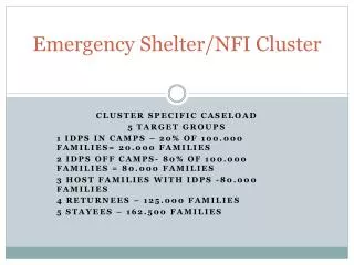
How to render GIS tools accessible and useful for shelter cluster members. Use of GIS in a humanitarian setting. Sharing geospatial data in a humanitarian setting. Result of good data sharing. Case: Batagram District. Pakistan 2006. Geospatial data accessibility.

E N D
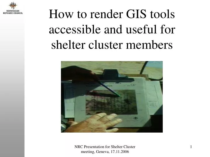
How to render GIS tools accessible and useful for shelter cluster members NRC Presentation for Shelter Cluster meeting, Geneva, 17.11.2006
Use of GIS in a humanitarian setting NRC Presentation for Shelter Cluster meeting, Geneva, 17.11.2006
Sharing geospatial data in a humanitarian setting NRC Presentation for Shelter Cluster meeting, Geneva, 17.11.2006
Result of good data sharing Case: Batagram District. Pakistan 2006 NRC Presentation for Shelter Cluster meeting, Geneva, 17.11.2006
Geospatial data accessibility • The data is accessible to other humanitarian actors • From HIC when data is available • From other main GIS actors (WFP/VAM, UNJLC etc.) with some restrictions • However, some main GIS actors in relief work • are not operational in all conflicts/natural disasters • are not all operational on day one • focus on the overall picture and not on all thematic/geographical areas • are grateful for GIS assistance NRC Presentation for Shelter Cluster meeting, Geneva, 17.11.2006
Geospatial data accessibility, cont. • Therefore, GIS facilities for all shelter actors are important and can facilitate • a complete Information Management by the individual actor • a better way of reporting • internal handling of geoinformation because of confidentiality NRC Presentation for Shelter Cluster meeting, Geneva, 17.11.2006
How small-scale shelter actors can employ GIS • Identification of existing geospatial data available in relevant thematic/geographical area • Selection of relevant existing geospatial data for own work • Identification of additional data needs • Collection, e.g using GPS, of additional data • Data integration of geospatial data from point 2. and 4. • Map production NRC Presentation for Shelter Cluster meeting, Geneva, 17.11.2006
Case:GIS tools for NRC shelter activities • Train trainers in NRC in • identification of existing geospatial data relevant for NRC’s shelter activities • collection of other geospatial data and use of GIS/GPS systems • incorporation of GPS data in a GIS software • map production NRC Presentation for Shelter Cluster meeting, Geneva, 17.11.2006
Expected outcomes • GIS tools established for NRC’s field operations that is • adapted to existing geospatial data from main actors • inexpensive • user friendly • Trained NRC staff use actively GPS and GIS in their daily operations in the field NRC Presentation for Shelter Cluster meeting, Geneva, 17.11.2006
GIS/GPS utility for NRC Free-GIS Utility GeoSpatialData Instructions Free-GPS Utility NRC Presentation for Shelter Cluster meeting, Geneva, 17.11.2006