Download
1 / 57
730 likes | 2.08k Vues
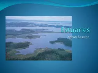
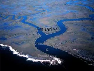
Estuaries. Where the Rivers meet the Sea. Definition Types Circulation Tides Peritidal/ Estuarine system Marsh Tidal Channels Tidal Deltas Mudflats/ Tidal flats Biology “Wetlands”. Estuaries. Where the Rivers meet the Sea

E N D
Estuaries Where the Rivers meet the Sea
Definition • Types • Circulation • Tides • Peritidal/ Estuarine system • Marsh • Tidal Channels • Tidal Deltas • Mudflats/ Tidal flats • Biology • “Wetlands”
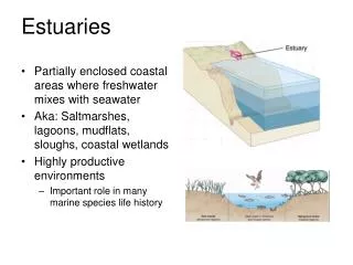
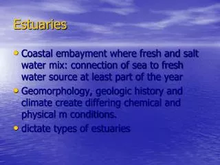
Estuaries • Where the Rivers meet the Sea • Semi- enclosed body of water where there is a mix of river and seawater, and mix of fluvial and marine processes • Mouths of many rivers flooded at last sea level high (last interglacial) • Boundary between fluvial and marine processes • Influenced by tides
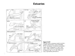
Types of Estuaries • Drowned river valley • Fjord • Bar- built • Tectonic
Tectonic San Francisco Bay
ESTUARY The Netherlands
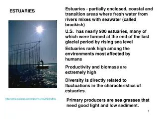
Value of Estuaries • Greatly influenced by river discharge and tidal mixing. • Environmental conditions fluctuate widely. • Biomass is high because estuaries have high nutrient levels. • Species diversity is low because fewer species can cope with the wide fluctuations in temperature, salinity etc. • “nursery grounds” • young stages develop in the estuary • (abundant food; low predation • may move offshore to adult habitats
Estuaries • greatly influenced by river discharge and tidal mixing. • Environmental conditions fluctuate widely. • Biomass is high because estuaries have high nutrient levels. • Species diversity is low because fewer species can cope with the wide fluctuations in temperature, salinity etc. • “nursery grounds” • young stages develop in the estuary • (abundant food; low predation • may move offshore to adult habitats
TIDES • tidal bulge results from moon and sun • neap (sun and moon effects cancel) • spring (compound) • diurnal; semidiurnal; mixed semidiurnal
Tidal range • tides are giant shallow water wave • at coasts, funnel into bays and other indentations • water piles up in enclosed areas • microtidal- up to 2 m • mesotidal 2 – 4 m • macrotidal > 4 m
tidal current • generated by horizontal movement of water • most pronounced in mesotidal • carries great volume in macrotidal • flood tides • Incoming • moves water onshore between low and high • ebb tides • Outgoing • moves water offshore • Slack • top and bottom of cycle (when high is in, or low is in) • bidirectional flow • leads to bidirectional cross- stratification with mud drapes • herring bone, mud drape, reactivation surface
Basic Circulation • Basic plumbing • water flows in at high tide- fills up • flows out at low! - empties • (Variations on the theme) • may be completely empty or may be wet throughout cycle • Harsh environment- desiccation, daily changes in temperature and salinity
Classification • One way of quantifying is by comparing the volume R of freshwater that enters from the river during one tidal period, with the volume V of water brought into the estuary by the tide and removed over each tidal cycle. • R is sometimes called the river volume, while V is known as the tidal volume.
Classification • Estuaries can be grouped into classes,according to their circulation properties and the associated steady state salinity distribution.The most important estuary types are1. salt wedge estuary (R>>V)2. highly stratified estuary (R>V)3. slightly stratified estuary (R<V)4. vertically mixed estuary (R<<V)5. inverse or reverse estuary (R=0)
Salt Wedge • River volume R is very much larger than the tidal volume V, or there are no tides at all. • The fresh water flows out over the sea water in a thin layer. • All mixing is restricted to the thin transition layer between the fresh water at the top and the "wedge" of salt water underneath. • Vertical salinity profiles therefore show zero salinity at the surface and oceanic salinity near the bottom all along the estuary. • The depth of the interface decreases slowly as the outer end of the estuary is approached • Mississippi and Congo Rivers
Highly Stratified Estuary • River volume R is comparable to but still larger thantidal volume V. • Strong velocity shear at the interface produces internal wave motion at the transition between the two layers. • The waves break and "topple over" in the upper layer, causing entrainment of salt water upward. • Entrainment is a one-way process, so no fresh water is mixed downward. • This results in a salinity increase for the upper layer, while the salinity in the lower layer remains unchanged, provided the lower layer volume is significantly larger than the river volume R and can sustain an unlimited supply of salt water • Examples of this type of estuary are fjords, which are usually very deep and have a large salt water reservoir below the upper layer.
Slightly Stratified Estuary • River volume R is small compared to tidalvolume V. • The tidal flow is turbulent through the entire water column (the turbulence induced mainly at the bottom). • As a result, salt water is stirred into the upper layer and fresh water into the lower layer. • Salinity therefore changes along the estuary axis not only in the upper layer but in both layers • This type of estuary is widespread in temperate and subtropical climates
Vertically Mixed Estuary • River volume R is insignificant compared with tidal volume V. • Tidal mixing dominates the entire estuary. • Locally it achieves complete mixing of the water column between surface and bottom, erasing all vertical stratification. • As a result, vertical salinity profiles show uniform salinity but a salinity increase from station to station as the outer end of the estuary is approached • This type of estuary is found in regions of particularly strong tides; an example is the River Severn in England.
Inverse or Reverse Estuaries • These estuaries have no fresh water input fromrivers and are in a region of high evaporation. • Surface salinity does not decrease from theocean to the inner estuary, but water loss fromevaporation leads to a salinity increase as theinner end of the estuary is approached • This results in a density increase and sinking of high salinity water at the inner end. • As a result, movement of water is directed inward at the surface and towards the sea at the bottom, with sinking at the inward end.
Components of the Peritidal System • Salt marsh1. High marsh2. Low marsh • Tidal channels • Tidal deltas • Ebb • Flood • Tidal mudflats
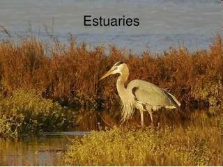
Salt Marsh Salt marshes are vegetated inter-tidal flats.
Salt Marsh • Marsh divided into high and low marsh • high is region above high tide • low is region that’s flooded daily • each has distinctive vegetations and grain size • high has coarser sediments • Is a much more terrestrial-like environment because it is flooded only at times of extreme high tide. • Is characterized by a more varied plant community. Spartina patens • low has finer sediments • Is dominated by the smooth cordgrass, Spartina alterniflora. • cut by channels which funnel water in and out • may completely empty or may be wet throughout cycle
Salt Marsh Salt marsh profile.
Salt Marsh • cut by tidal channels • funnel water in and out • daily influx of water brings muds • build up mud flats
Tidal channels • funnels water into single or multiple channels • currents can scour base • also meander and can cause walls to fail • lag of gravelly deposits (including shell material and mud clasts • armored mud balls • form point bars similar to those in rivers • BUT have fine material on top of sloping bar surface • alternations of sand and mud on bar deposits • tidal channel has lag; • channels generally cut down a few meters at least channel abandoned and finer sediments infill
Tidal flats • form in proximal areas and between channels
Tidal mudflats • away from area of strong tidal currents • flooded at high; exposed at low • fine sediments are carried in on high tide and deposited during slack and as it retreats • commonly bioturbated • surface network of channels partially channelize flow • allows vegetation to flourish • PEAT: thick accumulations of dead vegetation • organisms eat decaying vegetation • low marsh characterized by this process of daily alternating currents • higher areas of marsh are site of accumulation of dead marsh grass (wrack)
Cores through tidal flat deposits of the Devonian Swan Hills Formation, Alberta, Canada Dr. Stacy Atchley, Baylor Univ.
Tidal Flat Colonization—Paleontology and sedimentology of a Late Cambrian shoreline, where soft-bodied carcasses are stranded and early crawling organisms left tracks and trails. Dr. Whitey Hagadorn , Amherst Coll
Tidal Deltas • Ebb • Flood
Tidal Mudflats • Flooded at high; exposed at low • Fine sediments are carried in on high tide and deposited during slack and as it retreats • commonly bioturbated • fiddler crabs, etc • Surface network of channels partially channelize flow • allows vegetation to flourish • PEAT: thick accumulations of dead vegetation • (organisms eat decaying vegitation)
Marine and transitional marine to tidal flat Parallel bedded sandstone and mudstone. Note flame structures near base and load casts near top of core Shallow subtidal to intertidal Lenticular and flaser bedding: sandstone and mudstone. Typical of tidal flats Massive sandstone with vertical burrows