Download

1 / 53
530 likes | 988 Vues
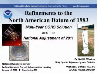
National Adjustment of 2011 (NA2011) Larry Signani. VELOCITIES. West Coast Crustal Motion. Horizontal velocities in the western U.S. relative to the North American Datum of 1983 as derived from geodetic observations. . -Times 8 years (2002-2010) -As will be seen realized with

E N D
West Coast Crustal Motion Horizontal velocities in the western U.S. relative to the North American Datum of 1983 as derived from geodetic observations. -Times 8 years (2002-2010) -As will be seen realized with NAD 83(2011)Epoch2010 (tent. name) Slide from R. Snay, NGS
List of abbreviations used • CONUS Conterminous United States • CORS Continuously Operating Reference Stations • FGDC Federal Geographic Data Committee • GNSS Global Navigation Satellite System • GPS Global Positioning System • HTDP Horizontal Time Dependent Positioning (NGS software) • IGS International GNSS Service • MYCS Multi-Year CORS Solution • Epoch An epoch is a moment in time used as a reference point.
List of abbreviations used • NA2011 National Adjustment of 2011 • NAD 83 North American Datum of 1983 • NAVD 88 North American Vertical Datum of 1988 • NADCON North American Datum CONversion (NGS software) • NGS National Geodetic Survey • NGSIDB National Geodetic Survey Integrated Data Base • OPUS Online Positioning User Service
CORS NETWORK • The National Geodetic Survey (NGS) operates the Continuously Operating Reference Station (CORS) Network that provides Global Navigation Satellite System (GNSS) data in RINEX format, and associated positions. • Currently NGS provides these coordinates in ITRF00 epoch 1997.00, and in NAD 83(CORS96) epoch 2002.00. • NGS has completed a full reanalysis of all data from CORS and a set of global sites with the goal to compute a fully consistent set of coordinates, GPS satellite orbits and Earth Orientation Parameters (EOP). • This initial Multi-Year CORS (MYCS1) effort is the first of a series reprocessing projects that will occur periodically in the coming years.
Why is NGS doing a national adjustment a mere 4 years after the last adjustment
Why Reprocess? • 1) Mixed coordinates from an earlier solution (1994-2002) that used only 3-8 ITRF reference frame sites to align to the global frame • 2) Mixed horizontal velocities: modeled from HTDP vs. computed • 3) Mixed vertical velocities, which for many of the NAD 83(COR96) epoch 2002.00 stations are assigned a value of 0 mm/yr • 4) NGS's current global frame is ITRF00 epoch 1997.00; projecting positions 13 years to the present is unrealistic • 5) NGS's current plate-fixed frame is NAD 83(CORS96) epoch 2002.00; projecting positions 8 years to the present is also questionable • 6) Implementing significant changes to existing processing algorithms and models including compliance with IERS conventions (i.e. software changes) • 7) Switching from using relative antenna calibration to absolute antenna calibrations • 8) The current state-of-the-art full (~230 stations) global reference frame: IGS08 epoch 2005.00 Given these major inconsistencies and changes, NGS elected to reprocess all its CORS data to provide a single consistent set of coordinates for all sites computed using the best available methods.
Why Reprocess?Generally we can’t continue to live in epoch 2002 Generate fully consistent orbits, station coordinates using latest models and methods • longer data spans • absolute antenna calibrations • satellite transmitting and ground receiving antennas • new network design—added redundancy • Delaunay triangulation over global sites and CORS backbone • tie remaining CORS to backbone as stars • IERS 2003 Conventions generally implemented • updated model for station displacements due to ocean tidal loading • updated models for troposphere propagation delays • use current frame; first attempt to obtain a full history of products in a fully consistent framework. Contribute NGS reprocessed orbits, to International GNSS Service (IGS) Slide by J. Griffiths and the MYCS Team
What is the intent of the project and what is it correctly called? The project is officially called the “National Adjustment of 2011”, abbreviated as NA2011. It is a nationwide, geometric adjustment of passive stations with positions determined using Global Navigation Satellite System (GNSS) technology and data, which includes the Global Positioning System (GPS). NA2011 is called “geometric” because it will yield new values for latitude, longitude, and ellipsoid height; it will NOT affect the orthometric heights of stations. However, a future nationwide vertical adjustment is being considered to determine GNSS-derived orthometric heights based on the results of NA2011
A Little History ‘Multi-year’ effort began 5 years ago IGS proposed re-processing all data to re- compute station coordinates, orbits and EOPs from 1994-present • MYCS positions were derived from the reprocessing of the full 16 year time series (1994-2010) and a rigorous stacking of weekly estimates in a fully consistent, global framework. • 33 of these MYCS stations are in Washington NAD 83(2011)Epoch2010 is a new realization of NAD 83 based on this NGS Multi-Year CORS Solution (MYCS)
“multiyear” “Multiyear” effort began 5 years ago •Began with a revision of PAGES and processing strategy driven by weak NGS orbit contribution to IGS. •IGS proposed re-processing all data to re-compute station coordinates, orbits and EOPs from 1994-present •Richard Snay provided resources and managed the effort of the “multiyear” effort till May 2010
What has changed between NAD 83(2011) epoch 2010.00 and NAD 83(CORS96) epoch 2002.00? There has been no datum change, that is, the origin, scale and orientation of NAD 83(2011) are identical to those of NAD 83(CORS96). The changes in coordinates are driven by multiple factors including the switch to absolute antenna calibrations, new/revised processing algorithms, improved discontinuity identification, longer data sets, and our improved definition of the global reference frame. However for the end user the biggest change is caused by the new reference epoch, which has changed by 8 years from 2002.00 to 2010.00. To show how small the change in reference frames is, we compare the coordinates of all CORS sites with more than 2.5 years of data at the same epoch of 2002.00 in both frames:
WHAT IS THE SCHEDULE • In July 2011, NGS will finalize a reanalysis of historic Continuously Operating Reference Station (CORS) data, in conjunction with an international effort coordinated by the International GNSS Service (IGS). • This reanalysis, known as the Multi-Year CORS Solution (MYCS), will yield new geometric coordinates and velocities on CORS. • For NGS products and services to be mutually aligned, it is necessary to perform an adjustment (constrained to the new MYCS coordinates) of as many GNSS vectors held in the NGS Integrated Data Base (NGSIDB) as possible. • These vectors represent GNSS observations between passive stations, and, importantly, between passive stations and CORS (i.e., active stations). The vectors tied to CORS will make it possible to determine new coordinates on passive control that are consistent with the MYCS.
When will NA2011 be completed? The goal is to complete and publish the results by the end of calendar year 2011, which also includes updating all affected NGS products and services. There are numerous technical and logistic challenges in executing a project of this magnitude, and it is difficult to estimate the time necessary to accomplish all the required tasks. Because of this, NGS has not set a specific date for completion of the project. This will instead be governed by meeting criteria for quality and completeness, both for the adjustment itself and its implementation.
Will these excluded stations remain on pre-NAD 83(2011) epoch 2010.00 for eternity? The answer is entirely dependent upon whether an acceptable GNSS survey is ever performed at that passive control mark. For non-GNSS (i.e., “classically” determined) control, the most accurate way to determine coordinates consistent with a modern realization of NAD 83 is to resurvey it using geodetic quality GNSS data. The intended use of this position will determine whether an OPUS solution is sufficient or if a complete GNSS survey submitted to NGS for publication is required.
What are “passive” and “active” control stations? I’m not familiar with the terminology. A passive station is, in NGS terminology, a conventional” ground station, e.g., a brass disk set in a substantial structure, a steel rod driven vertically into the ground until refusal, or other such stable physical marks that can be occupied with survey equipment. An active station is a GNSS antenna (and associated receiver) in a fixed location providing GNSS data to the public, such as a CORS,WSRN
Frame Definition and Nomenclature • ITRF frame (global) multi-technique—vlbi, slr, doris, gnss • IGS frame (global) GNSS only • NAD frame (plate fixed) related to ITRF • Critical to pay attention to frametags and epoch dates and antenna calibration values • Frame Name Epoch Antenna PCV* Data Duration • ITRF2000 1997.0 RelANTEX 1994.0-2002.0 • ITRF00 (NGS’ssoln) 1997.0 RelNGS ANTEX 1994.0-present • NAD 83(CORS96) 2002.0 RelNGS ANTEX 1994.0-present • ITRF2008 2005.0 Abs IGS05 ANTEX 1997.0- 2009.5 • IGS08 2005.0 Abs IGS08 ANTEX 1997.0-2009.5 • IGS08 (NGS’s tentative)2005.0 Abs IGS08 ANTEX 1994.0-2010.5 (ongoing) • NAD 83(2011) (tentative)2010.0 Abs IGS08 ANTEX 1994.0-2010.5 (ongoing) *PCV –phase center value; Abs-Absolute, Rel-Relative
GPS Absolute Antenna Calibration Absolute antenna calibrations that were used to process the data from CORS sites that will have IGS08 epoch 2005.00 and NAD 83(2011) epoch 2010.00 coordinates. These calibrations are distinct from earlier NGS calibrations that were relative antenna calibrations.NGS anticipates these absolute antenna calibrations and revised CORS coordinates to become operational in early July 2011.
How does the change in antenna calibration values from relative to absolute impact users? The new coordinates IGS08 epoch 2005.00 and NAD 83(2011) epoch 2010.00 were established using IGS08 absolute antenna phase center patterns. If a user processes data using relative antenna phase center values instead of absolute antenna phase center values they may get positions that differ by up to a few centimeters as compared to processing using absolute antenna phase center values. Users must therefore change the antenna phase center values they use when processing data.
Calibrated Antennas • 3SNAVIGATION • ALTUS Positioning Systems • AeroAntenna • Allen Osborne Associates • Antcom Corporation • Ashtech • DataGrid International • Gutec AB • Hemisphere GPS • Javad • Leica • Macrometer • Magellan Professional • Micro Pulse • NavCom • NavXperience • NovAtel • Sensor Systems • Septentrio Satellite Navigation • Sokkia • Spectra Precision • Stonex • Topcon • Trimble
Critical to pay attention to frame tags and epoch dates and antenna calibration values Frame Name Epoch Antenna PCV* Data Duration ITRF2000 1997.0 RelANTEX 1994.0-2002.0 ITRF00(NGS’ssoln) 1997.0 RelNGS ANTEX 1994.0-present NAD 83(CORS96) 2002.0 RelNGS ANTEX 1994.0-present ITRF2008 2005.0 Abs IGS05 ANTEX 1997.0-2009.5 IGS08 2005.0 Abs IGS08 ANTEX 1997.0-2009.5 IGS08 (NGS’stentative) 2005.0 Abs IGS08 ANTEX 1994.0-2010.5(ongoing) NAD 83(2011) (tentative) 2010.0 Abs IGS08 ANTEX 1994.0-2010.5 (ongoing)
Results Diagram shows plots of average error for 5 points constrained for each of the three realizations. The MYCS coordinates fit the baselines observed much better than the other two.
Are all CORS included in the MYCS? If not, what CORS are excluded? All CORS with GNSS data archived by NGS were included in the MYCS. The only CORS not included are those that have no archived data, which consists only of a small number of Cooperative CORS. Of these, the only ones excluded were decommissioned prior to becoming part of the NGS CORS network and did not provide their historic GNSS data to NGS. The Cooperative CORS program is no longer in effect, and so all currently operating CORS are simply “CORS”, and they are all included in the MYCS. A list of previously operating CORS that were not used in the MYCS will be provided in the near future.
What will the new, resultant realization of NAD 83 be called? NA2011 will provide coordinates on passive marks for the 2011 realization of the North American Datum of 1983 (NAD 83), abbreviated as NAD 83(2011). The appended year of the realization is also referred to as the “datum tag”. This naming convention is the same as that used for the Multi-Year CORS Solution (MYCS), which is so named because it will be finalized in 2011. To fully specify the realization, the name (and datum tag) should be followed by an “epoch” date, for example “NAD 83(2011) epoch 2010.00”. The epoch date is further described in the following FAQ.
What about the passive network that is currently aligned to NAD 83(2007) epoch 2007.00 (also known as NSRS2007)? NGS is in the process of readjusting most, if not all, of the passive vector control in the NGSIDB to make it consistent with MYCS1 solution. The results of this adjustment (National Readjustment of 2011) will have the same reference frame tag and epoch date as the MYCS1, namely NAD 83(2011) epoch 2010.00. The timeline for completing this project has not yet been finalized, but every effort is being made to get this done as quickly as possible.
What does the “epoch” of 2010.00 mean/signify? The “epoch” is the date associated with the coordinates of a control station. An epoch is a necessary part of a complete datum or reference frame name because coordinates can change with time (i.e., they may have non-zero velocities relative to some chosen, stable coordinate reference). For NA2011, the positions will be referenced to midnight January 1 of 2010 (epoch 2010.00). NGS has provided epoch dates for CORS and related products (such as OPUS) for many years, and for passive marks included in the 2007 national readjustment. This practice will continue for NA2011, and it will become more prevalent and consistent throughout NGS. Typically the epoch date is displayed with two decimal places. Users should be aware that if the velocity of a station is known, then its position can be computed at different epochs; thus one datum tag can have multiple epochs. However, the accuracy of the computed position will depend on the accuracy of the velocity, which varies by station and location. Epoch dates on some stations may also change without changing the datum tag if a local episodic event (such as an earthquake) occurs that requires a local adjustment to determine new positions. In summary, epoch dates are needed to accommodate the precision of GNSS measurements and to recognize the dynamic nature of the Earth and its effect on coordinates.
Why is the same datum realization name and datum tag used for both NA2011 and the MYCS, when separate names and datum tags were used in 2007 (i.e. “CORS96” vs. “NSRS2007”)? The use of separate datum tags was chosen in 2007 to reflect the variety of subtle differences between the NSRS2007 realization and CORS96, despite the fact that the two realizations were very closely aligned (median values of 1 cm in horizontal and 2 cm in vertical). For two reasons NGS has chosen to use the same datum tag for the active and passive realizations of NAD 83 in 2011. The first is that efforts to improve consistency between passive and active stations, over and above those made in 2007, are being attempted this time. Second, NGS hopes to avoid the confusion caused by the 2007 naming.
Are the CORS and CORS96 datum tags for NAD 83 the same? Yes, the CORS and CORS96 datum tags refer to the same realization of NAD 83, and CORS96 is the official designation. It is shown on NGS datasheets for CORS as NAD 83(CORS because the fixed format of the datasheet only allows four characters for the datum tag. Note that for other NGS products (such as those associated with OPUS), it is shown as NAD 83(CORS96).
Will all CORS with MYCS coordinates be constrained for NA2011? It is likely that most, but not all, CORS with MYCS coordinates will be constrained for NA2011. The reason for this is that there are two categories of MYCS coordinates. The first category is for CORS (and IGS) sites that have velocities computed from the GNSS observations at the CORS site itself. This requires processing of at least 2.5 years of data for the site, and that during the processing period at least 66% of the expected data were received. NGS expects that all CORS in this first category will be constrained for NA2011. Sites not meeting these criteria are in the second category. For these sites, there is not enough data to compute accurate velocities, and so the velocities are modeled using the NGS (HTDP) software. These modeled HTDP velocities are also used to transform the coordinates of the sites from the mean time of the dataset to a common reference time (epoch). Because these MYCS coordinates are (in part) modeled, it is likely that at least some of these will not be constrained for NA2011. However, CORS that are not constrained will NOT be assigned new published coordinates based on NA2011; the published coordinates will still be from the MYCS.
What control stations will be included in (affected by) this adjustment? GNSS observations (vectors) for all passive control stations in the NGS Integrated Data Base (NGSIDB) connected (directly or indirectly) to CORS with MYCS coordinates as of July 31, 2011 may be included in the adjustment. However, being “included in the adjustment” only assures that the observations will be evaluated for their possible inclusion in the final adjustment. As with any survey control network adjustment, observations that do not “fit” well with other observation (i.e., “outliers”) will be rejected. In some cases, this may result in passive control stations being excluded from NA2011, in which case they will retain their previous datum tag. Projects submitted after July 31, 2011 will be published with NAD 83(NSRS2007) coordinates until NA2011 is completed. At that time those projects in the queue will be adjusted to the new realization and published on NAD 83(2011) epoch 2010.00.
What stations will NOT be included in NA2011? Any passive station that does not have acceptable GNSS data will be excluded from NA2011, as will stations that are not (directly or indirectly) connected to a CORS in the MYCS. For passive stations meeting these criteria, NGS intends to provide NAD 83(2011) epoch 2010.00 coordinates everywhere that is appropriate and can be determined accurately with respect to the MYCS. This will include the conterminous US (CONUS) and Alaska, and it may include other locations outside CONUS as well. The decision as to what additional areas to include will be made during the course of the project. Stations not included in NA2011 will continue to have their positions referenced to the same datum realization used for current survey control prior to NA2011 (as indicated by the datum tag on NGS datasheets).
We are currently planning a survey that will not be completed and submitted to NGS before the July 31 cut-off date. What do we do? First, consult with NGS through the appropriate personnel or NGS headquarters personnel to ensure your project meets NGS requirements for projects performed during this time frame. When performing the constrained adjustments, unless advised differently by NGS personnel, hold NAD 83(NSRS2007) coordinates for all published passive control and NAD 83(CORS96) coordinates for all CORS in the survey. The same approach for constraining a survey should also be used for projects submitted to NGS that will be included in NA2011 (i.e., before the cut-off date).
Will local and network accuracies be computed for stations in projects that are submitted to NGS after the July 31 cut-off date? Yes, those stations will have network and local accuracies computed and published along with the NAD 83(2011) epoch 2010.00 coordinates. As with the NA2011 project itself, these accuracies will be provided in centimeters, and at the 95% confidence level in accordance with the Federal Geographic Data Committee (FGDC) Geospatial Positioning Accuracy Standards, Part 2
What is the expected magnitude of the position/height shifts, when compared to NAD 83(NSRS2007)? The MYCS provides an estimate of the positional changes between NAD 83(NSRS2007) and NAD 83(2011) epoch 2010.00. Note that NGS is treating NAD 83(CORS96) epoch 2002.00 as a proxy for NAD 83(NSRS2007) in making this comparison, which is appropriate since NAD 83(CORS96) was the basis for the 2007 national readjustment. Based on the MYCS results, the average expected change is about 2 cm horizontally and 1 cm vertically (i.e., ellipsoid height). However, these changes – especially the horizontal changes – vary significantly. In addition, the largest part of the horizontal change is due to time difference (velocity), especially in tectonically active areas, such as California; when brought to a common time (2002.00), the average horizontal change decreases to 0.2 cm. It is important to note that the coordinate changes are not evenly distributed across a region, and that shifts of many centimeters are expected to occur in some areas.
Will NGS provide a hybrid geoid model consistent with MYCS and NAD 83(2011) epoch 2010.00 ellipsoid heights? Yes, a new hybrid geoid model (GEOID12) will be produced. Preliminary activities in this regard are currently underway. Development of this model requires completion of NA2011 first; hence it cannot be delivered coincidentally with NA2011 results. As is obvious from the model name, NGS expects to deliver the model in 2012. As with NA2011, completion of the project will be determined by meeting quality and completeness criteria.
Ellipsoid heights from NA2011 and the new geoid model (GEOID12) will generally be inconsistent with published GNSS-derived orthometric heights based on previous geoid models or NAD 83 realizations. Will such inconsistencies be addressed? Possibly. NGS is currently investigating the need and feasibility of performing a nationwide vertical adjustment of all GNSS-derived orthometric heights in the NSRS. If performed, the GNSS-derived orthometric heights determined for all stations in the vertical adjustment will be consistent with NAD 83(2011) epoch 2010.00 and GEOID12, and they will be referenced to the North American Vertical Datum of 1988 (NAVD 88).
Will there be a transformation between old NAD 83 realizations and NAD 83 (2011)? A list of coordinate changes, from NAD 83(NSRS2007) epoch 2002.00 to NAD 83(2011) epoch 2010.00 will be provided to the public.
Will there be a NADCON-style transformation model to get us to NAD 83(2011)? We noticed there wasn't one for NSRS2007 and are really hoping there will be one this time around. For the purposes of transforming the official coordinates of each geodetic control point, NGS will not create a transformation model. An interpolative transformation tool, like NADCON, functions only to apply gross consistent regional shifts to entire areas. NGS will certainly examine the shifts in coordinates for such behavior, but the shifts in going to NAD 83(2011) from NAD 83(NSRS2007) are not expected to significantly exceed the formal errors of those shifts, nor are they expected to all move in one consistent direction regionally. NGS does not endorse the idea of applying a simple interpolative tool to all surveys and maps in a region, as they each will have their own unique connections to surrounding geodetic control. Although NGS will look at all possibilities, there is already compelling evidence that a singular transformed dataset will have very limited applications, and may actually be highly misleading. This is especially the case as the size of the area and required spatial accuracy increase.
How will NGS products and services be affected when the new coordinates are released? NGS have made every effort to minimize the impact of this coordinate change to all NGS products and services in terms of formatting changes. At this time we will change the name of the frame, but the spacing in all our products and services should remain the same. NGS will provide mockups of the revised CORS Coordinate Page, CORS Datasheet and OPUS output.