Download
1 / 18
200 likes | 383 Vues
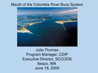
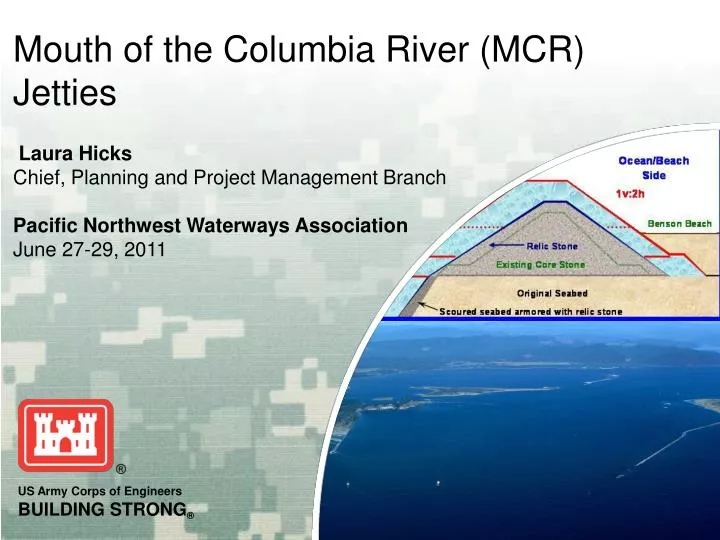
Laura Hicks Chief, Planning and Project Management Branch Pacific Northwest Waterways Association June 27-29, 2011. Mouth of the Columbia River (MCR) Jetties. Purpose: Project Functions. Stabilize deep-draft navigation channel through a regionally significant ocean inlet

E N D
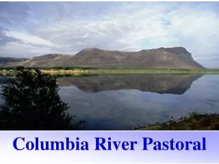
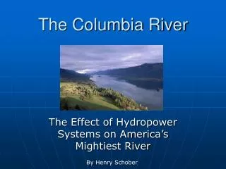
Laura Hicks Chief, Planning and Project Management Branch Pacific Northwest Waterways Association June 27-29, 2011 Mouth of the Columbia River (MCR) Jetties
Purpose: Project Functions • Stabilize deep-draft navigation channel through a regionally significant ocean inlet • Provide protection from waves and currents for all navigation • Minimize dredging requirements of channel • Minimize structure repair frequency and magnitude
Functioning Jetties at the MCR support the following: • $17 billion in international trade • 45 million tons of cargo1 • 3,500 cargo vessel crossings1 • 1,600 crossings at greater than 30 feet1 • The lives of mariners and fishermen • More than 40,000 maritime-related jobs • 1Data from Waterborne Commerce of the United States, 2008
Columbia River Estuary Sand Island pile dikes 1930-1935 Clatsop Spit Jetty “A” 1 mile long 1938-39 Peacock Spit North Jetty2.5 miles long 1914-1917 South Jetty6 miles long 1885-1913 Pacific Ocean MCR Jetties Major Rehabilitation
1965 2005 1939 1917 MCR North Jetty - Construction and Repair History (Receded approximately 1800’ in length since 1916.)
MCR South Jetty - Construction and Repair History (Receded approximately 4500’ in length since 1913) 2007 2006 1982 1961- 1962 1931-1936 1906-1913 1886-1895
Base Condition • Dune Augmentation/Stabilization • South Jetty Root & Trestle Bay • Letter Report, P&S, Beach Material Placement
South Jetty: The Observed Historic Movement of the Shoreline
Note the shoreline in relative to the tree line. Apr. 2010 Dec. 2009 Apr. 2010 Jan. 2010
Dec 2010 May 2010 Note the shoreline in relative to the tree line.
Major Maintenance Report • North Jetty Lagoon and Wetland Fill • Detailed Design Report, Plans & Specifications, Award Contract • Loss of 1.8 acres of wetlands and 4.70 acres of waters of the US. • Locating and developing mitigation site. • Redirecting stream away from lagoon wetlands. • Replacing Jetty Road culvert
Major Maintenance Report • North Jetty Critical Repairs STA 86 – 99
Major Maintenance Report • North Jetty Critical Repairs STA 86 – 99
Major Rehabilitation Report Status: • Draft IEPR report complete • SRB model disapproved • HQUSACE issuing memo regarding model disapproval • Based on a draft memo, district developed a path forward
Major Rehabilitation Report Path Forward: • Break planning model into distinct pieces, separating hazard functions, quantities, cost estimates, progressive damage calculations, etc. • Hire a professional Matlab programmer to work collaboratively with coastal engineer to document and rewrite code. • Coordinate with Division and HQUSACE vertical team to sign off on plan to obtain MRR approvals. Timeline: • Complete updated MMR and engineering analysis by 30 Nov 2011