Download
1 / 27
280 likes | 433 Vues
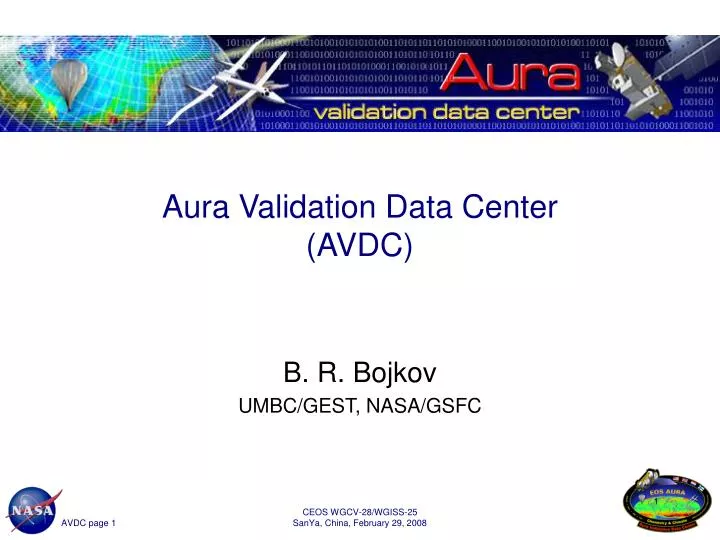
Aura Validation Data Center (AVDC). B. R. Bojkov UMBC/GEST, NASA/GSFC. Outline. Overview Mission, implementation and status Highlights of current activities Aura validation, sub-setting and campaign support Additional direction

E N D
Aura Validation Data Center(AVDC) B. R. Bojkov UMBC/GEST, NASA/GSFC CEOS WGCV-28/WGISS-25 SanYa, China, February 29, 2008
Outline • Overview • Mission, implementation and status • Highlights of current activities • Aura validation, sub-setting and campaign support • Additional direction • Long-term validation of A-Train and other NASA satellites, production of co-located/merged datasets, collection of international datasets, etc. CEOS WGCV-28/WGISS-25 SanYa, China, February 29, 2008
Overview CEOS WGCV-28/WGISS-25 SanYa, China, February 29, 2008
AVDC mission • The Aura Validation Data Center (AVDC) was established in 2004 to support the platform-wide validation activities (airborne missions, ground-based, balloons, other satellites) of the four Aura instruments (HIRDLS, MLS, OMI, TES) • AVDC supports the Aura instrument teams, NRA PIs (Aura and other), NASA campaigns, ESA PIs, NDACC PIs, and independent validation contributors, in the validation and improvement of Aura data products CEOS WGCV-28/WGISS-25 SanYa, China, February 29, 2008
What is the AVDC? • AVDC is a science driven facility located at GSFC with four core activities: • Data collection and archiving • Ground-based, sub-orbital and satellite datasets • Aura L2/L3 data sub-setting and co-location for data comparison • Validation and science campaign support • Aura instrument FOV predictions, facilitate data access, etc. • Generic data usage support • Aura related information, validation and dataset documentation, tools (conversion, search, etc.), Science Team presentations, etc. CEOS WGCV-28/WGISS-25 SanYa, China, February 29, 2008
Implementation • Central facility located at NASA GSSFC: http://avdc.gsfc.nasa.gov • Access for non-NASA datasets limited as per negotiated agreements and protocols • 9-Xserve cluster, 14 TB capacity • Modeled on the ESA Envisat Cal/Val facility (at NILU, Norway) • Strict data requirements including metadata and nomenclature (compliance check on all incoming files) • Maintains compatibility with Envisat Cal/Val formats to reduce burden on providers/users CEOS WGCV-28/WGISS-25 SanYa, China, February 29, 2008
AVDC status • Operational since February 2005 • Originally planned as a 4 year activity • May 2004 - April 2008 • AVE campaign support and L2 sub-setting began in the Fall 2004 • AVDC has 310+ users worldwide who signed the data disclosure agreement • ~ 150/day login access (to restricted pages) • 1.5*106 pages accessed in the last 4 months • 2.6 TB downloads in last 4 months (~56 GB/day) • total correlative data volume: 360+ GB • correlative satellite datasets: ~2 TB • AVDC stores all Aura L2 and L3 data locally CEOS WGCV-28/WGISS-25 SanYa, China, February 29, 2008
Average trop. NO2 for January, 2007 Example: Mapping of OMI NO2 • L3 OMI NO2 tropospheric column • and NO2 total column • Sci. product for OMI NO2 PI • Updated daily from L2 data • Generating: • Daily maps • Monthly averages • Data files and images • Google Earth functionalities • 800k downloads since Oct. ‘07 CEOS WGCV-28/WGISS-25 SanYa, China, February 29, 2008
Highlights of current activities CEOS WGCV-28/WGISS-25 SanYa, China, February 29, 2008
Data collection and archiving • AVDC actively collects correlative data, including: • Ground-based (NDACC, WMO, etc.). • Sub-orbital (NASA aircraft and large balloons). • NASA campaign data (AVE, INTEX, small campaigns). • Mirrors established facilities such as Langley and Ames aircraft repositories. • Constituent data from A-Train, NOAA, ESA, CSA satellites. • AVDC established informal data sharing arrangements with PIs, agencies and networks: • NDACC NRT arrangement. • Envisat cal/val and satellite data sharing. • CSA ACE and Odin data access. • NRT Environment Canada data access. • etc. • Data sharing arrangements have been set-up either through direct contact or facilitated through CEOS ACSG, and are protected through the AVDC data sharing protocol CEOS WGCV-28/WGISS-25 SanYa, China, February 29, 2008
Example: Typical ground-based data at AVDC Measurements made coincident to an Aura MLS/TES overpass during the SAUNA campaign (Finland) CEOS WGCV-28/WGISS-25 SanYa, China, February 29, 2008
AVDC ground-based collection • AVDC has lead data reporting homogenization efforts with the NDACC and the ESA Envisat cal/val program: • Homogeneous reporting format (AVDC HDF) • Data completeness for interpretation (for example averaging kernels, temporal resolution, etc.) • Documentation at http://avdc.gsfc.nasa.gov/Documentation/Metadata • AVDC efforts resulted in a changed paradigm and leads to improved data usability/usefulness for the satellite community • currently all profiling measurements have been harmonized (microwave radiometers, LIDAR, FTIR and balloon instruments) • UV-VIS and WMO core atmospheric measurements in process • AVDC approach/requirements also adopted for the ESA Generic Environment for Cal/Val Analysis (GECA) system and will be recommended for adoption by CEOS WGCV/WGISS CEOS WGCV-28/WGISS-25 SanYa, China, February 29, 2008
Global attributes Variable attributes AVDC HDF file layout for ozonesondes CEOS WGCV-28/WGISS-25 SanYa, China, February 29, 2008
AVDC user support • AVDC provides direct investigator support for planning, access to data and sub-setting, data formulation/conversion tools, etc. • Tools and documentation on-line at: • http://avdc.gsfc.nasa.gov/Tools/ • http://avdc.gsfc.nasa.gov/Documentation/ • Data search pages (login pages): • http://avdc.gsfc.nasa.gov/Data/Search/ • Science team and Aura working groups documentation and presentations available at: • http://avdc.gsfc.nasa.gov/ST&WG/ CEOS WGCV-28/WGISS-25 SanYa, China, February 29, 2008
Satellite instrument field of views (FOV) • AVDC generates validated satellite instrument Field Of Views (FOV) predictions in support of PIs and campaigns • 16-day Aura instrument FOV predictions for stations and campaigns (updated daily) http://avdc.gsfc.nasa.gov/Data/FOV/index.html • AVDC also stores “after the fact” instrument FOVs (from L2 data) • http://avdc.gsfc.nasa.gov/Data/Search/avdc_overpass_search.php which provides temporal and geographic search and subsetting capabilities • AVDC can also generate Aqua, Terra, CALIPSO, NOAA-16,17,18 and Envisat FOVs for campaigns - others instruments are easily added on a short turn-around CEOS WGCV-28/WGISS-25 SanYa, China, February 29, 2008
CEOS WGCV-28/WGISS-25 SanYa, China, February 29, 2008
Search for matching TES data • Search for actual TES FOV coincidences with the SAUNA LIDAR measurements and the ozonesonde launch of the night of March 31, 2006 using the web search interface CEOS WGCV-28/WGISS-25 SanYa, China, February 29, 2008
L2/L3 sub-setting & co-location • AVDC has very fast turn-around for temporal and geographic sub-setting capabilities (typically less than 1 day per request) http://avdc.gsfc.nasa.gov/Data/Aura/ • Sub-setting is updated as L2 data becomes available: • All OMI products • O3: 531 stations (OMTO3, OMDOAO3) • Aerosol: 313 stations, including all current Aeronet sites • NO2: 78 global, 40 CARB and 434 EPA sites • UV: 123 sites (regional co-locations) • SO2: 58 sites • MLS, HIRDLS and TES • O3, T, H2O at NDACC sites and other key profiling stations • AVDC coordinates sub-setting with L2 dataset PIs to ensure the best representativeness and quality CEOS WGCV-28/WGISS-25 SanYa, China, February 29, 2008
LIDAR/sonde latitude Co-located TES data for SAUNA CEOS WGCV-28/WGISS-25 SanYa, China, February 29, 2008
Supported campaigns since 2004 • NASA aircraft and large balloon campaigns • 2004 Houston AVE, Ft. Sumner • 2005 PAVE, Kiruna, Ticosonde, Ft. Sumner • 2006 AVE Costa Rica, INTEX-B • 2007 TC4, Kiruna • 2008 on Arctas, Aura UAV, AVE-Guam • NASA funded SAUNA, WAVES, SHADOZ/IONS, and WFF • ground-based activities (archives & active mission support) • 2006 AMMA (NASA and EU contributions) A-Train FOV • predictions and data subsets • EU Bauru balloon campaigns (SCOUT-O3 and ESABC) • Contributing to WMO ground-based intercomparisons (coordinated by INM), NOAA AIRS validation (Ron Brown cruise), Eumetsat MetOp validation • In the process of planning 3 CEOS cal/val activities through 2012 CEOS WGCV-28/WGISS-25 SanYa, China, February 29, 2008
Additional/future activities CEOS WGCV-28/WGISS-25 SanYa, China, February 29, 2008
Activity 1: Long-term validation • AVDC will: • Ensure that the long-term cal/val needs for Aura are met, and also support atmospheric constituent measurements from other NASA and non-NASA instruments • Continue the collection of ground-based and sub-orbital campaign data • Emphasize the quality and completeness (both availability and content) of the correlative datasets • Support future missions such as Glory, OCO, NPP/NPOESS CEOS WGCV-28/WGISS-25 SanYa, China, February 29, 2008
Activity 2: Expansion of non-US satellite datasets • AVDC to further expand non-US satellite atmospheric data collection at AVDC for validation and science - specifically datasets from Eumetsat, ESA, JAXA GOSAT, etc. • A feasibility study in collaboration with ESA to co-locate Aura MLS/HIRDLS with Envisat MIPAS is underway • AVDC will use ESA’s “Grid processing On Demand” (GPOD) computing resources at ESA/ESRIN CEOS WGCV-28/WGISS-25 SanYa, China, February 29, 2008
Activity 3: Merging data for science • The goal is to generate merged/co-located L2 data products from the A-Train and other satellite missions to help further scientific analysis • A case study using CALIPSO and MODIS datasets as input for a research version of the OMI aerosol product. This experimental dataset coordinated with the OMI aerosol PI (O. Torres) will make use of the OMI observations to derive aerosols parameters by: • using the actual vertical distribution of the aerosols as given by CALIPSO • and using the MODIS data for cloud screening purposes as well as for direct comparison of retrieved AOD to OMI results CEOS WGCV-28/WGISS-25 SanYa, China, February 29, 2008
OMI/MODIS/Calipso • Here we co-locate both CALIPSO and MODIS to the actual OMI pixels - thus not loosing any product information through averaging schemes • September 23, 2007 • OMI Aerosol Index (AI, top) • MODIS Aerosol Optical Thickness scene (bottom) • CALIPSO (orchid) • 1-day global co-location takes ~7h in background processing with non-optimized code CEOS WGCV-28/WGISS-25 SanYa, China, February 29, 2008
Activity 4: Experimental dataset production • AVDC is producing new or experimental L2 and L3 products using existing NASA and other satellite datasets • An example, in addition to the OMI NO2 mapping shown previously, is the Tropospheric Ozone Residual (TOR, Schoeberl et al., 2007) which is generated by merging the Aura MLS stratospheric ozone profiles and OMI total ozone products http://avdc.gsfc.nasa.gov/Data/Aura/Merged/TOR/ CEOS WGCV-28/WGISS-25 SanYa, China, February 29, 2008
Thank you CEOS WGCV-28/WGISS-25 SanYa, China, February 29, 2008