Download
1 / 28
310 likes | 615 Vues
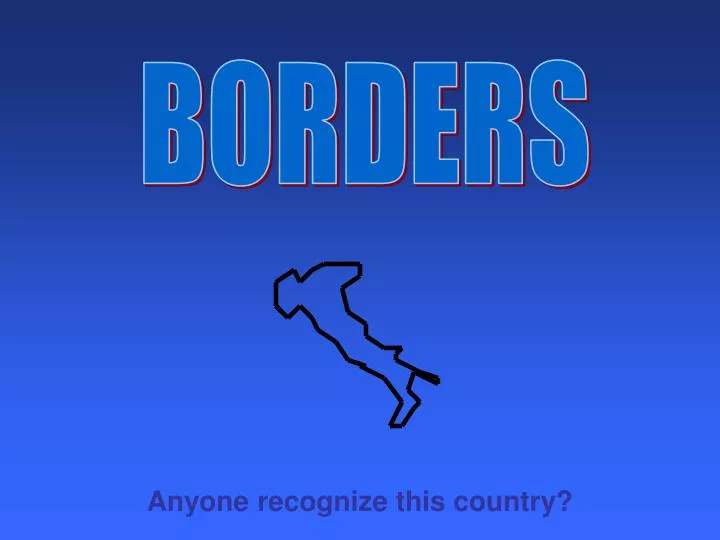
BORDERS. Anyone recognize this country?. Borders Borders form for any number of reasons. Most often, borders were originally inspired by rivers, lakes, seas, oceans, mountains, or some other landform.

E N D
BORDERS Anyone recognize this country?
Borders • Borders form for any number of reasons. Most often, borders were originally inspired by rivers, lakes, seas, oceans, mountains, or some other landform. • Borders might also have been influenced by latitude or longitude lines. Most of the time this comes as a result of an agreement between two different sovereign governments. • Still other times, a border might have been influenced by conflict. This type of border change is usually the most dramatic and occurs most quickly. • There are many examples of two governments that are in conflict over borders, even today.
This can also seem complicated, but you can use your head most of the time. What does it look like caused the border? Latitude line What is up with the border between Canada and the US here. Why does it curve? River Longitude Latitude River Latitude River River Latitude Longitude River Latitude River River River Let’s start in Texas. What is up with the wiggly lines on the northern border? River
The Dead Sea - Standing in Israel, looking across to Jordan Michigan and the Great Lakes David Shankbone. Creative Commons 3.0, Date Unknown Public Domain The Pyrenees Mountains form a natural border between Spain and France. China and Mongolia are separated by the Gobi Desert. Eric Gaba. Creative Commons 3.0, Date Unknown. Public Domain Border influenced by a sea Border influenced by a lake Border influenced by a mountain Border influenced by a desert
Can you put this puzzle together? • Recognizing borders by specific characteristics is a good strategy. For instance, you have already seen how Italy looks like a boot. • However, you must know some basic features of every continent as well as several major countries. • One good thing is that borders will always face the same direction and be the right size. It’s not like a puzzle.
Let’s first make sure they are facing the right direction. How about now? Any ideas?
Oregon Country 1846, by treaty with Great Britain Louisiana Purchase in 1803 from France This became Part of the U.S. in 1783 with the Treaty of Paris Mexican Cession - 1848 Annexation of Texas -1845 From the Adams-Onís Treaty in 1819 Gasden Purchase-1853 Ok, but do you remember how to label it?
Borders Change Through . . . EXPANSION • The borders of some countries have expanded over time for various reasons. Let’s use the United States as an example: • 13 Colonies – Revolution and Conquest • Appalachian Mountains to the Mississippi River – Treaty • Louisiana Territory - Purchase • Florida - Purchase and Treaty. • Oregon Territory - Treaty. • Texas – Annexation and Conquest • Mexican Cession – Conquest Treaty and Purchase. • Gadsden Territory - Purchase • The United States is unique in that it has pretty much only expanded over time.
Borders Change Through . . . Changing of Control • The borders of many countries have increased and decreased over time. Most of the time this type of change is due to some sort of conquest or conflict. Revolution is a common reason for a country to split its land. • World maps change often. Some changes are drastic and others are very slight, but maps from even a few years ago have different borders and some different names. • Let’s use Mexico as an example:
Aztec Territory Before Europeans Came
New Spain 1786 - 1821
Independent Mexico 1824
Mexico Today Current
Borders Change Through . . . Lack of Natural Borders • The borders of many countries have changed over time because there are no natural barriers or strong agreements to hold the borders steady. • Countries with this problem often struggle to . . . “hold their shape” on a map. The seem to shrink over time. • This is been a problem in Eastern Europe throughout history. The maps in that area of the world have changed often.
Territorial changes of Poland from 1635 to 2009 As you watch this, notice that the whole country disappears at times. So, what happens to the people and the culture? Do they disappear too? So if the culture is still there, what has really changed? What types of cultural problems can occur when the borders of a country are changed by force? Do these problems usually get better or worse over time?
Borders Change Through . . . Colonization and Conquest • Though we do not see this much any more, many of the most powerful countries throughout history attempted to add territory through colonization and conquest. • Countries and empires such as Rome, the Mongols, Greece, France, and England attempted to gain territory by conquering or colonizing places where people already lived. As you can imagine, this often led to conflict. • You will learn more details about these civilizations next year, but for now let’s look at the geographic impact only.
Listen closely to your teacher’s explanation of this map. Then see if you can explain this famous historical quote: “The sun never sets on the British Empire.”
SCRAMBLE FOR AFRICA • The term that is often used when a country attempts to settle colonies in other places around the world is “imperialism” or “expansionism”. You will learn much more about this next year. • African culture was impacted severely by the practice of imperialism. • Even today different tribal groups fight for control of borders which were drawn by Europeans. Quick Review: Tell me about the culture up here! Think about these borders. Did the Africans draw these? Why might that be a problem?
As the world powers of the past pursued colonization, many of them ran into problems. In some cases, they ran into other countries that wanted the land. In other instances, they might have lost it due to a revolution. This is still British They won all of Canada too! Part of “New France” the French colony 13 Colonies of the British British Win! • France lost all their North American land to the British after the French and Indian War. • Then only 13 years later British colonists declared their independence. In 1783 they gave a bunch of that land they won from the French to those same colonists. USA after the American Revolution
EXPANDING BY FORCE • Throughout history, many different countries and their leaders have sought to expand their territory. In some cases, they chose to do it by force or conflict. • Hitler (Germany), Napoleon (France), Roman Empire (Italy), Genghis Khan (Mongolia), the Empire of Japan, Persians (Iran), Alexander the Great (Greece) all were able to expand the borders of their countries or civilizations for a time. • However, when attempting to expand borders by force, there is usually a force that pushes back. In some cases these civilizations might be defeated (Hitler, Napoleon). In some cases they might have gotten too large and uncontrollable (Persia, Romans). Still in other cases, the leader dies, and there is no strong leader to replace them (Alexander, Genghis Khan ). • In any case, civilizations often return to the same size, or even a little smaller when all is said and done.
Greece Today Even though the borders of Greece eventually returned, Alexander the Great’s conquest had an impact on the areas he conquered. Think about what you have learned about culture and spatial diffusion. What impact do you think that would be?
Tataryn77. Creative Commons 3.0, October 2011. Italy Today The Romans eventually drifted out of power as their government weakened. Why would they have weakened? Think about the time period, communications, etc.
All of the blue states on this map were either part of France, controlled by France or promised to fight with France under the rule of Napoleon. Napoleon’s attempts to control Europe actually led to a big change in the border of a country across the world. Do you know what it was? (Hint: It happened in 1803) Kieran4. Creative Commons 3.0, February 2009.
Borders Change Through . . . DISPUTED BORDERS • In many locations around the world today, countries, cities, and individual people dispute borders. Usually their court systems can work it out. However, when two countries disagree, this can be a problem. Court systems really cannot help much. • Sometimes these borders have been somewhat settled, but in other cases, the sides still dispute the borders. • Let’s use Israel and Palestine as an example: Turn to page 244 in the Mastering the TEKS in World Geography Textbook.
Border Dispute: Pakistan vs. India • India and Pakistan have long been in conflict over the region known as Kashmir. Most of the area is controlled by India today. • Terrorism is a major problem in this region as many groups attempt to force India out of this profitable area. • This dispute between nuclear powers is one of the longest running border disputes in the world. What do you think would cause these borders to change in the future? Map Believed to be Public Domain
Technically, North Korea and South Korea are still at war. though the fighting officially ended with a truce in 1953 and they created a “demilitarized zone” between the borders. North Korea maintains a communist, government-controlled economy. South Korea has a mostly free enterprise system. Which do you think is stronger and why? Do you think this was a good idea or bad idea? Roke Roke Creative Commons 3.0, June 2006. Kokiri, Creative Commons 3.0, June 2006.
So let’s review the physical and human processes that lead to boundaries and other political divisions. Make sure you understand these and you can give an example. If you don’t get it you better ask now. It is a must!!! Physical Processes Human Processes Lack of Natural Borders Rivers Deserts Oceans Seas Mountains Etc. War Colonization Conflict Treaty Conquest Expansion Disputes over Borders Can you think of a way of setting borders that kind of applies to both? (Hint: It was set up by humans, but it is a real physical thing)