Download
1 / 23
230 likes | 320 Vues
R isk classification of veldfires as a basis for prioritising the establishment of FPAs. What does the Act require?. The Act requires a consistent basis for the setting of priorities for veldfire management interventions.

E N D
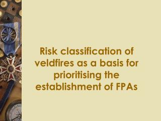
Risk classification of veldfires as a basis for prioritising the establishment of FPAs
What does the Act require? • The Act requires a consistent basis for the setting of priorities for veldfire management interventions. • Setting priorities requires an assessment of the risk of veldfire in various localities.
Rationale (1) • Veldfire risk is the chance of a veldfire igniting, spreading and causing damage to one or more assets, measured in terms of likelihood and consequence. • The risk classification used is therefore based on: • the likelihood of the natural vegetation burning • the consequence should a fire occur.
Rationale (2) • The risk classification so derived is then assigned to each municipality. • But first, the fire types occurring within each municipality have to be determined.
Determining the fire type (1) • Start at the biome level. • Vegetation within the biomes come from the work of Low and Rebelo (1996) (see next slide). • For example, vegetation types in the Fynbos Biome are: (West Coast Renosterveld, North-Western Mountain Renosterveld, Central Mountain Renosterveld, Grassy Fynbos, South & South-Eastern Coast Renosterveld, Escarpment Mountain Renosterveld, Laterite Fynbos, Sand Plain Fynbos, Limestone Fynbos and Mountain Fynbos)
Vegetation of South Africa, Lesotho and Swaziland: Low and Rebelo (1996)Department of Environmental Affairs and Tourism, Pretoria
Determining fire types (2) • For all vegetation types a fire type is assigned. • A fire type is a set of vegetation types having a similar frequency and nature of veldfire. (This is determined from available literature) • e.g. Fynbos Fire Types: (Laterite Fynbos, Sand Plain Fynbos, Limestone Fynbos and Mountain Fynbos)
Veldfire risk is accessed for each fire type using standard risk assessment techniques
Likelihood of a veldfire occurring(adapted from Standards Australia, 1999).
Consequences in terms of social, economic and environmental impacts
Risk assessment and assessed risk levels in each fire type in South Africa.
Risk classification method (at municipal level) • Assume a critical fire scenario for each fire type. • Judge consequences of the scenario. • Assess the likelihood of the scenario. (Above from existing reports) • Classify risk accordingly.
Assign fire risk to each municipality • Determine extent of fire type within municipality (Overlay municipality boundaries with Low and Rebelo map which is based on untransformed vegetation) • >30% of area with highest fire risk determines fire type for that area • The risk level is determined by the dominant fire type • Risk level is downgraded if higher risk types are found in areas where they are not a hazard to assets (e.g. Fynbos in isolated mountains)
Qualitative explanation of risk classifications • Moist woodland and sour grassland both rated as extreme • Fynbos rated as high
Assessed veldfire risk levels in some of the municipalities of the Western Cape, in each fire danger region.
Conclusion: • This veldfire risk assessment provides a basis for prioritising FPAs, and assigning resources accordingly. • Those areas with the highest fire risk get the first FPAs.
An example at a finer scale • This approach can be used at finer scales e.g. Cape Peninsula National Park • However, a comprehensive spatial database of the hazards and the social, environmental and economic assets is needed
Veldfire likelihood map(Courtesy of the Cape Peninsula National Park)
Veldfire consequence map(Courtesy of the Cape Peninsula National Park)
Veldfire risk map(Courtesy of the Cape Peninsula National Park)