Download
1 / 7
80 likes | 232 Vues
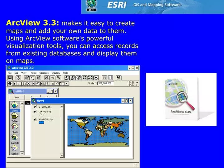
ArcView 3.3: makes it easy to create maps and add your own data to them. Using ArcView software's powerful visualization tools, you can access records from existing databases and display them on maps. The ArcGIS Desktop The ArcGIS Desktop includes a suite of integrated applications: ArcMap

E N D
ArcView 3.3: makes it easy to create maps and add your own data to them. Using ArcView software's powerful visualization tools, you can access records from existing databases and display them on maps.
The ArcGIS Desktop • The ArcGIS Desktop includes a suite of integrated applications: • ArcMap • ArcCatalog • ArcToolbox • Using these three applications together, you can perform any GIS task, simple to advanced, including mapping, data management, geographic analysis, data editing, and geoprocessing.
The following ArcGIS extension products add specialized tools and functionality to ArcView,ArcEditor, and ArcInfo. • ArcGIS Business AnalystNew • ArcGIS Spatial Analyst • ArcGIS 3D Analyst • ArcGIS Geostatistical Analyst • ArcGIS Survey AnalystNew • ArcGIS Tracking AnalystNew • ArcGIS Military AnalystNew • ArcGIS Publisher • ArcGIS StreetMap • ArcGIS Schematics • ArcScan for ArcGISNew • ArcPress for ArcGIS • Job Tracking for ArcGIS (JTX)New • MrSID Encoder for ArcGIS • Free ArcGIS Add-Ons • OGC Interoperability for ArcGIS • ArcWeb Toolbar • Tablet PC Support for ArcGIS • ArcMap GPS Support • Districting for ArcGIS
ArcInfo is the most comprehensive GIS available.It includes all the functionality of ArcView and ArcEditor plus advanced geoprocessing and data conversion capabilities. ArcInfo is the de facto standard for GIS.
ArcEditor contains all the functionality of ArcView and adds the power to edit features in a multiuser geodatabase including: • Topology • Versioning • Custom feature classes • Feature-linked annotation • Dimensioning • Rasters in a multiuser geodatabase • Multiuser editing • ArcEditor allows you to create and edit vector data formats including shapefiles, personal geodatabases, and multiuser geodatabases.