Download
1 / 77
790 likes | 968 Vues
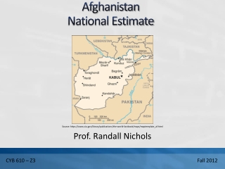
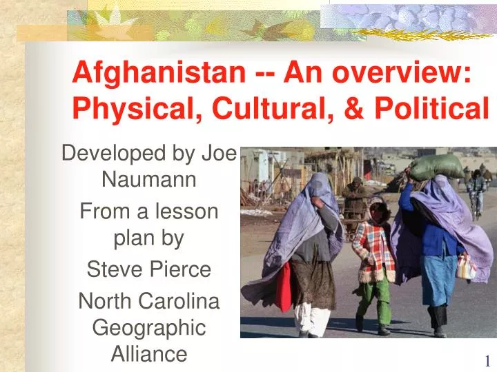
Afghanistan -- An overview: Physical, Cultural, & Political. Developed by Joe Naumann From a lesson plan by Steve Pierce North Carolina Geographic Alliance. Background.

E N D
Afghanistan -- An overview:Physical, Cultural, & Political Developed by Joe Naumann From a lesson plan by Steve Pierce North Carolina Geographic Alliance
Background • Afghanistan has had a long history of internal and external conflicts, including two wars with the United Kingdom in the1800s and an invasion by the Soviet Union in 1979. Since theSoviets left in 1989, Afghanistan has experienced many internalconflicts over control of the country.
A Crossroads and a Buffer State • Caught between many neighboring states • Crossroads on ancient trade routes • Buffer between differing religions • Buffer between major powers
American interest began when . . • Terrorist attack on the World Trade Center in New York on September 11, 2001 • Osama Bin Laden was identified as being the leader of a terrorist organization with headquarters in Afghanistan that planned the attack
Background • In 1996 a group called the Taliban seized control of most of thecountry. The Taliban was accused of supporting the terrorists thatattacked the World Trade Center and the Pentagon on September11, 2001. U.S. and allied military forces began conducting airstrikes on Taliban facilities in Afghanistan on October 7, 2001.
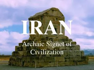
Afghanistan in Spatial Terms • Absolute Location: 33ºN, 65ºE • Relative Location: Landlocked country in southwest Asia • Neighbors: North and west of Pakistan; east of Iran; South of Turkmenistan, Uzbekistan, and Tajikistan • China shares a border with Afghanistan on the east along the Wakhan Corridor • The disputed region of Kashmir lies south of the Wakhan Corridor • Area: 251,825 sq. mi. (about size of Texas)
Places & Regions • Afghanistan lies at the crossroads of three major regions. • South Asia - Pakistan and India lie to the east • Southwest Asia/Middle East - Iran, Iraq, and the Persian gulf lie to the west. • Central Asia - five republics of the former Soviet Union lie to the north: Turkmenistan, Uzbekistan, Tajikistan, Kyrgystsan, and Kazakstan.
Kashmir • Kashmir, a region occupied by Pakistan and India, lies south of the Wakhan Corridor of Afghanistan. This disputed territory is the scene of sporadic fighting between the armies of Pakistan and India. China also occupies a part of Kashmir.
Physical Systems • Afghanistan has a wide variety of natural features including highmountains, large areas of desert and plains, and fertile valleys. Thecountry has three main land regions • The Northern Plains is the northernmost region in Afghanistan. • The Central Highlands cover about two-thirds of the country. This region includes the Hindu Kush. Most of the people of Afghanistan live in the narrow valleys of the Hindu Kush. • The Southwestern Lowlands mainly consist of deserts or semi-deserts.
Rugged Terrain • Mountains in Afghanistan • Hills and river valley in Afghanistan
A Harsh, Difficult Place to Live • Barren highlands & valley in the background (above) • Raising sheep in a barren land (left)
Climate • Afghanistan has a harsh continental climate. Harsh winters are accentuated by high elevation. Summers are warm, except at the highest elevations. Much of the country is arid or semi- arid. Precipitation is light, falling mostly in the spring and winter. Almost no precipitation falls from June to October.
Generalized Climate Zones • Only about 12% of the land is arable.
Dry as well as Cold Climate in Afghanistan • Southern desert above • Village in arid valley
More Climate • The climate graphs show the pattern of temperature and precipitation. January lows in Kabul can reach in the teens, while July highs can reach the low 90’s. In the south average high temperatures can reach the low hundreds in the summer. Precipitation ranges from about 13 inches per year in Kabul, and about 6 inches in Kandahar in the south
Harsh Winter • Nearly half of Afghanistan has 100 or more days of snow cover per year
Drought 2001 • Drought, the other side of harsh – moderate to severe all over the country
Human Systems • Most people live in rural areas - only 20% of the population is urban. Most live in fertile river valleys between high ridges that separate them. This leads to a fragmentation of the population and identification with tribe rather than nation. • Pashtun - 38% • Tajik - 25 % • Hazara - 19% • other groups - 12% • Uzbeks - 6%
Kunduz Nomads • Twenty years of fighting have made life difficult for the nomadic pastoral tribes in Afghanistan
Traditional village • Gumbazee village built with no wood
Languages and Religion • The major languages spoken in the country are: • Dari (Afghan Persian) - 50% • Pashtun - 35% • Turkic languages - 11% • Islam is the predominant religion • 84 % are Sunni Muslim • 15 % are Shi’a Muslim
Islam is the dominant religion Mosque in Kabul • The Taliban imposed their extremely strict, more than just fundamental, interpretation of Islam on everyone.
Taliban intolerant destruction of Historic Buddhist Religious Art • Bamyan Buddha before (left) • After the explosion (right)
Refugees • Afghans constitute the largest single refugee population in the world with an estimated 6 million people or 30 percent of the global refugee population. The population has been greatly affected by a refugee problem for years. Large numbers of Afghans are refugees in Pakistan.
Refugees • Pakistan has received the most
Women • In areas under Taliban control women were required to wear a burka when outside the home. This covers the body head to toe. • Schools were closed for girls, and professional women lost their jobs as they were not permitted to work outside the home. 30,000 widows in Kabul were been denied employment that had served as their only income.
Difficult conditions • Women forced to beg in Mazar-e-Sharif by Taliban • Cooking grass in refugee camp for lack of better food
View Through the Burka • View through a veil, or burka, which all Afghan women are required to wear outside the home. Restricted vision has reportedly caused numerous accidents involving vehicles and women pedestrians.
Harsh Treatment of Women by Taliban • Beating women (left) • Executing a woman publicly (right)
Suffer the Little Children • More than 10 million children have suffered under 10 years of drought and civil war. • Afghanistan ranks number 1 in worldwide maternal mortality • One in three Afghan children is an orphan • Almost half of Afghan children suffer from chronic malnutrition
Hungry Children Kids wait in line for food aid (right) • Looking in garbage (above left) • Picking wheat grains from ground (below)
Demographics • Population - 26,813,075 (2001 est.) • Age Distribution • 0-14 years - 42 % • 15-64 years - 55% • 65 + - 2.79% • Life Expectancy - 47 male; 45 female • Population Growth Rate - 2.5% • Population Doubling Time - 29 years • Infant Mortality Rate – 147:1,000 live births • Literacy Rate – total population - 32%; male - 47%; female - 15%
Human Environment Interaction • FARMING: Most of the people of Afghanistan are subsistence farmers. Much of the land is too dry or too mountainous for farming. Only 12% of the land is arable. Crops include wheat, nuts and fruits; grown mainly in river valleys. Sheep, goats, chickens, and cattle are livestock raised. • MINERALS AND RESOURCES: Afghanistan is rich in minerals, but many are not developed. Natural gas, copper, and gold, are the main resources
Agriculture & Drugs • Agriculture (top) • Growing opium poppies – major source of money Afghanistan has been theworld's largest producer ofraw opium in 1999 and2000.
Human Environment Interaction • INDUSTRY: Industry is not well developed. Textiles, and craft industries such as metalwork, jewelry, leather goods, and rugs are the major industries. • ECONOMIC FACTS • Gross National Product - $18.1 billion - per capita $800 • Trade- Imports - $150 million - Exports - $80 million
Industry & U.S. Influence • Homemade soda bottling warehouse Afghanistan and child labor
Traditional Crafts • Rug making by women (right) • Women in textile factory (below)