Download
1 / 25
250 likes | 467 Vues
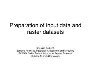
Accurate Projection of Small-Scale Raster Datasets. 21 st International Cartographic Conference 10 – 16 Aug 2003 Durban, South Africa. Accurate Projection of Small-Scale Raster Datasets. E. Lynn Usery, USGS, Mid-Continent Mapping Center, Rolla, MO

E N D
Accurate Projection of Small-Scale Raster Datasets 21st International Cartographic Conference 10 – 16 Aug 2003 Durban, South Africa
Accurate Projection of Small-Scale Raster Datasets • E. Lynn Usery, USGS, Mid-Continent Mapping Center, Rolla, MO • Jeong Chang Seong, Northern Michigan University, Marquette, MI • Dan Steinwand, Science Applications International Corp., EROS Data Center, Sioux Falls, SD • Michael P. Finn, USGS, MCMC, Rolla
Outline • Motivation • Objectives • Approach • Methods • Results • Conclusions
Motivation – What is the Problem? • Projection of global datasets with conventional GIS software results in error • Errors affect global models and invalidate results
Objectives • Develop a dynamic projection for raster data • Determine methods to measure error and apply error correction • Develop a better categorical resampler • Develop an system to support map projection selection
Approach • Empirical Testing • Compute exact areas in spherical coordinates and replicate cell-by-cell in projected data • Develop error theory using horizontal and vertical scale factors • Develop a categorical resampler with user selection of output pixel on down-sampling • Design and Implement a Decision Support System
Empirical Testing • Multiple Datasets • Global land cover, 30 arc-sec • Global Life (ecological) Zones, ½ degree • Global vegetation, 1 degree • Multiple Projections • Eckert IV • Hammer • Sinusoidal • Mollweide • Goode Homolosine • Wagner IV • Robinson (non-equal area)
Empirical Test ResultsUse of Commercial GIS Software • Software is not always reliable for global projection • Some projections do not run to completion • Inverse projection results in extension of raster areas to 0-degree lines • Repeat areas at edges of projection • Computation times extensive
Michael P. Finn: Mollweide from Commercial Software
Dynamic Projection of Raster Cells • Compute areas of pixels in geographic coordinates • Map each raster line to appropriate area • Result is accurate for computation and analysis, but each raster line has different size
Areas of Single Pixels Computed from Spherical Coordinates (in meters2)
Error Theory and ModelingBest projection for global scale • Criteria • It shouldn’t lose pixel values when a local-scale dataset is projected to the global-scale projection • It shouldn’t lose pixel values when a dataset in the global-scale projection is projected at a very accurate local-scale projection • Efficient storage
Reprojection accuracies between global and local projections
Error Theory and Modeling Summary • Scale factor model explains most pixel value changes • The change of pixel values occurs regardless of pixel resolutions • Significant change as category numbers increase • Significant change due to skewing
Categorical Resampling • Down-sampling to larger pixel size • aggregating multiple input pixels to one output pixel • Nearest neighbor selects one pixel value • Many pixels involved • use simple statistical methods to determine output image pixels based on the area the pixel coverage in the input image
Extreme Downsampling and Reprojection with the Nearest Neighbor
Extreme Downsampling and Reprojection with the New Algorithm
Decision Support System for Map Projection Selection • Global, continental, regional (10 ° min) • Preserve shape, area, compromise • Data type – raster or vector • User input determines projection selection
Conclusions • Projection of global raster data is a significant problem • Area preservation in raster data is possible for computation and analysis, not for display • A scale factor model accounts for most error and shows the sinusoidal projection to preserve areas better than others • Categorical resampling with modal categories yields better results than nearest neighbor methods • A Decision Support System is needed and now available
Addition Information • Available at: • http://mcmcweb.er.usgs.gov/carto_research/projection/index.html • E-mail: mfinn@usgs.gov
Accurate Projection of Small-Scale Raster Datasets 21st International Cartographic Conference 10 – 16 Aug 2003 Durban, South Africa